Highlands, North Carolina
Looking for the best hiking in Highlands? We've got you covered with the top trails, trips, hiking, backpacking, camping and more around Highlands. The detailed guides, photos, and reviews are all submitted by the Outbound community.
Top Hiking Spots in and near Highlands
-
Tallulah Falls, Georgia
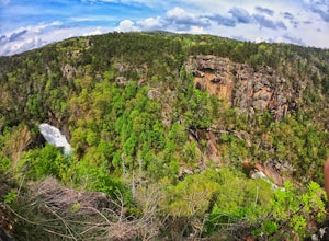
Camp at Tallulah Gorge State Park
4.7Tallulah Gorge is a must-see feature of Georgia. Campers can lay low and experience the gorge from its floor, engaging in river activities such as kayaking or swimming. Those seeking a thrill can hike the rim trails of the gorge, and even cross an 80' high suspension bridge. (Hikers who may be fe...Read more -
Tallulah Falls, Georgia
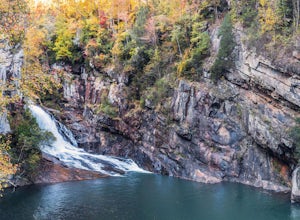
Hike to Hurricane Falls, Tallulah Gorge SP
4.41.85 mi / 564 ft gainThe trail is located in Tallulah Gorge State Park which is about 1 ½ hours northeast of Atlanta, off of Highway 441. There is a $5 per car entry fee into the park and they prefer the use of cash. From there, follow the signs to the Jane Hurt Yarn Interpretive Center, where there is parking and pl...Read more -
Canton, North Carolina
Hike to Bubling Spring Falls
0.1 mi / 50 ft gainThe road to get to this waterfall is right off of NC 215 which comes right off of the Blue Ridge Parkway and is only about 3 miles away from parkway. The parking area is very small and does not offer many parking spots but since it is not that popular of an area parking is usually not a problem. ...Read more -
Sylva, North Carolina
Pinnacle in Pinnacle Park
5.05.98 mi / 2142 ft gainHeading out from the parking area, head north on this challenging hike. For the majority of the hike, you'll have a pretty steady uphill charge. There are some flat parts between climbs, so be sure to catch your breath and get some water in during these times. Once you reach the fork, where you'...Read more -
Franklin, North Carolina
Wesser Bald Fire Tower
4.72.36 mi / 807 ft gainThe road leading to the trailhead is rough the last mile, but doable in any car. Just make sure to take it easy going up and be careful, especially if there has been any rain or snow. You will have reached the parking area for the hike once you see a large green Appalachian trail sign and a few...Read more -
Canton, North Carolina
Tennent Mountain
5.03 mi / 285 ft gainPark at the Lot at the end of Black Balsam road, and start your morning in the dark, down the old dirt road at the end of the lot. Take this road until you get to Ivestor Gap and make a right onto the Art Loeb, try and time it so the sun is just about to rise here. Hike or trail run The Art Loeb ...Read more -
Canton, North Carolina
Sam Knob and Flat Laurel Creek Loop
4.93.84 mi / 807 ft gainThis is one of my favorite quick "getaway" loops in the Pisgah Ranger District. Turn onto Black Balsam Knob Road (Mile Marker 420 on the Blue Ridge Parkway) go until you reach a dead end and park at the parking lot. You'll see the Sam Knob trail to the right of the public bathrooms. From there, i...Read more -
Haywood County, North Carolina
Black Balsam Knob via Art Loeb Trail
5.01.56 mi / 305 ft gainThe parking area for Black Balsam Knob is at mile marker 420.2 on the Blue Ridge Parkway. It's free to hike here. Take the Art Loeb Trail a half mile until you reach the knob. Along the way you will be walking almost entirely on the bald which is a very pleasant experience. You feel like you're ...Read more -
Lakemont, Georgia
Minnehaha Falls
4.20.39 mi / 98 ft gainDespite their beauty, not many hikers know about Minnehaha Falls. Even more shocking, these are some of the most accessible falls in all of North Georgia. Round trip, the hike to the falls will only take about a half a mile. Hikers can park along the side of the road at the trailhead. Follow the ...Read more -
Canton, North Carolina
Graveyard Fields-Black Balsam Knob Circuit
4.49.83 mi / 1522 ft gainWhen the weather is in your favor, these treeless mountain tops will have your jaw on the floor with layers upon layers of Blue Ridge Mountains. This hike can be done in one day, but with panoramic views at multiple points, you'll want to take your time along this link of trails. This ~10-mile l...Read more -
Clarkesville, Georgia
Panther Creek Falls
3.77.27 mi / 659 ft gainPark at the Panther Creek Recreation Area. The fee to park here is $4. There is extra parking alongside the road if the parking lot is full. The trail begins opposite the parking area, noted by a wooden sign. The trail gains elevation here and there with several drop-offs secured by cable cord f...Read more -
Brevard, North Carolina
Hike to John Rock
5.05 mi / 1000 ft gainThis 5 mile loop begins at the Pisgah Center for Wildlife Education and State Fish Hatchery near Brevard, NC. Ample parking is available adjacent to the trailhead with bathrooms and water accessible. Grab a map from inside as well. To start the hike, look at the education center, to the left is t...Read more -
Canton, North Carolina
Skinny Dip Falls
4.81.03 mi / 148 ft gainPark at the Looking Glass Rock Overlook. After enjoying the view of Looking Glass Rock, gear up and head to the right side of the parking area (right side if your back is to the overlook). On the opposite side of the road you'll see a mile marker and a little trail to the left of the marker. Foll...Read more -
Pickens, South Carolina
Hike to Table Rock Mountain
4.57.2 mi / 2433 ft gainWhile the Piedmont Foothills may sound deceptive, this is no easy trail. The first two miles of the Table Rock Trail take you soaring through the trees at a rapid pace. The trail is extremely well kept, but harsh and tough. A little before the two mile marker is a wooden shelter which is a great ...Read more -
Pickens, South Carolina
Summit Sassafras Mountain
5.017.2 mi / 5041 ft gainPinnacle Trail begins by the Nature Center in Table Rock State Park. Keep left at the first three splits in the trail. You will make some creek crossings, gain elevation through the forest, and pass by Mills Creek Falls (25 ft). At Bald Rock Overlook, you can catch some nice views of Table Rock M...Read more -
Pickens, South Carolina
Backpack the Foothills Trail through the Southeastern Appalachian Mountains
5.076.2 mi / 11036 ft gainStarting at Table Rock State Park (South Carolina) and working your 76.2 miles way towards Oconee State Park (South Carolina) is the most popular route, with a few spur trails that lead to places like Raven Cliff Falls in Cesar's Head State Park. The trail gains ~11,036 feet in elevation with ano...Read more

