Highlands, North Carolina
Looking for the best hiking in Highlands? We've got you covered with the top trails, trips, hiking, backpacking, camping and more around Highlands. The detailed guides, photos, and reviews are all submitted by the Outbound community.
Top Hiking Spots in and near Highlands
-
Cedar Mountain, North Carolina
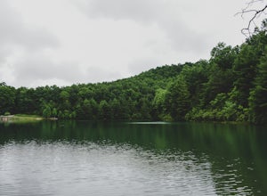
Hike to Fawn Lake
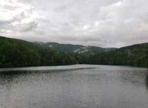
1 mi / 100 ft gainFawn Lake sits on the backside of DuPont State Forest, about a 15 minute drive from the High Falls Parking/ Visitor Center as well as Hooker Falls parking lots. With easy access and easy terrain, this is a must see to add to the list. While sometimes the main parking lots and trails of DuPont can...Read more -
Canton, North Carolina
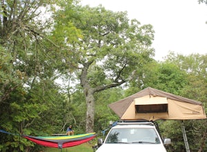
Camp at Mt. Pisgah
5.0The Mt. Pisgah campground is nestled right off of the Blue Ridge Parkway near Canton, NC. Since it is at an elevation of 4,980 feet the campground is a perfect destination to beat the heat and humidity that the region can be known for in the summer months. Reservations and information can be fo...Read more -
Maggie Valley, United States
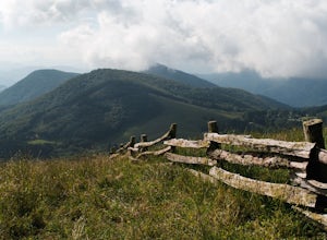
Hemphill Bald
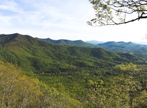
Hemphill Bald is a quintessential Smoky Mountains vantage point and this moderate loop trail leading to it takes you through beautiful forest and rolling hills. This area is incredible in all seasons - wildflowers in the spring, colorful leaves in the fall, and with bare trees in the winter, the ...Read more -
Sautee Nacoochee, Georgia
Unicoi Gap and Indian Grave Gap Loop
5.05.04 mi / 1765 ft gainThe Unicoi Gap and Indian Grave Gap Loop in Sautee Nacoochee, Georgia, is a moderately challenging hiking trail. Spanning approximately 5.04 miles, the loop offers a variety of terrain, including forested areas, open fields, and rocky paths. The trail is known for its two significant landmarks: U...Read more -
Sautee Nacoochee, Georgia
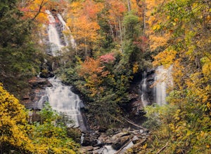
Anna Ruby Falls
4.01 mi / 374 ft gainThe hike to Anna Ruby Falls located in the Chattahoochee National Forest, bordering and often mistaken for being located in Unicoi State Park, begins at the Anna Ruby Falls Visitor Center. There is a $3 per person fee (16 years and under are free) to access the parking lot of the visitor center a...Read more -
Greenville County, South Carolina
Hike to Rainbow Falls and Pretty Place
5.05.96 mi / 1844 ft gainJones Gap State Park in the Upstate of South Carolina is one of the most beautiful parks in the state offering a good range of moderate and challenging hiking and backpacking trails through the Mountain Bridge Wilderness Area. Jones Gap also provides superb primitive camping sites along the rocky...Read more -
Greenville County, South Carolina
Hike the Jones Gap Loop
5.05.5 mi / 2000 ft gainStart on the Jones Gap Trail (blue), which will lead you alongside the Saluda River. After 2.5 miles, take the Old Springs Branch Trail (orange) to loop back to the lot.For a challenging, more strenuous hike, with great views of the Gap, check out Rim of the Gap Trail. It is not advised to take c...Read more -
Greenville County, South Carolina
Hike the Pinnacle Pass/Rim of the Gap Loop
11.5 mi / 2345 ft gainThe Trailhead: Located at Jones Gap State Park in Marietta, SC of northern Greenville County. Follow the trail across an iron bridge that crosses the Middle Saluda River, and be sure to register at the Ranger’s Station/Gift Shop on the far side of the gap. The trail head(s) are located directly o...Read more -
Easley, South Carolina
Doodle Trail
5.07.64 mi / 358 ft gainDoodle Trail is a point-to-point trail that takes you through a nice forest located near Easley, South Carolina.Read more -
Blairsville, Georgia
Hike to the Brasstown Bald Peak
4.31.42 mi / 430 ft gainOnce you make it to the parking area (parking fee required) to Brasstown Bald you will be at about 4284 feet elevation. From there you will have a short (0.6 mile) but steep hike to the tower that sits atop Brasstown Bald. Along the path you will see Rhododendron and various other blooms dependi...Read more -
Young Harris, Georgia
Hike the Miller Trek
5.06.3 mi / 1325 ft gainThis is an awesome trek with views of both Young Harris and Hiawassee, GA! The trail starts from the parking area where there is the Miller Trek A-Frame (see photo for reference)! There are several different trails within the trail system on the mountain, but if you take 5 minutes to read the map...Read more -
Helen, Georgia
Hike the Unicoi Lake Trail
1.9 miUnicoi State Park is a pleasant, refreshing park just outside of Helen, GA. There is a hiking trail, kayaking/canoeing launch, paddle boat rentals, camping area, and even a 3 segment zipline course (all three were fantastic)! Fishing is allowed, and when we went last there were a few kayakers fis...Read more -
Blairsville, Georgia
Hike to Horsetrough Falls
5.00.4 mi / 10 ft gainTo get to the trail head you will follow Wilks road five miles to Upper Chattahoochee River Campground. The five miles down the gravel road should be doable for a majority of cars as the gravel road is in good condition. Pretty much if you feel comfortable driving your car on a regular gravel roa...Read more -
Bryson City, North Carolina
Charlies Bunion via Kephart Loop
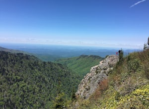
14.14 mi / 3671 ft gainCharlies Bunion via Kephart Loop is a loop trail located near Cherokee, North Carolina. This is a longer version of the Charlies Bunion hike starting from the Newfound Gap parking lot. The added benefit of this longer loop is the opportunity to see more of the Great Smokey Mountains! You'll pass ...Read more -
Bryson City, North Carolina
Kephart Prong Trail, Great Smoky Mountains NP
5.03.92 mi / 850 ft gainKephart Prong is a pretty easy hike in close proximity to the Visitor Center on the North Carolina Side of GSMNP. 2 miles up the trail, you'll arrive at Kephart Shelter, where you can rest and enjoy vies of the Kephart Prong. Once you've had your fill, head back down the way you came. During th...Read more -
35.556724,-83.495827
Forney Creek Loop
4.519.04 mi / 3500 ft gainThis is an overnight loop hike that is built around one night in the back country. It can be done as an ambitious day hike. Be advised that permits are required by the NPS for all overnight stays in Great Smoky Mountain National Park. The hike begins at the Clingman's Dome parking lot at the For...Read more

