Hayesville, North Carolina
Looking for the best hiking in Hayesville? We've got you covered with the top trails, trips, hiking, backpacking, camping and more around Hayesville. The detailed guides, photos, and reviews are all submitted by the Outbound community.
Top Hiking Spots in and near Hayesville
-
Farner, Tennessee
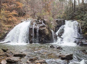
Turtletown Falls Trail
3.45 mi / 377 ft gainTurtletown Falls Trail is a loop trail that takes you by a waterfall located near Farner, Tennessee.Read more -
Blue Ridge, Georgia
Long Branch Loop Trail
5.02.33 mi / 299 ft gainLong Branch Loop Trail is a loop trail where you may see beautiful wildflowers located near Blue Ridge, Georgia.Read more -
Highlands, North Carolina
Explore Cullasaja Falls
5.00.3 mi / 200 ft gainThis is an awesome waterfall that offers views from several different spots along the road as well as a quick hike down to the base! The small pull-off area is located towards the top of the falls. There isn't much space (3 maybe 4 cars at a time), but there are additional pull-off areas further ...Read more -
Bryson City, North Carolina
Hike to Alarka Falls
5.01 mi / 100 ft gainTo visit the falls, take US-74 west from Bryson City to exit 64 . Take a left at the exit and drive on Alarka Road for about 10 miles. Follow the road all the way to the end where you will find a turnaround. Don't make the mistake of following the forest service road (it is gated), as it is not ...Read more -
Tallulah Falls, Georgia
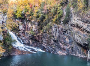
Camp at Tallulah Gorge State Park
4.7Tallulah Gorge is a must-see feature of Georgia. Campers can lay low and experience the gorge from its floor, engaging in river activities such as kayaking or swimming. Those seeking a thrill can hike the rim trails of the gorge, and even cross an 80' high suspension bridge. (Hikers who may be fe...Read more -
Tallulah Falls, Georgia
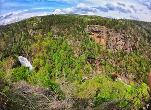
Hike to Hurricane Falls, Tallulah Gorge SP
4.41.85 mi / 564 ft gainThe trail is located in Tallulah Gorge State Park which is about 1 ½ hours northeast of Atlanta, off of Highway 441. There is a $5 per car entry fee into the park and they prefer the use of cash. From there, follow the signs to the Jane Hurt Yarn Interpretive Center, where there is parking and pl...Read more -
Bryson City, North Carolina
Explore Old 288 and the Lands Creek Bridge
2.51 miNC 288 was constructed in the 1920's, but did not last long with the construction of the Fontana Dam as the resulting lake covered the highway. The U.S. government entered an agreement in which they would provide a replacement road, but to this day it has not been completed and is know by locals ...Read more -
Highlands, North Carolina
Explore Dry Falls, North Carolina
4.60.42 mi / 95 ft gainDry Falls is located off of Hwy. 64, which has been designated as the Mountain Waters Scenic Byway, and the road does not disappoint. Hwy. 64 is a two lane road which hugs the northern side of Cullasaja Gorge, which has been carved by the Cullasaja River. Besides Dry Falls, Hwy. 64 leads you past...Read more -
Bryson City, North Carolina
Southern Smokies: Fontana Lake to Clingman's Dome
4.520.39 mi / 5750 ft gainThis is a strenuous (though not technical) hike that really showcases the forests, creeks, and (eventually) the highest point of Great Smoky Mountains National Park. As this is a point-to-point route, you will want to have two vehicles - one that you can leave at Clingman's Dome and one that you ...Read more -
Clarkesville, Georgia
Panther Creek Falls
3.77.27 mi / 659 ft gainPark at the Panther Creek Recreation Area. The fee to park here is $4. There is extra parking alongside the road if the parking lot is full. The trail begins opposite the parking area, noted by a wooden sign. The trail gains elevation here and there with several drop-offs secured by cable cord f...Read more -
Sylva, North Carolina
Hike to Cowee Bald Fire Tower
4.4 mi / 400 ft gainThe Cowee Bald Fire Tower is located in the Nantahala National Forest near Bryson City North Carolina. To get there you can either drive almost all the way to the top about .2 miles from the top but to get there you will need to have a 4WD or a higher clearance vehicle to cross a small stream. Ho...Read more -
Tellico Plains, Tennessee
Hike to Conasauga Falls
4.51.5 mi / 400 ft gainGetting to the trailhead can be a challenge if there has been any heavy precipitation or icy conditions due to the fact the last two miles are one mile of broken pavement and the last mile a dirt road. You should be fine in good conditions in any car; however, just make sure to take it easy on th...Read more -
Dahlonega, Georgia
Lake Zwerner (aka Yahoola Creek Reservoir)
5.03.24 mi / 367 ft gainLake Zwerner (aka Yahoola Creek Reservoir) is a loop trail that takes you by a river located near Dahlonega, Georgia.Read more -
Bryson City, North Carolina
Hike to Lonesome Pine Overlook
5.07 mi / 2300 ft gainTo start the hike to Lonesome Pine Overlook begin from the Noland Divide Trailhead in Deep Creek. The trail is a steady climb with an average gain of 700 ft. every mile. Approaching the top you'll walk along a rocky ridge line where you are able to see the overlook. As you continue, be sure to lo...Read more -
Townsend, Tennessee
Gregory Bald via Gregory Ridge Trail
5.011.3 mi / 3020 ft gainThe Gregory Bald summit is indisputably picturesque – the 10-acre meadow at the top hosts magnificent azalea blooms in June, wild blueberries in August, and views of Cades Cove, Rich Mountain, Fontana Lake, Thunderhead Mountain, and Clingmans Dome, year-round. Start this hike at the Gregory Ridg...Read more -
Cullowhee, North Carolina
Hike to Yellow Mountain Fire Tower via Cloud Catcher Lane
5.01.5 mi / 700 ft gainYellow Mountain Fire Tower features some of the best views, looking out over both the Northern Georgia mountains as well as seeing the flat-lands of South Carolina past the mountain ranges. This hike is pretty well known for its 12-mile round trip trek, starting in Cashiers, NC, however, there's ...Read more

