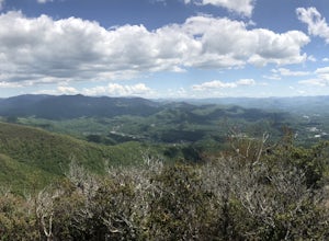
Fontana Dam, North Carolina
Top Spots in and near Fontana Dam
-
Franklin, North Carolina
4.0
27.11 mi
/ 5420 ft gain
Winding Stair Gap on Highway 64 is the starting point for this spectacular backpacking trip through the Nantahala National Forest. It's right outside the hiker friendly town of Franklin, NC, so the town is your last chance for a hot meal and any last minute supplies. There is a parking lot at the...
Read more
-
Sylva, North Carolina
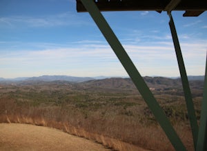
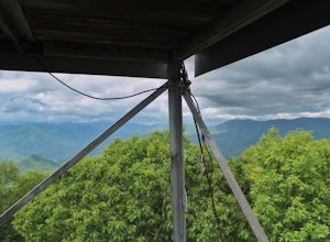
The Cowee Bald Fire Tower is located in the Nantahala National Forest near Bryson City North Carolina. To get there you can either drive almost all the way to the top about .2 miles from the top but to get there you will need to have a 4WD or a higher clearance vehicle to cross a small stream. Ho...
Read more
-
Tellico Plains, Tennessee
The Cherohala Skway is one of the National Scenic byways in America it spans over 43 curvy miles from Tellico Planes, Tennessee to Robbinsville, North Carolina. On the Skyway there are many overlooks ranging elevations from 2000-5200 feet all have beautiful views and different view points. The pa...
Read more
-
Cherokee, North Carolina
The pinpoint for this particular entrance starts just outside of Cherokee, North Carolina, following the Parkway North.
They say the Blue Ridge Parkway is more than just a road, it's a beautiful journey. Start this journey and you will quickly find this to be true. This 469 mile gateway connects...
Read more
-
Gatlinburg, Tennessee
Take Porters Creek Trail, a gravel road alongside Porters Creek. You will pass by an old farmstead and cemetery, as well as lots of wildflowers if you're out during the spring.
In a mile, keep left, then in another half mile or so you should cross over a small (and somewhat harrowing) footbridge...
Read more
-
Franklin, North Carolina
Begins at the parking lot for the Standing Indian Campground. (No permits are needed to park here) For the first 3.7 miles, take Kimsey Creek Trail, which runs along the water, until you meet up with the AT at Deep Gap. Rolling hills and lots of foliage throughout, leading up to Standing Indian M...
Read more
-
Cherokee, North Carolina
4.2
0.22 mi
/ 148 ft gain
Although it is not much of a hike at just 0.3 miles, it is accessible to people of all fitness levels. A climb up a series of stairs leads you to a trail overlooking Mingo creek. You will then find a 20 foot wide bridge which serves as the viewing platform of the falls.
If you care to advent...
Read more
-
Gatlinburg, Tennessee
4.9
7.83 mi
/ 2190 ft gain
This multi-tiered waterfall is known as the tallest in the park – a worthwhile reward for the steep and sometimes tricky terrain you'll face on the way up.
The popular route to the falls also passes through an impressive old-growth forest, which apparently boasts some of the tallest trees in the...
Read more
-
Tellico Plains, Tennessee
Getting to the trailhead can be a challenge if there has been any heavy precipitation or icy conditions due to the fact the last two miles are one mile of broken pavement and the last mile a dirt road. You should be fine in good conditions in any car; however, just make sure to take it easy on th...
Read more
-
Murphy, North Carolina
The Panther Top fire tower is located in the Nantahala National Forest outside of Murphy, NC. To get there you get off of US 74 then turn onto panther top rd and continue till you see the signs for the tower. Once you get there the hike is about .75 there mostly up on the way to the top of the to...
Read more
-
Bureau of Indian Affairs Highway 506, North Carolina
5.0
1.21 mi
/ 400 ft gain
Your hike will start at the base of the Blue Ridge Parkway just a few miles from the start in Cherokee. The trail starts right off of the parkway in a very small easy to miss dirt road. There is a small area to park that then you start your hike up the dirt road right after the gate. The hike to ...
Read more
-
Knoxville, Tennessee
This park is located in south Knoxville right off of Cherokee trail road. The parking lot is very large and can accommodate 15-20 cars. The park is home to the historic Fort Higley which was a Civil War fort built by the Union to protect Knoxville.
This is a great place to walk or run through t...
Read more
-
Knoxville, Tennessee
High Ground Park (Fort Higley) is an out-and-back trail that takes you through a nice forest and park located near Knoxville, Tennessee.
Read more
-
Young Harris, Georgia
5.0
6.3 mi
/ 1325 ft gain
This is an awesome trek with views of both Young Harris and Hiawassee, GA! The trail starts from the parking area where there is the Miller Trek A-Frame (see photo for reference)! There are several different trails within the trail system on the mountain, but if you take 5 minutes to read the map...
Read more
-
Kodak, Tennessee
Begin your trip by putting your kayak in the water at Kelly Lane. The parking area is large and grassy. The trip is 4 miles and takes about two hours. On your journey you will have views of flower fields and rock walls.
Once you get to the island paddle around and see the wildlife. There is a sec...
Read more
-
Sylva, North Carolina
5.0
5.98 mi
/ 2142 ft gain
Heading out from the parking area, head north on this challenging hike. For the majority of the hike, you'll have a pretty steady uphill charge. There are some flat parts between climbs, so be sure to catch your breath and get some water in during these times. Once you reach the fork, where you'...
Read more


