Collettsville, North Carolina
Top Spots in and near Collettsville
-
Bakersville, North Carolina
5.0
2.46 mi
/ 276 ft gain
Cloudland Trail is an out-and-back trail offering up expansive views of the surrounding area especially from Roan Bluff. This trail is located near Bakersville, North Carolina.
With minimal ups and downs, this makes for a decent family-friendly option. The trail is also dog friendly on-leash.
Read more
-
Bakersville, North Carolina
The AT from Carver's Gap to HWY 19 is about 14.5 miles, but with side adventures, it could be roughly 20 miles. The trail crosses the road and continues up about a 400 ft. elevation gain to the first of the balds. This section of the AT is beautiful at near 6000 ft. above sea level and you will g...
Read more
-
-
Roan Mountain, Tennessee
Hughes Gap to Roan High Bluff is an out-and-back trail that provides a good opportunity to view wildlife located near Bakersville, North Carolina.
Read more
-
Hiddenite, United States
From the parking lot, head northwest to find the trailhead for Buzzard Roost Loop. Follow that and stay left to meet up with the Hollow Rock Trail. This is a moderate hike with great views of the park. Perfect for a quick escape with the family.
For a quick and tasty bite after your hike, hit up ...
Read more
-
Burnsville, North Carolina
Park at the work center but don't block the gate. Hike around the gate and head up the grassy and gravel road. Once you get to the creek a narrow path leads upstream to the base of the falls.
gps: n35 46.101/ w82 11.713
Read more
-
Burnsville, North Carolina
Snaggy Mountain is privately owned land that offers a beautiful camping spot located just outside of the Pigsah National Forest. It's completely secluded by an Apple Orchard and is a great home base for several hiking adventures in the area. The location on the map will get you to the parking spo...
Read more
-
Old Fort, North Carolina
4.8
0.76 mi
/ 292 ft gain
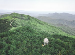
Green Knob Lookout Tower is an abandoned fire tower near Mt. Mitchell and located directly off the Blue Ridge Parkway. The tower boasts a full 360-degree, unobstructed view of Mt. Mitchell, Craggy Mountains, Table Rock, Grandfather Mountain, and the Parkway. Unlike most fire towers, this tower is...
Read more
-
Hampton, Tennessee
Appalachian Trail: Dennis Cove to US 19E is a point-to-point trail that takes you through a nice forest located near Roan Mountain, Tennessee.
Read more
-
Hampton, Tennessee
5.0
2.43 mi
/ 449 ft gain
Laurel Falls via Appalachian Trail is an out-and-back trail that takes you by a waterfall located near Hampton, Tennessee.
Read more
-
Hampton, Tennessee
Appalachian Trail: Dennis Cove to Watauga Lake is a point-to-point trail that takes you by a waterfall located near Hampton, Tennessee.
Read more
-
Hampton, Tennessee
From Hampton, Tennessee, take US-321S for about 3.5 miles. Turn right onto Dennis Cove Road and travel for 4 miles on this steep and very curvy mountain road. The trailhead is where the Appalachian Trail (AT) crosses the road at a small gravel lot on the left.
Take the AT north on the trail lea...
Read more
-
Hampton, Tennessee
The Hike to Dennis Cove Falls includes three water crossings and passes several small waterfalls. Sturdy cables spanning the width of the water crossings provide a fun way of traversing the creek without wading. It is completely possible to wade through the creek while holding onto the cables for...
Read more
-
Burnsville, North Carolina
The Black Mountain Crest Trail is legendary among hikers in the southeast. It is the highest trail east of the Mississippi, as it traverses the summit of several peaks over 6,000 feet. It is also widely acknowledged as one of the premier hikes on the east coast. To whit, the trail immediately asc...
Read more
-
Creston, North Carolina
Three Top Mountain sits within the same vicinity of Elk Knob. The mountain gets its name from its
three prominent rock projections at its peak. The highest point, unofficially
named “Big Rock”, is at an elevation of 5020 feet. Prior to the originally
named rock peak, you will arrive at Huckleb...
Read more
-
Burnsville, North Carolina
5.0
8.24 mi
/ 2310 ft gain
I personally find this trail to be more difficult and have more rewarding views than the Mt. Mitchell summit trail.
The Deep Gap Trail starts near the Mount Mitchell summit and heads into a forest of spruce and balsam fir trees. The trail then climbs along the ridgeline to neighboring summits. E...
Read more

