Clyde, North Carolina
Top Spots in and near Clyde
-
Lake Lure, North Carolina
Explore Chimney Rock
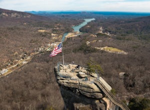
4.00.5 miChimney rock is a beautiful slab of weather granite that is visible from miles around. To get to this hike you'll want to head to Lake Lure in North Carolina, a beautiful lake located in the mountains of western North Carolina. Follow the signs for Chimney Rock and take the switchback road up t...Read more -
Lake Lure, North Carolina
Exclamation Point and Skyline Trail to Hickory Nut Falls
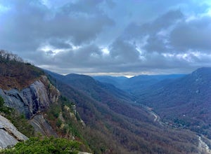
5.02.98 mi / 1204 ft gainExclamation Point and Skyline Trail to Hickory Nut Falls is an out-and-back trail that takes you by a waterfall located near Chimney Rock, North Carolina.Read more -
Lake Lure, North Carolina
Hike to Hickory Nut Falls
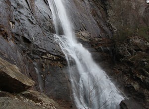
5.02 mi / 200 ft gainThis waterfall is located inside of the Chimney Rock State Park. There is a fee of 15 dollars to go to the State Park but it is very worth it because of the beautiful scenery and beautiful views. The hike to the waterfall is partially uphill on the way. When you get to the waterfall there are a f...Read more -
Burnsville, North Carolina
Mount Mitchell via the Old Mitchell Trail
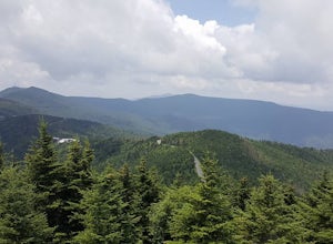
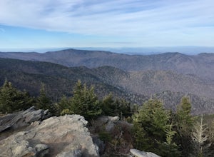
5.03.74 mi / 1194 ft gainAfter arriving in the park off of the beautiful Blue Ridge Parkway, park at the first parking lot you encounter on the righthand side of the road. There is a visitor's center there where you can inquire about the park and pick up a park map. Once you do that walk outside and look to the left of t...Read more -
Gatlinburg, Tennessee
Hike the Cucumber Gap and Little River Loop
4.05.5 mi / 800 ft gainThis loop offers a scenic 2.5 mile hike next to the river before looping back around via the Cucumber Gap Trail. At the tail end, you'll connect with the Jakes Creek Trail for about 0.7 miles to return you back to the parking lot. Many people hike this trial clockwise, but if it's a hot day, it...Read more -
Sevier County, Tennessee
Little River Trail to Backcountry Campsite #30
5.012.34 mi / 412 ft gainThe trailhead parking area is large but if no spaces are available additional parking can be had at the Jake's Creek trailhead at the top of the hill and to the right of the Little River trail parking lot. After parking, the trailhead itself will be to the left of the parking area. Parking Lot Co...Read more -
Old Fort, North Carolina
Catawba Falls
4.82.19 mi / 394 ft gainPlease note, Catawba Falls is temporarily closed. You can learn more about updates at www.fs.usda.gov. This quick and relatively easy hike is located close to Asheville, NC. If you're looking to have the trail to yourself, it can be a little tough. It's best to get there as early as possible or ...Read more -
Greeneville, Tennessee
Hike to Margarette Falls
5.02.7 mi / 715 ft gainTo reach the trail head, take exit number 39 to Erwin/Jonesborough and turn onto State Route 81/107 west and stay on this for 6.5 miles. Then you will turn left to stay on Route 107 and continue on for 16 more miles. Then you will take a left on Route 351 and drive 4.5 miles. Then you will take a...Read more -
Sevierville, Tennessee
Laurel Falls Trail
4.32.45 mi / 314 ft gainThis straightforward, yet scenic hike follows a paved trail to the falls, which is among the most popular in the park. This trail can be especially crowded during the summer, so be sure to arrive early. Keep an eye out for a few steep drop-offs on either side of the trail along the way. There ha...Read more -
Lake Lure, North Carolina
Boulder at Rumbling Bald
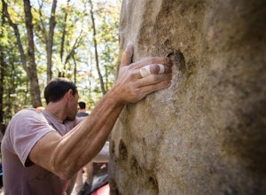
4.51.5 miLocated off of Boys Camp Rd. in Lake Lure, North Carolina, Rumbling Bald is a huge boulder yard that has been in use since the 1970's and has begun to flourish. Conveniently at the trail head is a gravel parking lot with three Port A Johns to use. Make sure you get to the parking lot early thou...Read more -
Burnsville, North Carolina
Deep Gap Trail at Mt. Mitchell State Park
5.08.24 mi / 2310 ft gainI personally find this trail to be more difficult and have more rewarding views than the Mt. Mitchell summit trail. The Deep Gap Trail starts near the Mount Mitchell summit and heads into a forest of spruce and balsam fir trees. The trail then climbs along the ridgeline to neighboring summits. E...Read more -
Saluda, North Carolina
Hike Bradley Falls
4.82.3 mi / 312 ft gainThis is a really nice hike along Cove Creek that leads to a beautiful, 100 foot waterfall. While most of the trail is a relaxing stroll, the end of the hike provides a little adventure for those who feel up for it. Starting from the parking lot, follow the main trail into the woods. Early in the ...Read more -
Salem, South Carolina
Camp on Lake Jocassee
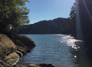
4.7To avoid the regret of cutting your trip too short, go ahead and book a campsite. Come as a walk-in or reserve your site. Either way, you will have to check in at the Park Office. Upon check-in, you will receive your map and general information. Check-in time for camping is 2PM. The only publi...Read more -
Lake Lure, North Carolina
Hike to Party Rock
4.52.4 mi / 1549 ft gainThis hike is a strenuous 2.4 miles that takes about 1.5 hours to complete. The trail is not maintained--it is an old logging road--so there are lots of loose rocks and you frequently have to hop over the washout/creek. However, the difficulty on the way up is extremely rewarding at the top!The tr...Read more -
Mountain Rest, South Carolina
Hike along the Chattooga River to Spoonauger Falls
1 mi / 100 ft gainSpoonauger falls housed in Sumter National Forest, received its name after the Spoonauger family which historically lived above the falls. From Walhalla SC, drive north on Highway 28 until it meets SC 107 (right under 10 miles). Take a slight right onto SC 107 and drive another 10 miles until yo...Read more -
Mountain Rest, South Carolina
Hike to Kings Creek Falls
4.80.5 miThe trail to Kings Creek begins behind the bulletin board in the Burrells Ford primitive campground parking lot. It is an easy .5 mile trail to the falls. The falls are only 70ft high but they are beautiful, there is an area to the side of the falls with some nice sitting rocks and the area under...Read more

