Balsam Grove, North Carolina
Looking for the best chillin in Balsam Grove? We've got you covered with the top trails, trips, hiking, backpacking, camping and more around Balsam Grove. The detailed guides, photos, and reviews are all submitted by the Outbound community.
Top Chillin Spots in and near Balsam Grove
-
Asheville, North Carolina
Take in the Sights at Pack Square Park
If you're in Asheville, it'll be quite difficult to miss out on going to or at least hearing about Pack Square Park. The park is bustling with activity as it's a common, middle ground place for people to meet up, to take a lunch break, or to catch some rays of sun on a warm day. It's also a commo...Read more -
Asheville, North Carolina
Stroll through Montford Park
Close to downtown and in between several bed and breakfasts in Montford, NC, you'll find Montford Park. Though you may not expect it, the park boasts a couple of tennis courts, a basketball court, and some green space for picnicking, relaxing with friends, or getting lost in a good book. People...Read more -
Asheville, North Carolina
Relax at Martin Luther King Jr Park
The Martin Luther King Jr Park includes a large multi-purpose field as well as a playground that's great for kids. It's the perfect place to go solo to clear your head and chill with a book or with family and friends for an outdoor game. Right at the entrance to the Park stands a statue of Mart...Read more -
Bryson City, North Carolina
Explore Old 288 and the Lands Creek Bridge
2.51 miNC 288 was constructed in the 1920's, but did not last long with the construction of the Fontana Dam as the resulting lake covered the highway. The U.S. government entered an agreement in which they would provide a replacement road, but to this day it has not been completed and is know by locals ...Read more -
Hendersonville, North Carolina
Hike to the Top of Bearwallow Mountain
5.02 mi / 583 ft gainOnce you have parked along the roadside near the trailhead, pass through the big gate on the right side of the road and take the trail off to the right. The trail winds up the mountain for a mile before it empties out onto the bald atop Bearwallow. Once on the bald, you can follow the gravel road...Read more -
Franklin, North Carolina
Photograph Wayah Bald Lookout Tower
0.1 mi / 0 ft gainThe Wayah Bald Lookout Tower is located in Nantahala National Forest in one of the oldest part of the protected land. It was first built in the 1920s then it was rebuilt throughout the years until it was finally made out of stone and concrete. The current tower that stands offers great views of t...Read more -
Asheville, North Carolina
Photograph Haw Creek Valley Overlook
The Haw Creek Valley Overlook is only 8 miles from downtown Asheville. If you're in the downtown area, it's a rather easy place to zip on over to if you're in need of some time away from urban life. This overlook is a hot spot for sunset watching and picture taking. If you plan on seeing what th...Read more -
Clyde, North Carolina
Photograph the Smokies from Buzzards Roost
This is an awesome place to check out if you are driving Interstate 40 or if you are visiting the area for awhile. The access point for Buzzards Roost is located on the same exit as the well known Max Patch Mountain, just in the other direction. Once off the exit, you will travel down a gravel Fo...Read more -
Greenville, South Carolina
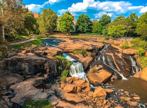
Hike Swamp Rabbit Trail to Reedy River Falls
4.53 mi / 100 ft gainSwamp Rabbit Trail is a 21 mile-long paved walkway that closely follows the Reedy River in Downtown Greenville. Over a half-a-million people visit the trail each year, but few ever walk the whole thing. What most people don’t know, is that it begins on a different river: the Enoree river and wind...Read more -
Gatlinburg, Tennessee
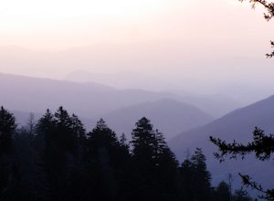
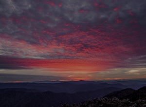
Catch a Sunrise at Newfound Gap
5.0Newfound Gap is a mountain pass in Great Smoky Mountains National Park. Newfound Gap is accessible via U.S. Route 441 from Gatlinburg, TN or Cherokee, NC. You can watch the sunrise from the parking lot at Newfound Gap or the viewing platform adjacent to the parking lot.At sunrise, layers of pink ...Read more -
Gatlinburg, Tennessee
Mount LeConte Lodge via the Boulevard Trail
15.95 mi / 3000 ft gainBegin your adventure by arriving at the Newfound Gap parking lot - before first light. Why? Because you won't want to miss the incredible sunrise from the parking lot - even before you step foot on the trail! It is said that a hiker will never get overly warm hiking the Boulevard to Leconte due ...Read more -
Hendersonville, North Carolina
Hike along The World's Edge
0.7 mi / 40 ft gainPark at the end of The World's Edge Road, but be aware that parking is very limited. There is a private residence up to the right so do not block their driveway/gate. Begin your hike by going through the leftmost gate, and continue straight until you reach the first view less than half a mile in....Read more -
Del Rio, Tennessee
Max Patch Mountain
5.01.51 mi / 315 ft gainMax Patch Mountain was once cleared for pasture land, leaving an expansive flat summit that now serves as the ideal location for a picnic hike, flying a kite, or laying in the sun surrounded by the Great Smoky Mountains. With little elevation gain and a short distance it is also very family (and ...Read more -
Clayton, Georgia
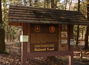
Camp at Tallulah River Campground
Tallulah River Campground is located in the Chattahoochee-Oconee national forest. It is just outside of Clayton, Georgia. The campground has about 15 spots that are big enough for a small to medium sized RV. Each camping spot also has a nice tent pad for a big tent. Most spots are also on the riv...Read more -
Lake Lure, North Carolina
Hike to Hickory Nut Falls
5.02 mi / 200 ft gainThis waterfall is located inside of the Chimney Rock State Park. There is a fee of 15 dollars to go to the State Park but it is very worth it because of the beautiful scenery and beautiful views. The hike to the waterfall is partially uphill on the way. When you get to the waterfall there are a f...Read more -
35.629385,-83.450994
Camp out at Mt. LeConte Lodge via Alum Cave
5.09.96 miAt the summit of Mt. LeConte in the Great Smoky Mountains National Park, the lodge sits at a elevation of 6400 feet. It is the only "accommodations" inside the park boundaries. It is the highest lodge in the eastern United States. Accessible only by hiking one of the five trails to the summit,...Read more

