Witherbee, New York
Looking for the best hiking in Witherbee? We've got you covered with the top trails, trips, hiking, backpacking, camping and more around Witherbee. The detailed guides, photos, and reviews are all submitted by the Outbound community.
Top Hiking Spots in and near Witherbee
-
Huntington, Vermont
Camel's Hump Summit via the Burrows Trail
4.04.4 mi / 2228 ft gainThis adventure takes you up the Burrows Trail from the Huntington side of Camel's Hump. There are multiple trails to the summit, but this trail is the shortest. It is 2.4 miles to the summit with 2300' elevation gain. The trailhead is accessed from the aptly named Camel's Hump Road out of Huntin...Read more -
Newcomb, New York
Hike Goodnow Mountain
5.03.9 mi / 1089 ft gainThe trailhead is located on NY 28N and is marked by a white trailhead sign that you can't miss from the road. The highly used trail starts out fairly level, then at 0.5 miles begins to ascend steeply in some spots the rest of the way to the summit. The hike is 1.95 miles from the parking area to ...Read more -
North Creek, New York
Hike Gore Mountain
5.010 mi / 3040 ft gainYou will start this hike following the blue blazed Schaefer trail. Though the sign shows 5.8 miles to the summit it is actually only 5.0 miles. Much of the way you follow Roaring Brook which has many waterfalls along the way. Just after the North Creek Reservoir you will get your first glance at...Read more -
Bolton, New York
Hike Cat & Thomas Mountains Preserve
5.05.8 miThere are a few ways to approach these two peaks. We chose to do a traverse using two vehicles.Starting at Edgecomb Pond Rd you will park along the road. There will be a sign and yellow discs directing you to the start of the trail. The first 0.4 miles is following a dirt road. You will then ...Read more -
Lake Clear, New York
Hike to the Summit of Ampersand Mountain
4.55.2 mi / 1775 ft gainAmpersand Mountain is part of the Saranac Lake 6er Hiking Challenge. It is one of six mountains surrounding Saranac Lake. The trail starts just across the street from the parking area. Though there is ample parking it can full up on a good day as it is a popular hike. The trail begins over most...Read more -
Lake Clear, New York
Relax at Ampersand Beach
1.1 mi / 20 ft gainLocated across from the Ampersand Mountain trailhead on NY Route 3, a trail will take you a short walk (about a half mile) to this beautiful, quiet beach on the shores of Middle Saranac Lake. Starting at the trailhead, you will continue along an unmarked but clear footpath that trails through the...Read more -
Indian Lake, New York
Hike to OK Slip Falls
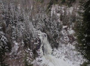
5.06.4 miStarting at the parking area you will walk 0.2 miles west on Route 28 to the north side of the road to locate the marked trailhead. After signing the trail register you will follow the the red marked trail approximately 0.5 miles to the first junction. At the junction you will branch right and f...Read more -
Fort Ann, New York
Hike Shelving Rock Mountain
3.4 mi / 650 ft gainThe trailhead for Shelving Rock Mountain has enough room for about five cars but additional parking can be found on the road leading to it. Be sure to sign the log book and begin the hike by passing around the "stop" car barrier.The trail starts off following a small stream (on your right) but yo...Read more -
Fort Ann, New York
Hike to Shelving Rock Falls
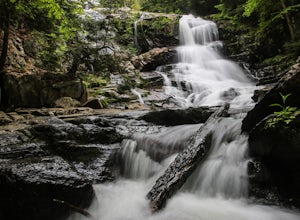
1 mi / 50 ft gainThe hike to beautiful Shelving Rock Falls is only a half mile and well worth the side trip if visiting the east side of Lake George. Shelving Rock Road, the road to the parking area, is long, winding, and unpaved, but maintained pretty well and passable in a sedan. You'll want to take the road a...Read more -
Jericho, Vermont
Americana and Mobbs Hill Loop
4.02.83 mi / 515 ft gainAmericana and Mobbs Hill Loop is a loop trail that is moderately difficult located near Jericho, Vermont.Read more -
Duxbury, Vermont
Camel's Hump Summit via Monroe Trail
4.86.22 mi / 2572 ft gainYou'll begin your Monroe Trail hike at approximately 1500', parking in one of three designated gravel lots along Camel's Hump Road in Duxbury. This trail is 6.8 miles round trip, and gains approximately 2583' in elevation. It is located on the east side of the mountain. Much of your hike will ...Read more -
Saranac Lake, New York
Camp at Fish Creek Pond
4.7Located in the Saranac Lake region there is a natural sand shoreline and water access for most campsites. There are countless rivers and ponds which allow use of motorized and non-motorized boats. The campsites are ideally located on Fish Creek Pond and Square Pond. The campsite offers a beac...Read more -
Mendon, Vermont
Hike to Killington Peak
5.03.4 miThe trail head (Bucklin Trail) is found a couple of miles up Wheelerville Road on the left. Wheerlerville is a dirt road that will be muddy in the spring and summer. The drive is long enough that you will think you did something wrong, but you haven't! the trail head will eventually pop up.The tr...Read more -
Johnsburg, New York
Hike Crane Mountain
4.54.6 mi / 1100 ft gainAt the trail register stay to your right at the fork in the trail. The left trail will be where you return. At approximately 0.5 miles you will reach an open ledge area, as you look up a rock cairn will mark where you pick up the trail. At 0.8 miles you will reach the first of two ladders to a...Read more -
Poultney, Vermont
Camp on Mount St. Catherine
5.0Looking for the best view in all of Poultney, Vermont? Look no further than Lake St. Catherine Mountain. Located within Deane's Nature Preserve, this fast and easy hike tops as one of the best views and camping spots for the little time and energy needed to reach the summit. Only 30-45 minutes fr...Read more -
Long Lake, New York
Hike to Owls Head Mountain Fire Tower in Sargent Ponds Wild Forest
5.06.2 mi / 1500 ft gainOwls Head Mountain is an Adirondack Fire Tower Mountain with an elevation of 2,812 feet. It is located in Long Lake in the Sargent Ponds Wild Forest and is a 6.2 mile out and back round trip hike. The trail head is located on Endion Ln, 2 miles north of the hamlet of Long Lake heading towards Tup...Read more


