New Russia, New York
Top Spots in and near New Russia
-
Wilmington, New York
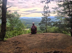
Hike Cobble Lookout in the Wilmington Wild Forest
4.72.6 mi / 240 ft gainPark at the trailhead located on County Route 18A just after the split from Whiteface Veteran's Memorial Highway in Wilmington, NY. There is a small parking lot for 4-5 cars and a pull off just ahead for another 3-4 cars. The trail begins at the back of the parking area. Following the contour of ...Read more -
Ticonderoga, New York
Hike to Lost Pond
3.9 mi / 260 ft gainFrom the parking area, follow the trail from the back of the parking area. Very quickly you will hike up to a trail register. The trail is mostly flat with a few inclines and is very well beaten. There are also yellow plastic trail markers to keep you on track. After 1.4 miles you'll reach the ju...Read more -
Lake Placid, New York
Hike to McKenzie and Haystack Mountains
12.4 mi / 4100 ft gainMcKenzie Mountain stands at 3,861 feet and is one of the highest 100 in the Adirondacks. Haystack Mountain stands at 2,874 feet. Both are part of the Saranac 6ers Challenge.The trailhead for this route to McKenzie and Haystack is located on route 86 in Ray Brook, there is a nice parking area off ...Read more -
Ausable Chasm, New York
Ausable Chasm
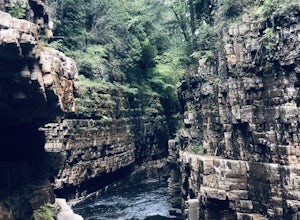
1.84 mi / 210 ft gainAusable Chasm is a loop trail that takes you past scenic surroundings located near Peru, New York.Read more -
Saranac Lake, New York
Hike to Mount Baker in Saranac Lake
1.8 mi / 900 ft gainMount Baker (also referred to as Baker Mountain) stands at 2,457 feet and sits in the village of Saranac Lake and is part of the Saranac Lake 6ers Challenge. This is a moderate out and back 1.8 mile hike with an elevation gain of around 900 feet. It is the easiest of the 6ers and makes for a grea...Read more -
Bristol, Vermont
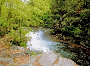
Explore Bartlett Falls
5.0The 14 foot falls plunge into a deep pool, perfect for cliff jumping. There is even a shallow end for younger children. Always take caution when cliff jumping. Make sure your path is clear of rocks. Direction: Turn east on Lincoln Gap Road from Rt. 116 a mile north of Bristol. The falls are vis...Read more -
Lake Clear, New York
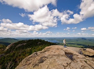
Hike to the Summit of Ampersand Mountain
4.55.2 mi / 1775 ft gainAmpersand Mountain is part of the Saranac Lake 6er Hiking Challenge. It is one of six mountains surrounding Saranac Lake. The trail starts just across the street from the parking area. Though there is ample parking it can full up on a good day as it is a popular hike. The trail begins over most...Read more -
Lake Clear, New York
Relax at Ampersand Beach
1.1 mi / 20 ft gainLocated across from the Ampersand Mountain trailhead on NY Route 3, a trail will take you a short walk (about a half mile) to this beautiful, quiet beach on the shores of Middle Saranac Lake. Starting at the trailhead, you will continue along an unmarked but clear footpath that trails through the...Read more -
Salisbury, Vermont
Camp at Lake Dunmore
The campground office for Branbury state park is on the opposite side of Route 53 from the pin on the map here, but the best campsites are where the pin is. Start by going and talking to the rangers at the office, they are super friendly and very helpful for recommendations of hikes or things to...Read more -
Newcomb, New York
Hike Goodnow Mountain
5.03.9 mi / 1089 ft gainThe trailhead is located on NY 28N and is marked by a white trailhead sign that you can't miss from the road. The highly used trail starts out fairly level, then at 0.5 miles begins to ascend steeply in some spots the rest of the way to the summit. The hike is 1.95 miles from the parking area to ...Read more -
Huntington, Vermont
Camel's Hump Summit via the Burrows Trail
4.04.4 mi / 2228 ft gainThis adventure takes you up the Burrows Trail from the Huntington side of Camel's Hump. There are multiple trails to the summit, but this trail is the shortest. It is 2.4 miles to the summit with 2300' elevation gain. The trailhead is accessed from the aptly named Camel's Hump Road out of Huntin...Read more -
Jericho, Vermont
Americana and Mobbs Hill Loop
4.02.83 mi / 515 ft gainAmericana and Mobbs Hill Loop is a loop trail that is moderately difficult located near Jericho, Vermont.Read more -
Indian Lake, New York
Hike to OK Slip Falls
5.06.4 miStarting at the parking area you will walk 0.2 miles west on Route 28 to the north side of the road to locate the marked trailhead. After signing the trail register you will follow the the red marked trail approximately 0.5 miles to the first junction. At the junction you will branch right and f...Read more -
Warren, Vermont
Explore Warren Falls
5.00.25 miWarren Falls is a popular local swimming hole just outside of Warren, VT on Route 100. You can access the falls by driving south on Route 100 from Warren (it's 3.5 miles south on the right hand side) or north from Granville on Route 100. The parking lot is clearly marked with a sign and ample par...Read more -
North Creek, New York
Hike Gore Mountain
5.010 mi / 3040 ft gainYou will start this hike following the blue blazed Schaefer trail. Though the sign shows 5.8 miles to the summit it is actually only 5.0 miles. Much of the way you follow Roaring Brook which has many waterfalls along the way. Just after the North Creek Reservoir you will get your first glance at...Read more -
Newcomb, New York
Paddle the Essex Chain of Lakes
Beginning in the Town of Newcomb, there is a sign for the Essex Chain of Lakes at the intersection of Route 28N and Pine Tree Road. Follow Pine Tree Road until you see a right for Goodnow Flow Road. Follow this road for 4.3 miles then take a right on Woody's Road. Take this road for 1.5 miles u...Read more

