Millerton, New York
Looking for the best hiking in Millerton? We've got you covered with the top trails, trips, hiking, backpacking, camping and more around Millerton. The detailed guides, photos, and reviews are all submitted by the Outbound community.
Top Hiking Spots in and near Millerton
-
Meriden, Connecticut
Higby Mountain Trail
2.11 mi / 486 ft gainThe popular route for this hike is to park your car at the base of the trail which is located right before merging onto 91-S in Middlefield, CT. The parking lot does seem to get crowded mid-day, especially if the weather is nice! The beginning of the hike is mostly flatter land and an incline w...Read more -
Hamden, Connecticut
Hike the Tower Trail to the Blue Trail at Sleeping Giant SP
5.03 mi / 518 ft gainSleeping Giant State Park is a place very close to my heart. I spent 4 years right across the street at Quinnipiac University and have hiked “The Giant” more times then I can count and at all different hours. There are a few different trails you can explore but my favorite one is up to the cliffs...Read more -
Hamden, Connecticut
Hike the Mill River Trail to the Blue Trail at Sleeping Giant SP
5.03 mi / 518 ft gainSince I was a child, I’ve always enjoyed hiking the Giant. As Connecticut parks go, this terrain is some of the most challenging (and unfortunately, the most dangerous) in the state. The actual ridge is approximately 2.75 miles long by 1.75 miles wide, and offers approximately 24 miles of hiking ...Read more -
Hamden, Connecticut
Boulder & Free Climb off the Blue Trail In Sleeping Giant SP
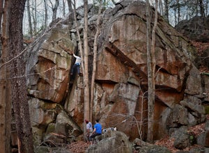
Sleeping Giant State Park does not just have great hiking, it also has great climbing and bouldering. Pick up the blue trail starting at the backside of the visitor center. This trail climbs pretty steadily but take note that as you hike up the cliff below you is a great spot to checkout for boul...Read more -
Philipstown, New York
Hike the Osborn Loop
7.6 mi / 850 ft gainThe Osborn Loop trail itself is not a loop. It connects to a 2.5 mile section of the Appalachian Trail. Hiking these together creates the loop. Start at the trail head for the Appalachian Trail on South Mountain Pass Road. There is parking for two or three cars. Walk up the road a short dist...Read more -
Pound Ridge, New York
Leatherman's Loop
1.25 mi / 1183 ft gainThis loop trail is moderately rated and reaches a total elevation gain of approximately 1,183 feet. It’s located in the Ward Pound Ridge Reservation, which spans roughly 4,315 acres. It is Westchester County’s largest park and includes roughly 35 plus miles of hiking trails to explore. The Ward...Read more -
Holyoke, Massachusetts
Whiting Street Reservoir Loop
3.74 mi / 138 ft gainWhiting Street Reservoir Loop is a loop trail that takes you by a lake located near Holyoke, Massachusetts.Read more -
Big Indian, New York
Hike to Balsam Mountain in the Catskills
5.4 mi / 2910 ft gainTimeline: Weekend, though can easily be done as an overnight trip or just a day hike Summary: Day 1: Hike to camp (0.7 miles, 340' elevation gain) Day 2: Hike to Balsam Mountain and back to camp (4 miles round-trip) Day 3: Relax & hike back to car (0.7 miles) Details: Park the car at McKinle...Read more -
Williamstown, Massachusetts
Hike the March Cataract Falls Trail
4.02.2 mi / 511 ft gainPark at the Junction of Sperry Rd and Rockwell Rd. To get to the trailhead, hike along Sperry Road for about 30 minutes. (Not to the end of the road, see map below.) Then hike along the March Cataract Trail, an out-and-back. You can bring dogs on leash. The trail is short but steep in some parts ...Read more -
Philipstown, New York
Anthony's Nose via Appalachian Trail
4.61.95 mi / 682 ft gainParking for the trail runs along both sides of 9D right up until the Bear Mountain Bridge. It can be busy on the weekends so just make sure you're as far off the road as you can and be especially careful unloading kids and dogs. The trailhead is located at approximately 41.322571, -73.975949 and ...Read more


