New York
Looking for the best hiking in New York? We've got you covered with the top trails, trips, hiking, backpacking, camping and more around New York. The detailed guides, photos, and reviews are all submitted by the Outbound community.
Top Hiking Spots in and near New York
-
Yonkers, New York
Run the Old Croton Aqueduct Trail
5.026.5 miThis trail traces the route of the Old Croton Aqueduct, which carried water to New York City between 1842 and 1955. Our recommended route starts near the Greystone Station in Yonkers, NY (Metro-North Hudson Line) and ends by the Scarborough Station, but you can easily modify your route – the enti...Read more -
Cragsmoor, New York
Sam's Point, Ice Cave Trail, Verkeerderkill Falls
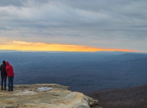
4.96.99 mi / 1063 ft gainLocated in Sam's Point Preserve, this hike has three major attractions – panoramic views from Sam's Point, mysterious and chilly Ice Caves, and a knee-weakening perch atop Verkeerderkill Falls. Pay attention to seasonal conditions before making this trip. Spring and early summer are best for see...Read more -
Carmel Hamlet, New York
Ninham Mountain Fire Tower
5.01.23 mi / 367 ft gainThis is more of a stroll than a hike, which is nice because you can add it to another hike in the same day if you're in the area. From the dirt parking lot take the trail off to the right. Just stay straight and in about 15 minutes you'll see a huge fire tower (hard to miss). Feel free to climb a...Read more -
High Falls, New York
Mohonk Mountain House Labyrinth and Lemon Squeeze Hike
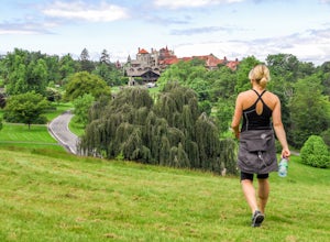
4.5Mohonk Mountain House is a historic resort located just outside the Catskills in the Hudson Valley just 90 miles north of New York City. With 85 miles of winding trails throughout the Mohonk Preserve, you'll have endless hiking options upon your arrival.Parking at the Gatehouse is limited, so be ...Read more -
Niagara Falls, New York
Hike To Niagara Gorge Whirlpools
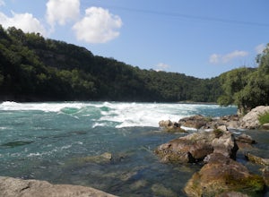
3.72 miThere are many different hiking trails in the Niagara Falls area, one of the favorites and most challenging being Devils Hole and Whirlpool Trail. Park at the far end of the lot at Whirlpool Park and walk towards the river where you'll see the trailhead going north. After about 5 minutes on this ...Read more -
Lake Placid, New York
Hike Mount Marcy
4.713.94 mi / 3383 ft gainThe hike does offer several different terrains and an elevation gain of 3170 feet, which can make you feel like it's going to be a long day. There are four routes for summiting Mount Marcy. This is the most popular route and leaves from the Adirondack Loj. Once you hit the trail, you will head up...Read more -
Cortlandt, New York
Hike the Camp Smith Trail
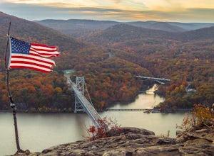
4.55.92 mi / 1759 ft gainThis approximately 3-hour hike borders the Hudson River, and is one of the best in Westchester County. Start off at the parking area at the Bear Mountain Tollhouse, or at a small parking area farther up Bear Mountain Road, if you want a slightly shorter hike. The trail is fairly steep in places, ...Read more -
Chittenango, New York
Chittenango Falls
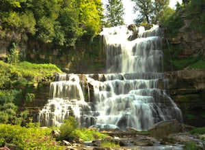
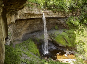
4.70.53 mi / 102 ft gainChittenango is a great place to hang out and take pictures for a couple of hours. It is a very short hike and the trail takes you from the top of the falls on one side, down to the bottom, across the river, and then up to the top on the other side. The whole trail only takes about 45 min and is a...Read more -
Tuxedo Park, New York
Hike to the Sterling Ridge Fire Tower
5.08.5 miStart out by turning right when you walk out of the visitor center onto Sterling Lake Loop (Blue Blazes). The visitor center is worth going in as they have a full diorama of the park with LED light to show trail routes. About .3 miles into the hike you will cross over a small bridge with a waterf...Read more -
North Elba, New York
Hike Cascade & Porter Mountains
4.74.8 mi / 1900 ft gainCascade 4,098ft and Porter 4,084ft are two easy peaks which are usually hiked together. The trail starts on Rt 73 and you starts climbing up slowly but not challenging at all. Is 2.4 mIles to summit of cascade, the last 0.2 miles is a open rock scrambling but I'm the winter when the weather is b...Read more -
Trumansburg, New York
Gorge Trail to Taughannock Falls
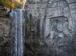
4.91.95 mi / 364 ft gainThe trailhead is located right off NY Route 89 with plenty of parking just across the street from it. Be sure to take your camera and tripod because these 215 ft tall falls are a sight to see! The hike to the base of the falls is a very easy 1.5 miles out and back. In the summer months the trai...Read more -
Highland Falls, New York
Popolopen Torne
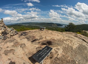
4.51.18 mi / 531 ft gainPopolopen Torne is a hidden gem in the Hudson Valley, a surprisingly unknown trail with a beautiful payoff and a far deeper meaning. A short hike to the top puts you at the foot of a memorial to those who have served their country, a pile of painted rocks carried up by those who want to pay their...Read more -
Bear Mountain, New York
Hike Bald Mountain, Bear Mountain State Park
4.76.8 mi / 1080 ft gainFrom your starting point at the Bear Mountain Inn, go left along the Cornell Mine Trail. (This part can be a bit confusing, but go past the carousel to a shaded picnic area; that is where the trail starts.) You will go under a bridge and follow the trail until it takes a sharp left and descends t...Read more -
Beacon, New York
Explore Long Dock and Dennings Point Parks
4.0Long Dock and Dennings Point are two of the most popular parks in Beacon, that just so happen to be connected by a train track turned trail. Plenty of parking is available at Long Dock, and its a perfect spot to picnic, launch your kayak into the Hudson, or cast your line hoping to reel in the bi...Read more -
Moravia, New York
Hike Carpenter and Angel Falls
4.03 mi / 450 ft gainHead 12 miles south on Route 41A along Skaneateles Lake from Skaneateles NY. Make a left onto Appletree Point Road and go a little more than a half mile to where the intersection of Carver Road is. There is a small gravel parking area off to the left with room for about 8 cars. The trailhead beg...Read more -
Elka Park, New York
Backpack the Eastern Half of Devil's Path in the Catskill Mountains
5.014 mi / 3900 ft gainThe Eastern half of Devil's Path has four major summits: Indian Head, Twin, Sugarloaf and Plateau. Each summit is a straight climb up and down, then back up to as much as 3,900 ft. There are some sparse sections of level ground, but most is a steep descent uphill or steep slide downhill. Your ...Read more

