Gloversville, New York
Looking for the best hiking in Gloversville? We've got you covered with the top trails, trips, hiking, backpacking, camping and more around Gloversville. The detailed guides, photos, and reviews are all submitted by the Outbound community.
Top Hiking Spots in and near Gloversville
-
Caroga Lake, New York
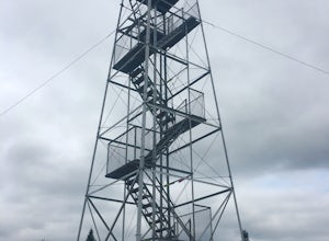
Kane Mountain Fire Tower
4.22.1 mi / 518 ft gainThe Kane Mountain fire tower is one of the more frequented Adirondack towers due to the ease of the trail and its proximity to so many Caroga Lake camping areas. The short hike is family friendly and available year round, part of the trail doubles as a cross country skiing trail in fact. Driving...Read more -
Schenectady, New York
Hike Plotter Kill Preserve
4.35.5 mi / 820 ft gainThere are a few entries into the preserve' however, this hike has you entering off of Mariaville Road. There is a kiosk here and you will enter on the Red trail. Shortly after you can go out and back on the Blue trail to view the Upper and Lower Falls from lookouts above. Once back to the Red t...Read more -
Altamont, New York
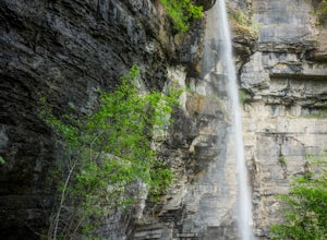
Hike through the Wolf Creek Falls Preserve
3.03 mi / 200 ft gainOver 3 miles of trails provide access to all parts of the preserve, and end up winding through mixed terrain including a wetland, waterfalls, and old stone walls. The property crosses the Bozenkill Road at two points on either side of private parcels (with beautiful homes), so be vigilant there; ...Read more -
Wells, New York
Hike to Auger Falls
4.0Augers Falls is a not so well kept secret in the Wells/Speculator area of the Adirondacks. It's usually not very crowded but the people that go to take it in come from far and wide. It's an easy family friendly hike (and that includes furry family, just keep them on leash) that offers some fantas...Read more -
Hadley, New York
Hike the Adirondack's Hadley Mountain
5.03.6 mi / 1545 ft gainHadley Mountain historically has faced its share of forest fires. The fires left thin soil, leading to more exposed rock on this fairly quick, scenic hike. Due to the rockiness, when you're thinking about heading out for this hike, be sure to grab a sturdy pair of hiking boots or at least your st...Read more -
Schenectady, New York
Hike the Lisha Kill Preserve Loop
5.02.3 mi / 324 ft gainThis 2.3 mile loop trail is lightly trafficked and great for all skill levels. Starting out the trail register, you will see signs from The Nature Conservancy which manages the preserve. Descending down a hill with lots of exposed tree roots, you will then cross over the meandering Lisha Kill and...Read more -
Voorheesville, New York
Hike the Indian Ladder Trail
4.53.5 mi / 200 ft gainThere are many parking areas within the park. Park at the overlook parking. From here you head west following the wood fence. This is the Cliff Top trail. Approximately after walking 0.5 miles you will reach the stairs that will lead you to the base of the cliffs. This marks the start of the...Read more -
Albany, New York
Blueberry Hill West Red and Yellow Trail
1.37 mi / 52 ft gainBlueberry Hill West Red and Yellow Trail is a loop trail where you may see beautiful wildflowers located near Albany, New York.Read more -
Albany, New York
Blueberry Hill East
1.73 mi / 59 ft gainBlueberry Hill East is a loop trail where you may see beautiful wildflowers located near Albany, New York.Read more -
Voorheesville, New York
Hike the Keleher Preserve Loop
2.03 mi / 1636 ft gainThe historic preserve is operated by the Mohawk Hudson Land Conservancy, so trails are clearly marked and extremely well maintained. There are features of the original farm that the land was used for from the 18th Century, including hand-thrown stone walls and an old logging road that cuts throug...Read more -
Lake Pleasant, New York
Hike Pillsbury Mountain Fire Tower
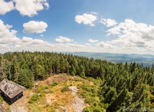
5.0Pillsbury Mountain is a fairly short but satisfying hike, ending with beautiful views of surrounding mountain ranges and lakes, and home to a defunct ranger station and fire tower. To get to the parking area within the Perkins Clearing wilderness area, head north on Route 30 out of Speculator and...Read more -
Lake Pleasant, New York
Backpack to Cedar Lakes Lean-to #2 in the West Canada Lakes Wilderness
5.3 mi / 705 ft gainKnow before you go! It’s a bumpy road in and a bumpy road out so be sure your vehicle is ready to handle a long, winding dirt and rocky road back to the trail head. The road is approximately 7 miles to the trailhead starting on Jessup River Road off of State Route 30 in Speculator, NY. Follow Jes...Read more -
Johnsburg, New York
Hike Crane Mountain
4.54.6 mi / 1100 ft gainAt the trail register stay to your right at the fork in the trail. The left trail will be where you return. At approximately 0.5 miles you will reach an open ledge area, as you look up a rock cairn will mark where you pick up the trail. At 0.8 miles you will reach the first of two ladders to a...Read more -
Indian Lake, New York
Hike Snowy Mountain Fire Tower
4.77.5 mi / 2142 ft gainSnowy Mountain is the largest mountain in this region of the Adirondacks, and with a 2100'+ elevation gain over the 3.5 mile ascent is actually more work than some of the famed High Peaks. Going north on Rt 30, the parking lot is marked as Snowy Mountain on the right hand side. If you make it to ...Read more -
North Creek, New York
Hike Gore Mountain
5.010 mi / 3040 ft gainYou will start this hike following the blue blazed Schaefer trail. Though the sign shows 5.8 miles to the summit it is actually only 5.0 miles. Much of the way you follow Roaring Brook which has many waterfalls along the way. Just after the North Creek Reservoir you will get your first glance at...Read more -
Bolton, New York
Hike Cat & Thomas Mountains Preserve
5.05.8 miThere are a few ways to approach these two peaks. We chose to do a traverse using two vehicles.Starting at Edgecomb Pond Rd you will park along the road. There will be a sign and yellow discs directing you to the start of the trail. The first 0.4 miles is following a dirt road. You will then ...Read more

