Cornwall, New York
Top Spots in and near Cornwall
-
Beacon, New York
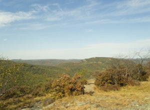
Hike the Scofield Ridge Loop
7.5 mi / 1850 ft gainThere are some great view points along this route. Start from the Mount Beacon Park trailhead parking area. This leads to the Casino Trail (red markers). The trail climbs steeply to some old ruins of a casino. Most of what remains is only the brick structure housing the mechanics for a trolle...Read more -
Beacon, New York
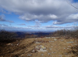
Hike Fishkill Ridge
Fishkill Ridge is a strenuous but rewarding hike, and one of the less known areas in the Hudson Valley. The parking area is at the very end of Sunnyside Road in Beacon, along with the information board at the trailhead. The red trail leaves the lot and will take you up to the first peak on the ri...Read more -
Beacon, New York
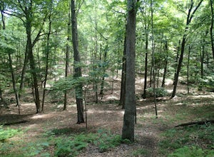
Hudson Highlands Overlook Trail
3.29 mi / 1017 ft gainHudson Highlands Overlook Trail is an out-and-back trail that takes you through a nice forest located near Beacon, New York.Read more -
Highland Falls, New York
Popolopen Torne
4.51.18 mi / 531 ft gainPopolopen Torne is a hidden gem in the Hudson Valley, a surprisingly unknown trail with a beautiful payoff and a far deeper meaning. A short hike to the top puts you at the foot of a memorial to those who have served their country, a pile of painted rocks carried up by those who want to pay their...Read more -
Philipstown, New York
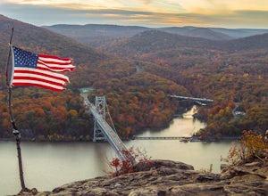
Anthony's Nose via Appalachian Trail
4.61.95 mi / 682 ft gainParking for the trail runs along both sides of 9D right up until the Bear Mountain Bridge. It can be busy on the weekends so just make sure you're as far off the road as you can and be especially careful unloading kids and dogs. The trailhead is located at approximately 41.322571, -73.975949 and ...Read more -
Philipstown, New York
Hike the Osborn Loop
7.6 mi / 850 ft gainThe Osborn Loop trail itself is not a loop. It connects to a 2.5 mile section of the Appalachian Trail. Hiking these together creates the loop. Start at the trail head for the Appalachian Trail on South Mountain Pass Road. There is parking for two or three cars. Walk up the road a short dist...Read more -
Bear Mountain, New York
Hike Bald Mountain, Bear Mountain State Park
4.76.8 mi / 1080 ft gainFrom your starting point at the Bear Mountain Inn, go left along the Cornell Mine Trail. (This part can be a bit confusing, but go past the carousel to a shaded picnic area; that is where the trail starts.) You will go under a bridge and follow the trail until it takes a sharp left and descends t...Read more -
Cold Spring, New York
Hike the Perkins/Fahnestock/Charcoal Burners Trail Loop
7.5 mi / 800 ft gainThis is one of my favorite hikes in the Clarence Fahnestock State Park. A real mixed bag but mostly very enjoyable. The trail starts at the Charcoal Burners Trailhead Route 301. There is only road side parking on a soft shoulder, both sides of the road. After a short walk into the forest, you re...Read more -
Monroe, New York
Hike the Jessup/Highlands/Long Path Trails
7.8 mi / 500 ft gainThis trails starts at a small park in Woodbury called Gonzaga Park. Closed from mid-November to April, you are still able to park just outside the gate if that is the time of year you are hiking. Three different trail names share this path. The Jessup trail starts/end at Gonzaga Park and trave...Read more -
Cortlandt, New York
Hike the Camp Smith Trail
4.55.92 mi / 1759 ft gainThis approximately 3-hour hike borders the Hudson River, and is one of the best in Westchester County. Start off at the parking area at the Bear Mountain Tollhouse, or at a small parking area farther up Bear Mountain Road, if you want a slightly shorter hike. The trail is fairly steep in places, ...Read more -
Hopewell Junction, New York
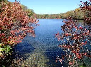
Beaver Pond via Appalachian Trail
5.03 mi / 400 ft gainBeaver Pond is a small body of water created by a dam that was constructed during the days of iron ore mining in the area. The pond is crystal clear and has a wonderful tree line right on the water. The best time to visit here is early morning in the fall. With the leaves changing color they m...Read more -
Hopewell Junction, New York
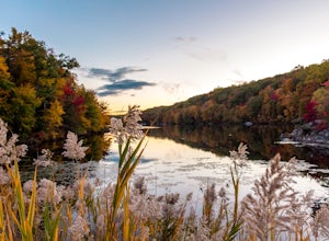
Lake Canopus Viewpoint
4.02.07 mi / 148 ft gainIts a great place to explore as it has a beautiful calm lake especially in the fall, the reflection of the water and the awesome colors are unbelievable. Its a short hike but you certainly could go further up. Parking is free by the road, hike towards the lake about a mile or so. The sound of bi...Read more -
Kent, New York
King's Chamber and Moose Hill Loop
3.14 mi / 499 ft gainKing's Chamber and Moose Hill Loop is a loop trail that takes you by a lake located near Carmel, New York.Read more -
Carmel Hamlet, New York
Ninham Mountain Fire Tower
5.01.23 mi / 367 ft gainThis is more of a stroll than a hike, which is nice because you can add it to another hike in the same day if you're in the area. From the dirt parking lot take the trail off to the right. Just stay straight and in about 15 minutes you'll see a huge fire tower (hard to miss). Feel free to climb a...Read more -
Tuxedo Park, New York
Backpack Harriman State Park
4.518 mi / 1200 ft gainWhile the first day is a bit longer and less exciting in terms of frequent landmarks, its a relaxing hike through rocky, wooded, forest among bountiful blueberry bushes and the occasional raspberry bush. Enjoy the isolation on this leg. The second day is packed with frequent and beautiful landmar...Read more -
Tuxedo Park, New York
Hike to the Sterling Ridge Fire Tower
5.08.5 miStart out by turning right when you walk out of the visitor center onto Sterling Lake Loop (Blue Blazes). The visitor center is worth going in as they have a full diorama of the park with LED light to show trail routes. About .3 miles into the hike you will cross over a small bridge with a waterf...Read more

