Au Sable Forks, New York
Top Spots in and near Au Sable Forks
-
Lake Clear, New York
Relax at Ampersand Beach
1.1 mi / 20 ft gainLocated across from the Ampersand Mountain trailhead on NY Route 3, a trail will take you a short walk (about a half mile) to this beautiful, quiet beach on the shores of Middle Saranac Lake. Starting at the trailhead, you will continue along an unmarked but clear footpath that trails through the...Read more -
Keene Valley, New York
Climb Chapel Pond Slab
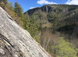
Chapel Pond area is mostly known for its ice climbing on the other side of the pond, but some easier, but runout slab climbing can be had on the eastern side. There is ample parking on both sides of the road in the form of pull offs and the walk to the base of the climbing is only a few hundred ...Read more -
Keene Valley, New York
Backpack the Dix Range
4.517 miDay 1The trail begins about a mile past the intersection of Rt. 73 and Rt. 9 just east of a bridge over the North Fork Boquet River. Note: this trail is unmarked, so be sure to have an accurate map of the area. I recommend going to The Mountaineer store in Keene Valley and asking one of the cler...Read more -
New Russia, New York
Explore Split Rock Falls
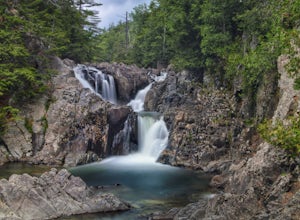
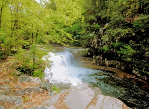
5.0The the easiest and the fastest access of any New York waterfalls Split Rock Falls, is within 10 feet of the parking lot and as soon as you open the car door you hear the water gushing down the Boquet River. The clear, cold waters of Split Rock Falls cascade through groves of hemlock and spruce, ...Read more -
Saranac Lake, New York
Camp at Fish Creek Pond
4.7Located in the Saranac Lake region there is a natural sand shoreline and water access for most campsites. There are countless rivers and ponds which allow use of motorized and non-motorized boats. The campsites are ideally located on Fish Creek Pond and Square Pond. The campsite offers a beac...Read more -
Waverly, New York
Azure Mountain Firetower
1.8 mi / 899 ft gainAzure Mountain Firetower is an out-and-back trail that takes you by a lake located near Saint Regis Falls, New York.Read more -
Essex, New York
Deep Water Solo at The Palisades on Lake Champlain
Free soloing gets a lot of hype in the climbing world. No surprise, you're putting your life at risk basically. But, as climbers haven't you wanted to experience free soloing? You can, and you can take away some of the risk/death aspects of it by deep water soloing. This rare form of climbing can...Read more -
324 State Park Road, Vermont
Hike to Mount Philo
5.01.9 mi / 538 ft gainMount Philo is a great hike year-round with incredible views from the summit. Starting from the bottom, the right hand portion of the loop is ‘paved,’ while the left hand portion is more of a traditional trail hiking experience. Dogs are allowed on this trail, but must be kept on leash. Take caut...Read more -
Tupper Lake, New York
Hike to Mount Arab Fire Tower
2.2 mi / 764 ft gainLocated just a couple miles outside of Tupper Lake this little hike is a gem. The trailhead starts just across the street from the parking area. The 1.1 mile one-way trail is marked with red discs and easy to follow. The trail has a moderate incline in areas. It follows the northern ridge of t...Read more -
Newcomb, New York
Hike Goodnow Mountain
5.03.9 mi / 1089 ft gainThe trailhead is located on NY 28N and is marked by a white trailhead sign that you can't miss from the road. The highly used trail starts out fairly level, then at 0.5 miles begins to ascend steeply in some spots the rest of the way to the summit. The hike is 1.95 miles from the parking area to ...Read more -
Jericho, Vermont
Americana and Mobbs Hill Loop
4.02.83 mi / 515 ft gainAmericana and Mobbs Hill Loop is a loop trail that is moderately difficult located near Jericho, Vermont.Read more -
Long Lake, New York
Camp along Section 2 of the Northern Forest Canoe Trail
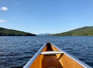
The Northern Forest Canoe Trail is a 740-mile paddling trail with the western terminus located in Old Forge, New York and the eastern terminus in Fort Kent, Main. Section Two is a 42.4 mile journey in the Adirondacks of New York from Long Lake to Saranac Lake. There are primitive campsites and ...Read more -
Long Lake, New York
Canoe from Long Lake to Tupper Lake in the Adirondacks
This is a 3-4 day adventure that begins with part of the Northern Forest Canoe Trail. Rent a canoe at a local outfitter and make arrangements for your vehicle shuttle. They will drive your car to the end point of the adventure. A couple of options include St. Regis Canoe Outfitters and Raquette...Read more -
Newcomb, New York
Paddle the Essex Chain of Lakes
Beginning in the Town of Newcomb, there is a sign for the Essex Chain of Lakes at the intersection of Route 28N and Pine Tree Road. Follow Pine Tree Road until you see a right for Goodnow Flow Road. Follow this road for 4.3 miles then take a right on Woody's Road. Take this road for 1.5 miles u...Read more -
Long Lake, New York
Hike to Owls Head Mountain Fire Tower in Sargent Ponds Wild Forest
5.06.2 mi / 1500 ft gainOwls Head Mountain is an Adirondack Fire Tower Mountain with an elevation of 2,812 feet. It is located in Long Lake in the Sargent Ponds Wild Forest and is a 6.2 mile out and back round trip hike. The trail head is located on Endion Ln, 2 miles north of the hamlet of Long Lake heading towards Tup...Read more -
Bristol, Vermont
Explore Bartlett Falls
5.0The 14 foot falls plunge into a deep pool, perfect for cliff jumping. There is even a shallow end for younger children. Always take caution when cliff jumping. Make sure your path is clear of rocks. Direction: Turn east on Lincoln Gap Road from Rt. 116 a mile north of Bristol. The falls are vis...Read more

