Santa Fe County, New Mexico
Looking for the best hiking in Santa Fe County? We've got you covered with the top trails, trips, hiking, backpacking, camping and more around Santa Fe County. The detailed guides, photos, and reviews are all submitted by the Outbound community.
Top Hiking Spots in and near Santa Fe County
-
Sandia Park, New Mexico
Golden Open Space Mesa Trail Loop
5.02.07 mi / 131 ft gainGolden Open Space Mesa Trail Loop is a dog and family-friendly loop trail located near Sandia Park, New Mexico. The trail is open year-round and offers expansive views of the valleys and mountains alongside Juniper and Pinyon trees. These trails are used by mountain bikers as well, so please keep...Read more -
Jemez Springs, New Mexico
Climb Las Conchas
5.05 mi75 minutes north of Albuquerque, Las Conchas is a trailhead that sits right off the highway with two accessible, although small, parking lots. Right out of the gate the wide and well worn trail drops down to follow the river north through a wide mountain valley lined with large stands of trees, ...Read more -
Cedar Crest, New Mexico
Tree Spring Trail
5.04.11 mi / 984 ft gainTree Spring Trail is an out-and-back trail where you may see beautiful wildflowers located near Sandia Park, New Mexico.Read more -
Cedar Crest, New Mexico
Sulphur Canyon #281 and Cienega Horse Bypass #266 Loop
4.02.25 mi / 469 ft gainSulphur Canyon #281 and Cienega Horse Bypass #266 Loop is a loop trail that provides a good opportunity to view wildlife located near Cedar Crest, New Mexico.Read more -
Sandia Park, New Mexico
Hike the 10K Loop
5.2 mi / 700 ft gain10K trailhead springs from it a whole handful of beautiful trails. With access to a rocky path that leads off into raw wilderness, a clean and smooth walking, hiking, and mountain biking trail covered by tall pine canopy, or a wide cut service road ideal for easy strolls, you have plenty of opti...Read more -
Jemez Springs, New Mexico
Dip into Spence Hot Springs
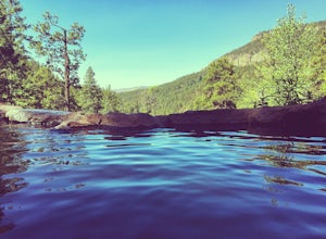
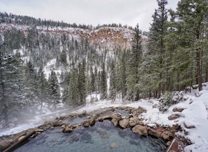
4.01.2 mi / 193 ft gainExit Interstate 550 and head North on Highway 4 heading towards Jemez Springs. The Spence Hot Springs Parking Lot and Trailhead is about 25 miles North off Highway 4. The trail starts on a decline into the canyon for about 800 feet before you cross the bridge over the scenic river. Continue follo...Read more -
Albuquerque, New Mexico
Hike the Piedra Lisa Trail
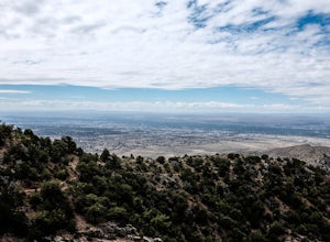
5.04.2 mi / 1000 ft gainUp near the iconic La Luz Trailhead is a smaller and somewhat hidden trail a little farther up the road, Piedra Lisa Trail. This short two mile climb to the ridge that divides the view of Albuquerque and Placitas tops out at a rocky outcrop that provides simply stellar views of the city and to t...Read more -
Albuquerque, New Mexico
Summit Point 8300
6.5 mi / 1300 ft gainPoint 8300, also nicknamed Mayan Temple by the locals, is the highest point in the Rincon Ridge. In order to reach the summit you start by following the South Piedra Lisa Trail for about 2.25 miles to the ridge. Once you reach the ridge the Piedra Lisa goes off to the right, but there is an unmar...Read more -
Albuquerque, New Mexico
Hike La Luz Trail
5.07.2 mi / 3378 ft gainLeaving from the foothills above Albuquerque this trail leads you from the desert up to the peaks of the Sandia Mountains. You'll climb from the city at 7000 ft above sea level all the way up to 10,378 ft in altitude along a trail the changes from high desert to deep pine forest. The views alon...Read more -
Jemez Springs, New Mexico
San Antonio Hot Springs via Thompson Ridge Route
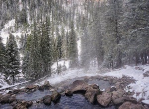
5.02.66 mi / 469 ft gainAlthough you can reach these hot springs via the main trail in the winter, the Thompson Ridge route is a shorter option that comes in from above the springs rather than below. If you go in winter, you'll need winter route finding skills for the trail (there's no signage at any point) and an all w...Read more -
Jemez Springs, New Mexico
San Antonio Hot Springs
4.61.46 mi / 312 ft gainThese hot springs are a short hike from the parking area along the top of Forest Service Road 376. I've added additional details below in the event that the road is closed due to seasonality or you prefer to stretch your legs for a significantly longer, yet scenic hike. The GPX track is displayin...Read more -
Albuquerque, New Mexico
Michael M. Emery and Trail 305 Loop
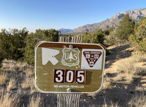
5.03.17 mi / 335 ft gainThe Michael M. Emery and Trail 305 Loop in Albuquerque, New Mexico, is a moderately challenging hiking trail. It spans approximately 3.17 miles and is primarily used for hiking, walking, and nature trips. The trail is well-marked and offers a variety of terrain, including dirt paths, rocky sectio...Read more -
Tijeras, New Mexico
Sandia Crest Trail
26.24 mi / 5528 ft gainThis point-to-point hike took me about 11.5 hours to complete, however I consider myself to be in decent hiking shape and was moving at about 2.5 miles per hour for the majority of the hike. I would give yourself ample time if you want to complete this in 1 day or you can back country primitive c...Read more -
Tijeras, New Mexico
Hike the Upper Faulty Loop
5.4 mi / 1040 ft gainLoop: South Crest Trail > Lower Faulty Trail > Upper Faulty Trail > South Crest Trail The trail starts at the Canyon Estates Trailhead along the South Crest Trail. You'll follow this trail for 0.8 miles before you reach the junction for the Lower Faulty Trail. This is the steepest part o...Read more -
Albuquerque, New Mexico
Hike Embudito Canyon
4.04.2 mi / 1204 ft gainThis is a hiking area in the foothills of the Sandia Mountains. This route is a 3.9 mile heavily trafficked loop up Oso Ridge and down Embudito Canyon. There is plenty of room to park at the Embudito Trail Trail head, on the eastern side of Albuquerque. From the parking lot, take the center trai...Read more -
La Senda de Medio Trailhead, New Mexico
Hike La Senda de Medio Trail
5 miIf you find yourself in Taos for the weekend, the La Senda del Medio trail is a perfect hike to add to your adventure. About 20 minutes south of town and located in Rio Grande del Norte National Monument, this trail follows the Rio Grande for 2.5 miles and connects 5 different campgrounds. The tr...Read more

