Nambe, New Mexico
Top Spots in and near Nambe
-
Glorieta, New Mexico
Hike the Glorieta Battlefield Trail
2.25 mi / 500 ft gainThis trail is a little tricky to get to, so be sure to stop at the Pecos NHP Visitor Center first for directions. You will also need to retrieve a gate code from the ranger. I would recommend picking up a guide inside the Visitor Center so you know what you're looking at on the trail (important)....Read more -
Lamy, New Mexico
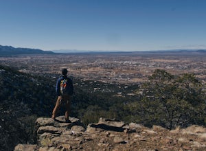
Hike to the Happy Valley Overlook in the Galisteo Basin Preserve
1 mi / 150 ft gainThe Galisteo Basin Preserve south of Santa Fe, New Mexico is community conservation area of some 10,000 acres with 28 miles of publicly accessible trails for hikers, mountain bikers, and equestrians.The Happy Valley Overlook is a great, quick way to get an epic view of a large portion of Galisteo...Read more -
Pecos, New Mexico
Ancestral Sites Trail
5.01.2 mi / 89 ft gainThe park is easy to get to from Santa Fe. It's about 30 miles SE on the I-25 highway that leads you through Pecos. Once at the park, the 1.25 mile loop trail begins and ends at the visitor center. Don't forget to stop in there. It's surprisingly nice with some terrific history of the area dating...Read more -
Pecos, New Mexico
Hike the Grand Slam in Pecos New Mexico
7.5 mi / 600 ft gainPecos National Historical Park offers up the "grand slam" for hiking, which is a bit of a misnomer because they only have 3 trails and a grand slam indicates you would have completed 4 of something. In order to achieve the "grand slam" you need to hike all 3 trails in one day, completing approxi...Read more -
Jemez Springs, New Mexico
Hike at Kasha-Katuwe Tent Rocks National Monument
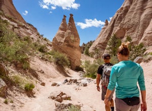
4.93 miHiking at Tent Rocks is a must-do for anyone in the northern New Mexico area. It's an accessible trail that gives you incredible rewards with little effort. The cone-shaped "tent rocks" are the result of erosion following a volcanic explosion 6-7 million years ago, making for some incredible and ...Read more -
La Senda de Medio Trailhead, New Mexico
Hike La Senda de Medio Trail
5 miIf you find yourself in Taos for the weekend, the La Senda del Medio trail is a perfect hike to add to your adventure. About 20 minutes south of town and located in Rio Grande del Norte National Monument, this trail follows the Rio Grande for 2.5 miles and connects 5 different campgrounds. The tr...Read more -
Pecos, New Mexico
Hike the South Pasture Loop Trail
3.8 mi / 196 ft gainThe South Pasture Loop trail, while part of the Pecos NHP, isn't in the main park. Currently, this trail is only open on the weekends and the road gate closes at 1pm. The trail itself closes at 3pm, and takes about 2-3 hours unless you plan on hiking for speed. No pets allowed. 0.7 miles down th...Read more -
Jemez Springs, New Mexico
Climb Las Conchas
5.05 mi75 minutes north of Albuquerque, Las Conchas is a trailhead that sits right off the highway with two accessible, although small, parking lots. Right out of the gate the wide and well worn trail drops down to follow the river north through a wide mountain valley lined with large stands of trees, ...Read more -
Jemez Springs, New Mexico
Dip into Spence Hot Springs
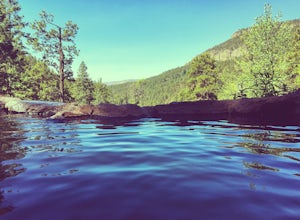
4.01.2 mi / 193 ft gainExit Interstate 550 and head North on Highway 4 heading towards Jemez Springs. The Spence Hot Springs Parking Lot and Trailhead is about 25 miles North off Highway 4. The trail starts on a decline into the canyon for about 800 feet before you cross the bridge over the scenic river. Continue follo...Read more -
Jemez Springs, New Mexico
San Antonio Hot Springs via Thompson Ridge Route
5.02.66 mi / 469 ft gainAlthough you can reach these hot springs via the main trail in the winter, the Thompson Ridge route is a shorter option that comes in from above the springs rather than below. If you go in winter, you'll need winter route finding skills for the trail (there's no signage at any point) and an all w...Read more -
Jemez Springs, New Mexico
San Antonio Hot Springs
4.61.46 mi / 312 ft gainThese hot springs are a short hike from the parking area along the top of Forest Service Road 376. I've added additional details below in the event that the road is closed due to seasonality or you prefer to stretch your legs for a significantly longer, yet scenic hike. The GPX track is displayin...Read more -
Jemez Springs, New Mexico
Visit the Jemez Soda Dam
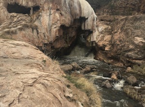
For the past 7,000 years, calcium carbonate at this spot in northern New Mexico. And after all those centuries, it has formed into a natural bridge across the Jemez river, roughly 300 feet in length. Drive northeast from Jemez Springs on New Mexico State Route 4. Just under 2 miles later, the fo...Read more -
Abiquiu, New Mexico
Hike to Chimney Rock at Ghost Ranch
4.53 mi / 600 ft gainStart your adventure by checking in at the Ghost Ranch Visitor Center, then find the trailhead just behind the building. You'll quickly drop down through an arroyo and then walk through a gate. The trail begins to climb briefly then flattens out with beautiful views across to Pedernal and the Pie...Read more -
U.S. Highway 64, New Mexico
Devisadero Peak
5.48 mi / 1375 ft gainThe Basics: 8,304 foot Devisadero Peak, which literally translates to "lookout," does not actually provide a great view from its treed summit. However, this lollipop loop hike has many vantage points over the Taos Valley as it snakes up and around this foothill mountain. To get to the trailhea...Read more -
Taos, New Mexico
Drive the Enchanted Circle Scenic Byway
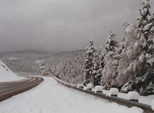
Start the drive at the Taos Plaza in downtown Taos. You can drive the whole loop and enjoy the beautiful scenery and small villages along the way. In the spring, there may still be snowfall, making the drive even more beautiful.Read more -
El Prado, New Mexico
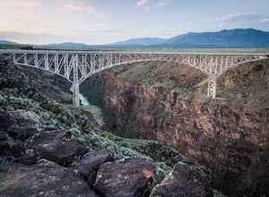
Photograph the Rio Grande Gorge Bridge
4.6Completed in 1965, the Rio Grande Gorge Bridge is the seventh highest bridge in the United States. The design is a steel deck arch bridge than spans 1280 feet and sits 565 feet high. The bridge has sidewalks and viewpoints of the gorge on each side with parking at the Rio Grande Gorge Rest Area p...Read more

