Sandyston, New Jersey
Looking for the best hiking in Sandyston? We've got you covered with the top trails, trips, hiking, backpacking, camping and more around Sandyston. The detailed guides, photos, and reviews are all submitted by the Outbound community.
Top Hiking Spots in and near Sandyston
-
Philipstown, New York
Anthony's Nose via Appalachian Trail
4.61.95 mi / 682 ft gainParking for the trail runs along both sides of 9D right up until the Bear Mountain Bridge. It can be busy on the weekends so just make sure you're as far off the road as you can and be especially careful unloading kids and dogs. The trailhead is located at approximately 41.322571, -73.975949 and ...Read more -
Cornwall-on-Hudson, New York
Hike the Stillman - Bluebird Loop
5.4 mi / 1200 ft gainThis loop hike starts at the northern trailhead of the park where the Stillman Trail begins. The parking area has enough space for only 6 or 7 cars. Start off on a wide maintained carriage road. After about a half mile, the Stillman Trail (yellow markers) breaks of to the left. However, stay ...Read more -
Bloomsbury, New Jersey
Hiking in Musconetcong Gorge Preserve
3.3Start out on Ridge Trail (yellow blazes), found at the rear of the parking lot. Shortly, you will come to a stream crossing, followed by a set of wooden steps. Just before the next stream, turn left following the white blazes. This section of the trail makes a moderately rocky descent, as it foll...Read more -
Cornwall, New York
Hike the North Point Loop
6.5 mi / 1400 ft gainThere is three different trailheads to access the North Point Loop. I chose the trailhead that would give me the longest hike. That would be the Butter Hill parking area on Route 9W north. From the parking lot, start on the connector trail designated with white markers. Follow this for about ...Read more -
Cornwall, New York
Storm King Mountain Loop
4.52.44 mi / 400 ft gainThis is an easy, yet very rewarding hike with a lot of viewpoints on the way up. Technically you scale up two mountains, Butter Hill and Storm King, but most people just describe it as Storm King Mountain. This is a great hike for families with younger kids, those who don't have much time but wan...Read more -
Cortlandt, New York
Hike the Camp Smith Trail
4.55.92 mi / 1759 ft gainThis approximately 3-hour hike borders the Hudson River, and is one of the best in Westchester County. Start off at the parking area at the Bear Mountain Tollhouse, or at a small parking area farther up Bear Mountain Road, if you want a slightly shorter hike. The trail is fairly steep in places, ...Read more -
Philipstown, New York
Hike the Osborn Loop
7.6 mi / 850 ft gainThe Osborn Loop trail itself is not a loop. It connects to a 2.5 mile section of the Appalachian Trail. Hiking these together creates the loop. Start at the trail head for the Appalachian Trail on South Mountain Pass Road. There is parking for two or three cars. Walk up the road a short dist...Read more -
Lake Harmony, Pennsylvania
Explore Boulder Field in Hickory Run State Park
3.0Boulder Field is easily found following signs in Hickory Run State Park and has its own parking lot. Boulder Field is a small piece of landscape leftover from the last ice advance thousands of years ago. It covers an area of 400 feet wide by 1,800 feet long and about 10 feet deep. Boulders rang...Read more -
Albrightsville, Pennsylvania
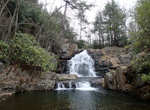
Hawk Falls in Hickory Run State Park
4.10.68 mi / 108 ft gainHawk Falls is located in Hickory Run State Park, Pennsylvania in the Poconos Mountains. The trail is mostly downhill, with some slippery sections so wear adequate shoes and take caution when you approach the falls. A rock outcrop at the top of the falls makes for a great lookout point. The 0.7 ou...Read more -
Beacon, New York
Sunset Point - South Beacon Mountain Loop
4.08.92 mi / 2470 ft gainThis loop hike form the Notch Trail northern trailhead on Route 9D. There is enough parking at this trailhead for about 5-6 cars. The Notch Trail is identified with blue trail markers. It is well maintained and plenty of markers to guide your way. This is important because there are m...Read more -
Beacon, New York
Sugarloaf Mountain via Wilkinson Memorial Trail
5.02.15 mi / 820 ft gainTrail is currently closed. Get updates at parks.ny.gov. Sugarloaf Mountain is part of the Hudson Highlands State Park, along with Breakneck Ridge, Bull Hill, and Mt Beacon. Though the views are just as impressive as its sister trails, it is never as crowded and it's one of my favorite spots in ...Read more -
Cold Spring, New York
Sugarloaf Mountain and Breakneck Ridge Loop
4.74.33 mi / 1562 ft gainThe Breakneck Ridge to Sugar Loaf Loop gives rise to various bypasses that offer hikers moderate to advanced terrain and multiple rock scrambles. The loop entails a total elevation gain of 1,670 feet and a total distance of 5.5 miles. The start of the trail begins at the (white blazes) at the no...Read more -
Cold Spring, New York
Breakneck Ridge Loop
5.05.91 mi / 1526 ft gainThis short but steep loop hike in Hudson Highlands State Park offers multiple panoramic views of the Hudson River along the way. Please note that only experienced hikers should attempt this route – although the hike seems short, the elevation gain and steep rocky scrambles offer serious technical...Read more -
Lehighton, Pennsylvania
Hike the Falls Trail at Beltzville State Park
4.05.5 miAt the Christman Trailhead, hike a quick, flat 2.5 miles following the yellow trail markers through farm meadows and birch forests to the Falls Trail loop/intersection. Here hike the Falls trail which is a 0.5 mile loop that links back to the 2.5 mile section back to the parking area. Bridges and...Read more -
Cold Spring, New York
Mt. Taurus (Bull Hill)
4.53.52 mi / 1375 ft gainMt. Taurus (or Bull Hill) is a short, family and dog friendly, hike just outside the town of Cold Spring, easily accessible by car or taking the train into town. It snakes along the edge of an old quarry that is just now being retaken by nature and provides lookouts towards the Hudson, other near...Read more -
Cold Spring, New York
Hike the Cornish/Brook/Notch/Washburn/Undercliff Loop
8 mi / 1500 ft gainThis loop is a great option to avoid crowds on the west side of the Washburn trail. Start at the same trailhead for the Washburn Trail. The Cornish Trail is on the left and there is an obvious sign at the trail split a few feet from the parking area. The Cornish Trail is an old road from about...Read more

