Riverside, New Jersey
Top Spots in and near Riverside
-
Princeton, New Jersey
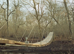
Visit the Princeton Battlefield Park Suspension Bridge
4.80.5 miTo find this bridge, you essentially park at the Princeton Battlefield Park and walk all the way down towards the woods (you'll pass an old house if you're going the right way). When you enter the woods there will be a tight trail but it will quickly open up. When it does, you want to take a left...Read more -
Collegeville, Pennsylvania
Skippack Creek Loop
4.07.25 mi / 377 ft gainThe Skippack Creek Trail in Evansburg State Park was one of my favorites on this most recent trip. Any chance I can hike a trail alongside a river, I take advantage of it. The trail starts on the south side of Skippack Creek at a parking area on Kratz Road. It was early in the morning and the wea...Read more -
Glen Mills, Pennsylvania
Hike the White Trail in Ridley Creek State Park
2.55 mi / 450 ft gainThe white trail is the only true loop hike in the park. Strangely enough, it has no official trailhead. You can gain access to the trail from either Pavilion/picnic are #9 or Pavilion/picnic area #16. I chose picnic area #9 and hiked in a clockwise direction. This section starts very close to and...Read more -
Malvern, Pennsylvania
Hike Valley Forge
3.92.5 miThere are many trails to choose from on Mt. Misery and a good place to start is at the parking lot located at the intersection of Yellow Springs Road and Library Lane (off of the main Valley Creek Road).The Mt. Misery Trail starts there, heads up through the trees about 0.75 miles and meets up wi...Read more -
Princeton, New Jersey
Mountain Lakes Nature Preserve Loop
4.52.3 mi / 157 ft gainAn 8-mile network of maintained trails traversing this Preserve, Mountain Lakes North, John Witherspoon Woods,parts of Tusculum (private) and Community Park North makes a variety of loop hikes possible. Pathways include a boardwalk (over wetlands) and paved bicycle roads. Click here for a trail...Read more -
Stockton, New Jersey
Explore Kugler Woods Waterfall
4.00.5 miDrive 5.2 miles north on Route 29 from the center of Stockton, NJ and you will come across a very small parking lot on the left side of the road. If you park your car there, walk back south on Route 29 about 50 feet, and cross over to the woods-side of the road. There you will find the trailhea...Read more -
Hopewell, New Jersey
Hike through the Sourland Mountain Preserve
5.02.91 miThe Sourland Mountain Preserve stretches from Hunterdon County all the way into Somerset County. The trails referenced here are on the southwest side of the preserve in Hunterdon County. They are accessible from an on site parking lot at 233 Rileyville Road in Ringoes NJ.There are several trails ...Read more -
Stockton, New Jersey
Hike to the Hidden Lockatong Waterfall
3.72 miIf you're on Kingwood Stockton Road, there will be a dirt road with a Lockatong Nature Preserve sign before it (going north on Kingwood Stockton Road, the sign will be on your left. If you're driving south, the sign will be on your right). Just drive all the way until the end of the dirt road and...Read more -
Tinicum Township, Pennsylvania
Hike the High Rocks State Park Loop
4.61.5 miHigh Rocks State Park, a section of Ralph Stover State Park, offers visitors some of the best views in Eastern Pennsylvania. Across from the parking lot on Tory Road, you will find the main trailhead. This will lead you to several different trail options, all varying in length, and all bringing y...Read more -
Frenchtown, New Jersey
Hike to the Devil's Tea Table
3.00.5 mi / 20 ft gainApart from the rock, there's more trail to follow for a stunning overview and a great spot to hang out and relax. The view is a must-see, it is so much better in person. The hike is not challenging at all, it is basically a straight trail. Climbing some medium sized rocks might be required, but i...Read more -
Hammonton, New Jersey
Batsto Lake Trail
4.07 mi / 108 ft gainBatsto Lake Trail is a loop trail that takes you by a lake located near Washington Township, New Jersey.Read more -
Lakehurst, New Jersey
Relax at Lake Horicon
Lake Horicon Park is located at the corner of Union Avenue and Lake Street in Lakehurst, New Jersey. For swimmers: the lake is cedar water, a lifeguard is on duty at first beach from June 19th through September 1st from 11:00 am until 5:00 pm daily. At the rear of the lake picnic tables and gr...Read more -
Washington, New Jersey
Harrisville Pond
4 mi / 125 ft gainHarrisville Pond is a loop trail that takes you by a lake located near Chatsworth, New Jersey.Read more -
Wilmington, Delaware
Creekside and Brandywine Valley Trail Loop
4.55.5 mi / 20 ft gainThis loops starts out from the Rockland Road Trail head. There is a pay station here that is self-regulated. Creekside Trail starts here and runs the entire length of Brandywine Creek State Park along the Brandywine River. The trail is an easy 2.6 miles long and continues into First State Natio...Read more -
Wilmington, Delaware
Rocky Run Loop Trail at Brandywine Creek State Park
3.2 mi / 272 ft gainThe Rocky Run Trail is a 3.2-mile loop through Brandywine Creek State Park in Wilmington, Delaware. The trail has some nice views of the Brandywine River and the surrounding forest. There are some rocky areas of mild elevation, so be prepared. The trail is not well marked, and there are many of...Read more -
Wilmington, Delaware
Hike the Hidden Pond Trail
4.02.15 mi / 282 ft gainBrandywine Creek State Park, a 933-acre park located in Northern Delaware, offers 14 miles of hiking trails, expanses of open fields, and the beautiful Brandywine Creek. The Hidden Pond trail is an excellent hike through the hardwood forests and down to the banks of the creek. The trail begins ...Read more

