Morristown, New Jersey
Looking for the best hiking in Morristown? We've got you covered with the top trails, trips, hiking, backpacking, camping and more around Morristown. The detailed guides, photos, and reviews are all submitted by the Outbound community.
Top Hiking Spots in and near Morristown
-
Philipstown, New York
Anthony's Nose via Appalachian Trail
4.61.95 mi / 682 ft gainParking for the trail runs along both sides of 9D right up until the Bear Mountain Bridge. It can be busy on the weekends so just make sure you're as far off the road as you can and be especially careful unloading kids and dogs. The trailhead is located at approximately 41.322571, -73.975949 and ...Read more -
Philipstown, New York
Hike the Osborn Loop
7.6 mi / 850 ft gainThe Osborn Loop trail itself is not a loop. It connects to a 2.5 mile section of the Appalachian Trail. Hiking these together creates the loop. Start at the trail head for the Appalachian Trail on South Mountain Pass Road. There is parking for two or three cars. Walk up the road a short dist...Read more -
Newtown, Pennsylvania
Canoe Neshaminy Creek at Tyler State Park
1 miEnjoy a peaceful paddle on Neshaminy Creek by canoe in Tyler State Park. The park is in a beautiful part of Bucks County and also offers paved and unpaved trails for running and bike riding, an extensive disc golf course, swimming in the creek, and picnic areas. It is likely that you will see a h...Read more -
New Windsor, New York
Hike Jessup/West Ridge Loop via the Sweet Clover Trail
10 mi / 1700 ft gainSchunnemunk Mountain State Park is one of my favorite parks. It offers many trails and possibilities for different loops. The attraction of Schunnemunk Mountain is the long double ridges running parallel to each other and amazing views in all directions.This hike starts at the Taylor Road parki...Read more -
Barrett Township, Pennsylvania
Hike to the Indian Ladder Falls at Skytop
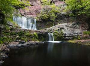
3.25 miThis 1.75 Mile one-way walk is beautiful. Located on the Skytop Lodge property, the trail winds its way through the forest and along side a creek with benches and picnic areas. Park in the falls trail parking lot on the east side of rt. 390. Google maps will take you right there if you search Ind...Read more -
Cornwall, New York
Hike the North Point Loop
6.5 mi / 1400 ft gainThere is three different trailheads to access the North Point Loop. I chose the trailhead that would give me the longest hike. That would be the Butter Hill parking area on Route 9W north. From the parking lot, start on the connector trail designated with white markers. Follow this for about ...Read more -
Cornwall, New York
Storm King Mountain Loop
4.52.44 mi / 400 ft gainThis is an easy, yet very rewarding hike with a lot of viewpoints on the way up. Technically you scale up two mountains, Butter Hill and Storm King, but most people just describe it as Storm King Mountain. This is a great hike for families with younger kids, those who don't have much time but wan...Read more

