Boulder City, Nevada
Top Spots in and near Boulder City
-
Clark County, Nevada
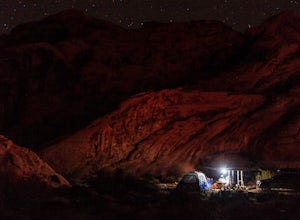
Camp at Arch Rock Campground in Valley of Fire State Park
Arch Rock Campground is first come first serve campground in Valley of Fire State Park. It is the more "primitive" of the two campsites in the park. That is, there are far less RVs in this site and it is often easier to get a spot.To get here, take the Valley of Fire Highway to the entrance, whic...Read more -
Clark County, Nevada
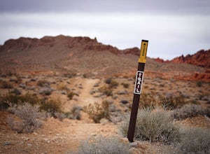
Hike the Pinnacle Loop in the Valley of Fire
5.0Pinnacle Loop is an unmaintained poorly marked trail leading to a cluster of sandstone towers, hidden close to some of the more popular areas of the Valley of Fire like Atlatl Rock and a campground.Getting TherePinnacle Loop shares the same trailhead as the popular Atlatl Rock picnic area and pet...Read more -
Las Vegas, Nevada
Drive the Red Rock Canyon Scenic Loop
4.512 miBegin your drive from the visitor center. Drive along the scenic highway and stop at one of the multiple parking areas to get out of the car, stretch your legs, and hike some the trails starting from the parking area. There is a variety of easy to moderate difficulty trails stemming from the park...Read more -
Clark County, Nevada
Hike the Prospect Trail in the Valley of Fire
4.511 miComing from the adventure guide map you can buy at the Visitors Center, which you should do, they describe the Prospect Trail in the following:"Hikers and equestrians enjoy 5.5 miles of outback trail between Valley of Fire Highway and White Domes. Many work out the logistics of being picked up o...Read more -
Las Vegas, Nevada
Bike the Cowboy Trails Near Red Rocks Canyon
5.015 mi / 2000 ft gainThe Cowboy Trails offer a perfect break from climbing in Red Rock Canyon or a night on the Town in Las Vegas. You will need to be as tough as a cowboy (or cowgirl) to ride these trails. It is just as much of a workout going up as it is down. However, this area offers you the chance to hone your ...Read more -
Las Vegas, Nevada
Bouldering at Kraft Boulders, Red Rock
0.25 miDrive through Calico Basin near Red Rock Canyon Conservatory Area, and park at the end of the road. (The parking lot is pinpointed above) Once you're out of your car, you'll see the Cube. It's a 25 foot boulder, with both easy and extremely difficult climbs on it. Head toward the Cube (toward the...Read more -
Las Vegas, Nevada
Rock Climb the Black Corridor
5.00.4 miThis is a popular area for beginners and intermediate rope climbers. The corridor is sheltered from the wind, which makes it climbable year-round (but bring a light jacket!). Approach: Climbing coordinates are 36.15547, -115.43613.Driving on Scenic Loop Dr., park on the right at the second parkin...Read more -
Clark County, Nevada
Hike the Petroglyph Canyon Trail to the Mouse's Tank
0.8 mi / 25 ft gainStart the hike from the parking area for the Petroglyph Canyon Trail. The trail is not difficult to hike, but has deep sand in some places. There are very good views of the rock formations and of the desert vegetation and there are a couple of places where petroglyphs can be seen. The view at the...Read more -
Clark County, Nevada
Hike to Mouse's Tank in Valley of Fire State Park
5.01.5 miThis short hike takes you through a red sandstone canyon covered in beautiful Native American rock art. The incredible amount and concentration of petroglyphs on this hike make this a must-see in Valley of Fire State Park.There is a parking lot roughly one mile north of the visitor center where t...Read more -
Las Vegas, Nevada
Hike Calico Tanks at Red Rock Canyon
4.52 mi / 400 ft gainEnjoy a easy scenic hike in this beautiful Nevada desert hike. Great for beginners who are willing to climb a little. This hike has about 400 ft elevation gain and go through a terrain of boulders and canyons that were fairly easy to walk on and climb. Towards the top of the hike, before reaching...Read more -
Clark County, Nevada
Hiking Charlie's Spring in The Valley of Fire
6.7 miCharlie's Spring is a small oasis in the Valley of Fire State Park just outside of Las Vegas, Nevada. The unmarked trail is flat and follows a wash for 2.5 miles down dry sandstone waterfalls, a small slot canyon and ends in a small spring surrounded by cattails and bushes, a start contrast to th...Read more -
Clark County, Nevada
Hike the Rainbow Vista Trail
5.01.1 mi / 95 ft gainStart the hike from the parking area. At the beginning, the trail is rather sandy. Further in, the trail gets easier and has wonderful views of the surrounding rocks and there is interesting desert vegetation. The colors in the rocks are incredible! This is one one the prettier hikes in the park.Read more -
Clark County, Nevada
Photographing Rainbow Vista
4.5Rainbow Vista is located in the heart of Nevada's Valley of Fire State Park and only a short drive, north on I-15 out of Las Vegas.To get to Rainbow Vista drive the loop road toward the park's visitor center. It's a good idea to stop here if you need water, snacks, or a map. Remember the desert g...Read more -
Clark County, Nevada
Explore Elephant Rock, NV
4.3Elephant Rock is a beautiful red sandstone arch right at the West Entrance of Nevada's first state park, The Valley of Fire.Elephant Rock is easy to find. From I-15 take exit 75 and travel west. The exit is easy to find and there's an indian smoke shop and casino. If you forgot to get supplies yo...Read more -
Las Vegas, Nevada
Hike The Mountain Springs Trail
5 mi / 1012 ft gainGetting there is pretty straight forward. Take 160 west towards mountain springs and use your phone to pull up the trail head on a map. It comes up quick on the right, and is nothing more than a gravel lot with a few 4x4 trails headed out of it. There is one main trail, a vehicle path, that leav...Read more -
Las Vegas, Nevada
Rock Climb at Red Rock Conservation Area
The official address for Red Rock Conservation area for you GPS travelers is: 1000 Scenic Loop Dr, Las Vegas, NV 89161. Head into the park, and you'll be on the one way Scenic Loop Drive. Red Rock is home to thousands of different routes, so it's easy to get lost amidst the rock. I recommend usin...Read more

