Swiftcurrent, Montana
Looking for the best photography in Swiftcurrent? We've got you covered with the top trails, trips, hiking, backpacking, camping and more around Swiftcurrent. The detailed guides, photos, and reviews are all submitted by the Outbound community.
Top Photography Spots in and near Swiftcurrent
-
Browning, Montana
Backpack to Cosley Lake
27.2 mi / 475 ft gainThe hike goes through different wooded areas, open fields, and passes by the ranger's ranch. In no time, you will be able to see the aqua blue colors of Cosley Lake, as you approach the campground for the night.The campground has pit toilets and a bear bag hanging station, along with a cooking ar...Read more -
West Glacier, Montana
Camp at Sprague Creek Campground on Lake McDonald
4.5Ten miles long and nearly 500 feet deep, Lake McDonald, the largest lake in Glacial National Park. Sprague Creek is a small 25-site campground on the northeast shore of the lake, about 9 miles from the west entrance of the park. Campsites are on a first-come, first-serve basis and fill up early....Read more -
West Glacier, Montana
Backpack to Lincoln Lake
16.75 mi / 3747 ft gainIt's a 1600 ft slow increase in elevation. You can walk around the loose rocks going around the lake for an additional 2 miles of hiking. There is a back-country campground at the base of the glacier-fed lake and an amazing waterfall at the opposite end of the of the campground. To camp overnig...Read more -
Glacier County, Montana
Triple Divide Pass Trail to Red Eagle Lake
29.22 mi / 5499 ft gainA couple of notes to keep in mind before you start... this is a loop that takes you to a different part of the park so you will either need two vehicles (one for the pickup spot and one to take you to the trailhead) or you will need to hitchhike back to you drop off vehicle. Also you will need to...Read more -
Waterton, Alberta
Hike to Crypt Lake
4.310.8 mi / 2296.6 ft gainThe hike begins with a gradual climb through shaded forest, which thins as you progress into the hanging valley. Along the way, you will pass by three amazing waterfalls: Twin Falls at 3.5km (2 mi), Burnt Rock Falls at 5.6km (3.5 mi) and the 600ft Crypt Falls at 8km (5 mi). There is also a 1km (0...Read more -
Waterton, Alberta
Explore Cameron Falls
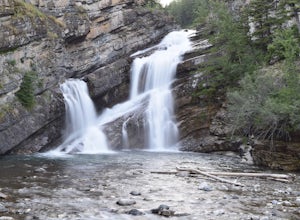
Located on the west side of Waterton townsite in Waterton Lakes National Park is the iconic waterfall Cameron Falls. Probably one of the most photographed waterfalls in Waterton due to its accessibility The waterfall is practically right off of the road/bridge with easy parking right next to it. ...Read more -
Waterton, Alberta
Hike Bear's Hump, Waterton Lakes NP
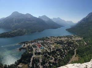
4.71.7 mi / 738 ft gainThe trailhead is located at the Visitor Center of Waterton Lakes National Park. The trail is very well maintained, but know that the elevation gain is quick - in less than a mile you gain 738 ft. Roundtrip is 1.7 miles and is totally worth the short but strenuous hike.When you reach the top there...Read more -
Waterton, Alberta
Stargaze at the Top of Bear's Hump
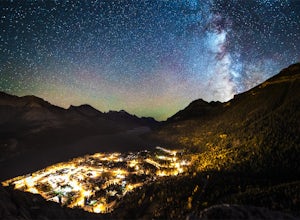
1.7 mi / 656.2 ft gainBear's Hump is one of the shortest hikes in Waterton Lakes National Park. Fortunately, it also offers one of, if not the best, views of the small mountain town of Waterton and surrounding peaks. At 2.8 kilometres and 200 meters of elevation gain round trip, this hike can be done in about an hou...Read more -
Waterton, Alberta
Backpack the Alderson-Carthew Trail
5.012.4 mi / 4101.1 ft gainTake the Akamina Parkway in Wateron Lakes National Park to its terminus at Cameron Lake. Your hike will start from here. If you’re through-hiking either drop another vehicle off at Cameron Falls in the town site, or be prepared to hitch a ride back to Cameron Lake, due to heavy traffic this is ...Read more -
West Glacier, Montana
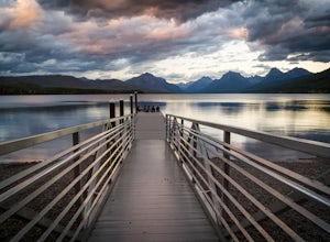
Capture Sunrise or Sunset at Lake McDonald
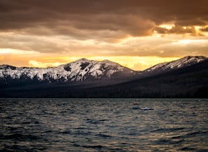
5.0Lake McDonald doesn't offer the close-up views of glaciers and mountains like some of the other spots in Glacier NP, but it does offer sweeping views of park's west side. The most popular spot to photograph this grand perspective is along the southwest beach and dock. The dock makes the most in...Read more -
Waterton, Alberta
Hike Mount Lineham
I’ve heard a lot about the hiking in Waterton and the stunning scenery, but I never really bought into it from the pictures alone – I’m glad I finally took the opportunity to find out for myself. Mount Lineham is a short extension of Lineham Ridge, and while it might not eclipse the views from th...Read more -
West Glacier, Montana
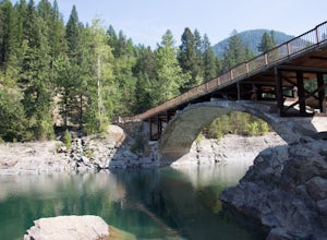
Swim at the Belton Bridge
2.0The Belton Bridge is the old entrance to glacier. You can get there by turning right down old river bridge road, which is the first right when you turn in to the West Glacier village. There are some 5-8 ft rocks to jump off, but be sure to check the water below them first. The water is gorgeous, ...Read more -
West Glacier, Montana
Camp at Bowman Lake
5.026.85 mi / 3005 ft gainBowman lake is the 3rd largest lake in Glacier National Park and one of the most remote areas accessible by car. The drive out on a dirt road is slow and bumpy but the reward is an area without crowds and lots of adventure potential. The first-come-first-served campground offers 48 sites near t...Read more -
West Glacier, Montana
Waterton Lake via Bowman Lake
49.5 mi / 6365 ft gainOur trip started on Thursday evening, spending the night at the Bowman Lake campground. You can park your car here and it's where the hike will start and end. I recommend staying here the night before because day 1 is a doozy, so you'll want an early start. Day 1 is the hardest day of the hike, ...Read more -
West Glacier, Montana
Bowman Lake to Quartz Lake Loop
5.013.3 mi / 2618 ft gainThe trail to Quartz lake begins on southend of the Bowman Lake beach. I recommend going in a clockwise direction and getting the steep bit out of the way, but the ~13 mile loop can be done either way. Follow the Bowman Lake shore on the West Lakes Trail for about half a mile and then you will fi...Read more -
Flathead County, Montana
Hike Glacier View Mountain
5.04 mi / 2880 ft gainDriving north from Columbia Falls, MT for 20 miles, park after the junction of the Camas Road and the North Fork Road. This parking area is directly after the junction on the east side of the road and the trail begins on the west side of the road.The beginning of the trail is started with many sw...Read more

