Madison County, Montana
Looking for the best hiking in Madison County? We've got you covered with the top trails, trips, hiking, backpacking, camping and more around Madison County. The detailed guides, photos, and reviews are all submitted by the Outbound community.
Top Hiking Spots in and near Madison County
-
McAllister, Montana
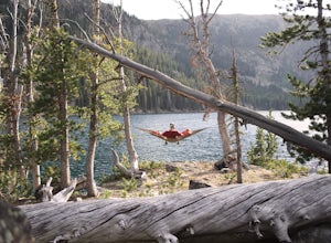
Camp at South Meadow Creek Lake
4.0To access the lake, take South Meadow Creek Road that exits US 287 at McAllister, MT. This dirt road will head west into the Tobacco Roots before turning into FS Road 1221 approximately 3 miles before the lake. If you are in a vehicle not equipped for off-roading, park your vehicle where FS Road ...Read more -
Harrison, Montana
Relax at Potosi Hot Springs
4.3Rain filled the air and fog hung low. It was to dreary to do much, but the idea of soaking in a natural warm springs beneath the peaks of the Tobacco Root mountains was too tempting to stay in side.Potosi Hot Springs is about 25 minutes out of the town of Pony, MT. It’s one of my favorite places ...Read more -
Big Sky, Montana
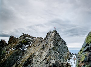
Summit Beehive Peak
5 miBeehive Basin has it all, a mini playground for outdoorsmen. My first visit was during the winter one year ago. We hoped to ski The Fourth of July Couloir, but conditions were not ideal and we left thinking about all the possible ski routes.I’ve been up numerous times since, running and climbing....Read more -
Gallatin Gateway, Montana
Beehive Basin Trail No. 40
5.07.01 mi / 1601 ft gainBeehive Basin Trail No. 40 is an out-and-back trail that takes you by a lake located near Big Sky, Montana.Read more -
Ousel Falls Road, Montana
Short Hike to Ousel Falls
5.01.6 mi / 250 ft gainThe trailhead is easy to find, and has a vault toilet and a decently sized parking lot. The trail leaves from right next to the toilets, and is very easy to follow. Follow a couple easy switchbacks down the hillside, cross the memorial bridge and stop to take in the beautiful scenery before follo...Read more -
Big Sky, Montana
The Reflector Loop
5.03.65 mi / 814 ft gainThe Reflector Loop is a well-known hiking trail located in Big Sky, Montana. This trail is approximately 3.65 miles long and is rated as moderate in difficulty. It features an elevation gain of about 814 feet, making it a suitable choice for hikers with a moderate level of fitness. The trail is...Read more -
Gallatin Gateway, Montana
Summit Storm Castle Peak
4.85 mi / 1900 ft gainStorm Castle (or Castle Mountain) is a rocky peak that rises to an elevation of 7,280 ft on the east side of the Gallatin Canyon overlooking Beckman Flats. The hike is a gorgeous 5 mile out and back trail located just 30 minutes south of Bozeman, Montana in the Gallatin Canyon. This trail offers ...Read more -
Gallatin Gateway, Montana
Hike to Lava Lake
5.06 mi / 1600 ft gainThe 6 mile round trip to Lava Lake is a steady climb that runs beside Cascade Creek through the Lee Metcalf Wilderness. The trail starts at the Gallatin River and continues upward through dense evergreen forest. There are no confusing intersections but is quite rocky and considered to be moderate...Read more -
Gallatin Gateway, Montana
Hike to Garnet Mountain Lookout
5.07.7 mi / 2800 ft gainStarting in Bozeman, travel south of Gallatin Gateway about 5 miles on Hwy 191 and turn left on to Storm Castle Creek Road. Follow this road for about 3.5 miles until the road ends. At this point, there is a decent sized parking area. The trail is open year round with ATV access and also snowmobi...Read more -
Gallatin Gateway, Montana
Hike to Golden Trout Lakes
4.05 mi / 1300 ft gainThe Golden Trout lakes offer a scenic getaway just out of the Gallatin Valley Canyon. To access the trail head, turn east onto Portal Creek Road #984 and continue southeast for 6.8 miles. The road is in rough condition and is better suited for vehicles with a higher clearance. The trail head is e...Read more -
Gallatin Gateway, Montana
Backpack the Gallatin Crest Trail
42 mi / 6000 ft gainThere are some different options for starting and ending this hike, but the route I did started at Buffalo Horn Trailhead and ends at the Hyalite Creek Trailhead, and is approximately 42 miles total. I did the trail over the course of three and a half days, spending three nights in the backcountr...Read more -
Livingston, Montana
Climbing Alpine Ice at Emerald Lake
From the East Fork parking lot in Hyalite Canyon hike 4 miles gaining an easy 1,500 feet to Emerald Lake. Surrounded by mountains, Emerald Lake is a beautiful destination in itself. If you are looking for climbing, pick one of the many lines around.My partner and I decided to pick off one of the ...Read more -
Butte, Montana
Hike Maud S. Canyon Loop
4 mi / 994 ft gainMaud S is a great moderately traveled trail that weaves you through dry grassland, forests, and provides you with beautiful mountain views totaling 994 ft of elevation gain. You will find people hiking, running hills, mountain biking, and walking their dogs on this trail. After completing the ste...Read more -
Livingston, Montana
Summit Hyalite Peak
4.915 miHyalite peak is one of my favorite hikes. Named after the canyon it sits in Hyalite peak as 360 degree views, an offers and escape from the crowds of Hyalite Canyon due to the length of the hike. This 15 mile hike starts at the upper parking lot of hyalite canyon. The trail follows a river nearly...Read more -
Bozeman, Montana
Hike Sypes Canyon
3.04 miSypes Canyon Trail is a gorgeous hike to a scenic lookout over Bozeman, MT. The trail only lies 20 minutes north of Bozeman and offers the perfect after work exercise. The trail is heavily populated with people and trail conditions fluctuate throughout the year. The trail follows a small creek th...Read more -
Gallatin Gateway, Montana
Hike to Emerald and Heather Lake
5.010.9 mi / 2000 ft gainOnce in Bozeman, Take 19th Ave. south to Hyalite Canyon Rd. Turn left and continue past Hyalite Reservoir; when the road splits, take the left fork toward Palisade Falls. Continue past Palisade Falls to the end of the road. The trailhead is immediately ahead of you. This hike is around 11 miles t...Read more

