Essex, Montana
Top Spots in and near Essex
-
Browning, Montana
Backpack to Poia Lake, Glacier NP
12.8 mi / 1700 ft gainLocated in Many Glacier, the Red Gap Pass trail begins at the Apikuni Falls Trailhead located east of the Many Glacier Lodge (if you're looking to check out the falls before your hike, check out Hike to Apikuni Falls at Glacier National Park). The trail starts at a gradual incline and continue th...Read more -
Flathead County, Montana
Hike Demer's Ridge
7.47 mi / 3420 ft gainThis trail is a point to point, so two cars are necessary. The ending point is where Camas Rd intersects the North Fork Road at the Blankenship Bridge. The starting point for the hike is at Demer's Pit. Driving 22 miles from Columbia Falls, MT, make your way to the parking spot, Demer's Pit. From...Read more -
Whitefish, Montana
Hike Whitefish Mountain via the Danny On Trail
5.07.6 mi / 2250 ft gainThe Danny On Trail starts from the base area of Whitefish Mountain Ski Resort and zig zags its way up to the summit. The trailhead is near the Chalet building/Hellroaring Saloon upper parking lot (there's a big sign). The trail passes through Douglas fir, western larch, spruce and fir trees. The ...Read more -
West Glacier, Montana
Backpack to Logging Lake
8.8 miBackcountry camping is the best plan if you’d like to visit Logging Lake, and the primitive campsites lay at the end of a four and a half mile hike through some of the most unspoiled sections of the park. The trail follows logging creek most of the way to the lake traversing through a variety of ...Read more -
Bigfork, Montana
Summit Swan Peak
18.49 mi / 6180 ft gainThis hike is about an hour drive south from Kalispell. Follow MT-83 S for about 47 mi. towards and past Swan Lake. Take a left on NF-554 and follow the road for 1.6 mi. and take a right on Squeezer Creek Rd. and follow the road for 4 mi. to a gated road and park near the gate. Follow the gated ro...Read more -
Dayton, Montana
Kayak to Wild Horse Island
5.0There are many boat ramps to access Flathead Lake, but the closest location to Wild Horse Island is Dayton, MT. Dayton offers easy access with only about a 1-hour paddle to the island for the novice kayakers. Unfortunately, the boat ramp in Dayton does not have room for parking, thus it is only a...Read more -
Choteau, Montana
Hike Mount Werner
9.5 mi / 3048 ft gainThe Mount Werner Trail starts at the Blackleaf Canyon Trailhead in the Montana front range of the Rocky Mountains. On a side note, Blackleaf Canyon is also a popular rock climbing area. On the trail, you'll walk along Blackleaf Creek, and Muddy Creek so water will be available during the hike in ...Read more -
West Glacier, Montana
Camp at Bowman Lake
5.026.85 mi / 3005 ft gainBowman lake is the 3rd largest lake in Glacier National Park and one of the most remote areas accessible by car. The drive out on a dirt road is slow and bumpy but the reward is an area without crowds and lots of adventure potential. The first-come-first-served campground offers 48 sites near t...Read more -
West Glacier, Montana
Waterton Lake via Bowman Lake
49.5 mi / 6365 ft gainOur trip started on Thursday evening, spending the night at the Bowman Lake campground. You can park your car here and it's where the hike will start and end. I recommend staying here the night before because day 1 is a doozy, so you'll want an early start. Day 1 is the hardest day of the hike, ...Read more -
West Glacier, Montana
Bowman Lake to Quartz Lake Loop
5.013.3 mi / 2618 ft gainThe trail to Quartz lake begins on southend of the Bowman Lake beach. I recommend going in a clockwise direction and getting the steep bit out of the way, but the ~13 mile loop can be done either way. Follow the Bowman Lake shore on the West Lakes Trail for about half a mile and then you will fi...Read more -
West Glacier, Montana
Kayak Bowman Lake, Glacier NP
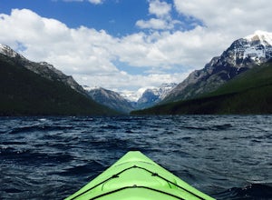
5.0The lake is located in the northwestern portion of Glacier National Park, about 32.5 miles from the west entrance and 30 miles from the Canadian Border. From the little town of Polebridge, it is 6 miles north along an unpaved road. The lake is 7 miles long and approx .5 miles wide. Access to the ...Read more -
Choteau, Montana
Hike Jones Creek
5.04 mi / 300 ft gainThe trail head to Jones Creeks is just off of Teton River Road (the road that takes you up to Teton Pass Ski Area) and is marked with a sign, however it's only visible when you're coming down from Teton Pass. If you miss the sign, keep in mind it's about two miles past the Cave Mountain Forest Se...Read more -
Browning, Montana
Backpack to the Foot of Glenns Lake
20.6 mi / 950 ft gainStarting from the Chief Mountain Parking Area, take the trail to the left of the bathrooms at the end of the parking lot (left of the bathrooms if you are facing the bathrooms and the main road is to your right). You will quickly hike to a wooden kiosk. Read this kiosk for any pertinent informati...Read more -
Browning, Montana
Backpack to Cosley Lake
27.2 mi / 475 ft gainThe hike goes through different wooded areas, open fields, and passes by the ranger's ranch. In no time, you will be able to see the aqua blue colors of Cosley Lake, as you approach the campground for the night.The campground has pit toilets and a bear bag hanging station, along with a cooking ar...Read more

