North Andover, Massachusetts
Top Spots in and near North Andover
-
Wellesley, Massachusetts
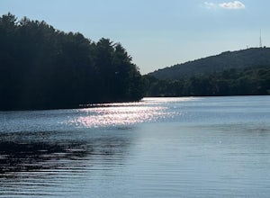
Note: The campus is currently closed due to COVID-19 restrictions. This is a lake on Wellesley College Campus. It is easy to get to from just about any direction. Just park and walk toward the lake, and there are paths that will take you there. The easiest place to park (pinned on the map) is ju...
Read more
-
Hull, Massachusetts
Fort Revere is an 8-acre (3.2 ha) historic site situated on a small peninsula located in Hull, Massachusetts. It is situated on Telegraph Hill in Hull Village and contains the remains of two seacoast fortifications, one from the American Revolution and one that served 1898-1947. There are also a ...
Read more
-
Bedford, New Hampshire
We began our hike at Kennard Trailhead, which is easy to miss if you aren’t looking for it. The approximate GPS address is 596 New Boston Road, Bedford, NH, though in reality the parking area is about 0.2 miles west of the junction of New Boston Rd and Esther Drive.These trails are very well mai...
Read more
-
Marlborough, Massachusetts
Hemingway Street Trail is an out-and-back trail that provides a good opportunity to view wildlife located near Marlborough, Massachusetts.
Read more
-
Portsmouth, New Hampshire
Prescott Park is a waterfront park in Portsmouth, New Hampshire that is famous for its extensive flower gardens. During the warmer months, visitors can enjoy the blooms of the annual and perennial beds, sit in the shade of the Japanese crabapple trees, and relax on the white benches along the pe...
Read more
-
Bolton, Massachusetts
Fyfeshire is located in Bolton Massachusetts off "Wattaquadock Hill Road", near the "Fotini's Restaurant and Bar".
The trailhead begins at a small parking area with a stone gate that says Fyfeshire Conservation area on a wood plank. Once you are in the conservation area you will see an opening in...
Read more
-
Quincy, Massachusetts
4.0
12.7 mi
/ 2542 ft gain
Park in the lot across from Batterymarch Rd off of Willard St. Access the Skyline trail from here, it is marked blue. Follow the signs. The trails in Blue Hills are perfect for training for backpacking because they are so steep and rocky. I would fill up a big pack and take the skyline trail up t...
Read more
-
-
-
Clinton, Massachusetts
Wachusett Reservoir is located in central Massachusetts, northeast of Worcester. Easy location and parking, you can go anytime of the day and you won't be disappointed. The Reservoir is the second largest body of water in the State of Massachusetts, taking place in 5 cities around the area, West ...
Read more
-
Ashland, Massachusetts
Park in the lot on State Park Road (see map) to access the trail. It's a popular trail that is dog-friendly. Pay attention to the trail as at parts it is not well marked.
Read more
-
Ashburnham, Massachusetts
Entering Mount Watatic in your GPS will take you to Rindge State Road (119), continue about two minutes down the road past where the GPS tells you.
on the Right hand side you will will see a sign for Mount Watatic Parking area or just enter in coordinates: 42.696796, -71.904521
You will begin the...
Read more
-
Temple, New Hampshire
Miller State Park is the oldest State park in New Hampshire and offers the perfect spring, summer or fall hike. From the parking area, visitors can choose from one of three trails: The Marion Davis Trail (1.4 miles to peak), The Wapack Trail (1.4 miles to peak) or the Auto-road (~ 1.0 miles to pe...
Read more
-
Temple, New Hampshire
5.0
8.3 mi
/ 2290 ft gain
This route will take you to both peaks and on most of the trails in this section of the park!
Take the Wapack Trail (1.4 miles, rocky, challenging) to the summit of South Pack (2290') and climb the fire tower for some incredible views! On a clear day, you can see the Boston skyline. Then continue...
Read more
-
Rollinsford, New Hampshire
4.0
3.88 mi
/ 108 ft gain
Scoutland Road Trail is an out-and-back trail where you may see beautiful wildflowers located near Rollinsford, New Hampshire.
Read more
-
Norwell, Massachusetts
Choose from multiple trails in Norris that offer beautiful views of the the North river and marshland. Great spot to do some trail running through the woods and see the river too. There is also a pond a short distance from the parking lot that offers a great fishing spot with a picnic table nearb...
Read more

