Swanton, Maryland
Looking for the best hiking in Swanton? We've got you covered with the top trails, trips, hiking, backpacking, camping and more around Swanton. The detailed guides, photos, and reviews are all submitted by the Outbound community.
Top Hiking Spots in and near Swanton
-
Davis, West Virginia
Freeland Boardwalk Trail
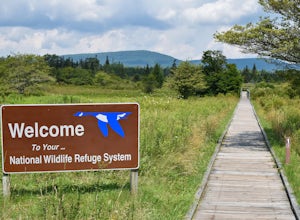
4.00.56 mi / 43 ft gainA free entrance and parking area for about a half dozen cars off Freeland Road features this quick adventure for all ages. The Canaan Valley National Wildlife Refuge and Freeland Boardwalk offers a variety of wildlife and environments like Ponds, Wetlands, Forests, and a natural limestone spring....Read more -
Masontown, West Virginia
Hike to Raven’s Rock Overlook
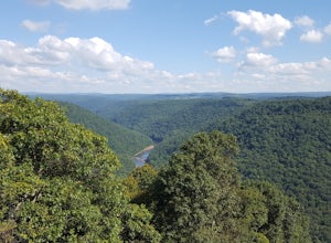
4.81.5 mi / 587 ft gainThe Raven’s Rock Trail leading to the Raven’s Rock Overlook is easily the second most photographed area of the Coopers Rock State Forest! There are two ways to access the trail which doubles as an access road. The first trail access can be found along the WV County Road 73/16 also known as Cooper...Read more -
Morgantown, West Virginia
Hike to the Henry Clay Furnace
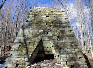
3.01.8 mi / 70 ft gainAcross the road from the McCollum camping area entrance of Coopers Rock sits the entry point of the Clay Run Trail. With a hiking distance of 1.8 miles (1 hour and 10 minute walking time), this adventure will lead you to a jaw-dropping landmark, the Henry Clay Furnace.Built between 1834 and 1836,...Read more -
Parsons, West Virginia
Hike Table Rock
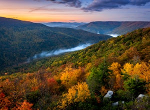
4.71.2 mi / 200 ft gainThis hidden gem is located near Lindy Point and Blackwater Falls State Park. Unlike Lindy Point, which is very popular, hikers are usually able to enjoy the views from Table Rock all by themselves. The Table Rock trail head is located off of Canaan Loop Rd. I highly recommend driving to the tr...Read more -
Cabins, West Virginia
Backpack the North Fork Mountain Trail & Chimney Top
5.024.7 miOne of my favorite hikes in West Virginia, since the whole ridge is full of views. Backpacking the North Fork Mountain Trail is about 24.7 miles in total and a challenging hike but with relentless views. In my opinion, the best West Virginia has to offer. Summertime backpacking the whole the NFM...Read more -
Mill Run, Pennsylvania
Hike the Bear Run Nature Reserve Loop
4.08 miBear Run Nature Reserve features a number of trail loops that range from 1.7 miles in length to 11.9 miles. By hiking overlapping trails, you can complete an 8 mile hike that passes by Paradise Overlook, which provides great views of the Youghiogheny River Gorge. Start at the trailhead, which i...Read more -
Mill Run, Pennsylvania
Explore Fallingwater
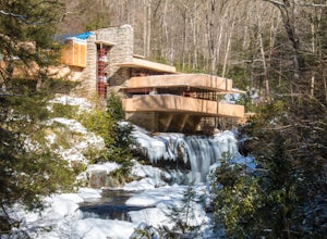
4.8"Fallingwater is the name of a house built over a waterfall in southwest Pennsylvania. Frank Lloyd Wright, America’s most famous architect, designed the house for his clients, the Kaufmann family. Fallingwater was built between 1936 and 1939. It instantly became famous, and today it is a Natio...Read more -
Dunbar, Pennsylvania
Hike the Sugar Run Trail
1.6 miThis trail connects Old Mitchell Trail to Johnathan Run Trail. It is a short but fun hike down to the falls. We parked by the helicopter landing field and the trail head was right by the entrance to the parking lot.The hike down to the falls was nice and easy, but coming back up was tough. The tr...Read more -
Cabins, West Virginia
Hike to Chimney Rock in the Monongahela National Forest
4.74.85 mi / 1319 ft gainChimney Rock (also referred to as Chimney Top) is a hidden gem in the Monongahela National Forest that offers some of the best views in the state of West Virginia. There are several trail options that pass this overlook, including a 24 mile point-to-point backpack of the North Fork Mountain Trai...Read more -
Davis, West Virginia
Hike to Rohrbaugh Cliffs in Dolly Sods
5 miRohrbaugh Cliffs is the social name given to the expansive views found along the Rohrbaugh Plains Trail. This easy hike in the Dolly Sods Wilderness will take you to one of the best overlooks in the area. For a longer or more challenging hike, connect this trail with one of the many others in t...Read more -
Oldtown, Maryland
Hike to Paw Paw Tunnel
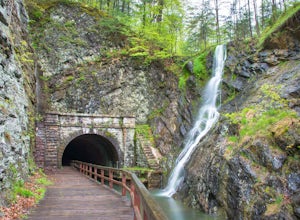
3.82.4 miThis hike is short and sweet, with it only being 2.4 miles to the other side of the tunnel and back. It's easily accessible, located right off the highway at the Paw Paw Tunnel Campground on the Potamac River at the border of Maryland and West Virgina. The town of Paw Paw is on the West Virgina s...Read more -
Mathias, West Virginia
Hike Cranny Crow to Millers Rock Loop
10.6 mi / 2100 ft gainThis is a really good day hike to explore another one of the many fantastic state parks that West Virginia has to offer while avoiding some of the crowds that many of the popular ones have. The main feature of the park is the Cranny Crow Overlook which features views into two Virginia and three W...Read more -
Seneca Rocks, West Virginia
Seneca Rocks Trail
4.73.12 mi / 784 ft gainSeneca Rocks is probably one of the best known landmarks in West Virginia. This iconic formation sits 900 feet above the North Fork River. I highly recommend anyone interested in taking a trip to West Virginia take some time to visit Seneca Rocks. These rock formations are really an amazing site....Read more -
Seneca Rocks, West Virginia
Camp at Yokum's Vacationland
With warm weather, we couldn't wait to go camping so we drove a few miles south of us to Yokum's Vacationland to camp in a teepee. It was THE BEST! It was so cold and we forgot our air mattress pump so we ended up car camping but the whole adventure was so awesome. We were the only people camping...Read more -
Seneca Rocks, West Virginia
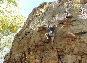
Climb Seneca Rocks
5.02.6 mi / 700 ft gainPark at the Seneca Rocks visitor parking spot located just off Mountaineer Drive. Take the trail directly across from the lot, cross the bridge over the stream, and follow the trail about one mile until you see a rock stair trail on your left side (Seneca Rocks side). Follow this rock stair trail...Read more -
Somerset, Pennsylvania
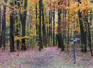
Hike to Wolf Rocks
3.35 miYou'll find the trailhead for Wolf Rocks at top of Linn Run Rd off Laurel Summit Rd. Off the left-hand side you will find what is referred to as parking lot D - the route to Wolf Rocks begins there.The hike is nothing to write home about, though with only a 5 mile total for the out-and-back it's ...Read more

