Oakland, Maryland
Looking for the best photography in Oakland? We've got you covered with the top trails, trips, hiking, backpacking, camping and more around Oakland. The detailed guides, photos, and reviews are all submitted by the Outbound community.
Top Photography Spots in and near Oakland
-
Davis, West Virginia
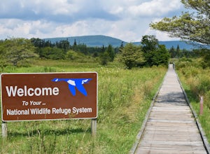
Freeland Boardwalk Trail
4.00.56 mi / 43 ft gainA free entrance and parking area for about a half dozen cars off Freeland Road features this quick adventure for all ages. The Canaan Valley National Wildlife Refuge and Freeland Boardwalk offers a variety of wildlife and environments like Ponds, Wetlands, Forests, and a natural limestone spring....Read more -
Masontown, West Virginia
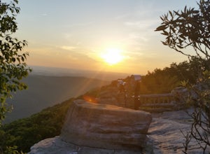
Take in the View at Coopers Rock Overlook
5.00 mi / 0 ft gainThe Coopers Rock Overlook is the crown jewel of Coopers Rock State Forest. The name is derived from a legend about a fugitive who hid near the overlook to elude capture. He was a cooper by trade and continued to make and sell barrels to the local communities to support himself while living in the...Read more -
Salisbury, Pennsylvania
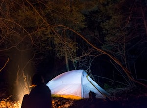
Primitive Camp along Wolf Rocks Trail
3.01.5 mi / 50 ft gainThis is a GREAT location for beginning backpackers with minimal backpacking rules, short trails and cell service. Although all trails (with a few exceptions found in this brochure -labeled as "Areas Closed to Camping") in the Forbes State forest allow primitive backpack camping (primitive backpac...Read more -
Cabins, West Virginia
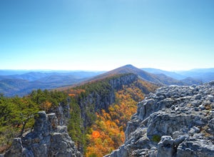
Backpack the North Fork Mountain Trail & Chimney Top
5.024.7 miOne of my favorite hikes in West Virginia, since the whole ridge is full of views. Backpacking the North Fork Mountain Trail is about 24.7 miles in total and a challenging hike but with relentless views. In my opinion, the best West Virginia has to offer. Summertime backpacking the whole the NFM...Read more -
Ohiopyle, Pennsylvania
Explore Cucumber Falls
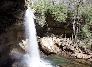
4.30.25 mi / 30 ft gainJust off Kentuck Road, at the southern end of Ohiopyle State Park, you arrive at Cucumber Falls' marked parking lot. Access to this lot is limited (about 20 cars). Most of the time you will be able to find a spot, but when not, parking on the side of the road is perfectly acceptable.Walking down ...Read more -
Mill Run, Pennsylvania
Explore Fallingwater
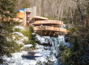
4.8"Fallingwater is the name of a house built over a waterfall in southwest Pennsylvania. Frank Lloyd Wright, America’s most famous architect, designed the house for his clients, the Kaufmann family. Fallingwater was built between 1936 and 1939. It instantly became famous, and today it is a Natio...Read more -
Dunbar, Pennsylvania
Hike the Sugar Run Trail
1.6 miThis trail connects Old Mitchell Trail to Johnathan Run Trail. It is a short but fun hike down to the falls. We parked by the helicopter landing field and the trail head was right by the entrance to the parking lot.The hike down to the falls was nice and easy, but coming back up was tough. The tr...Read more -
Seneca Rocks, West Virginia
Seneca Rocks Trail
4.73.12 mi / 784 ft gainSeneca Rocks is probably one of the best known landmarks in West Virginia. This iconic formation sits 900 feet above the North Fork River. I highly recommend anyone interested in taking a trip to West Virginia take some time to visit Seneca Rocks. These rock formations are really an amazing site....Read more -
Mathias, West Virginia
Hike Cranny Crow to Millers Rock Loop
10.6 mi / 2100 ft gainThis is a really good day hike to explore another one of the many fantastic state parks that West Virginia has to offer while avoiding some of the crowds that many of the popular ones have. The main feature of the park is the Cranny Crow Overlook which features views into two Virginia and three W...Read more -
Elkins, West Virginia
Hike to High Falls in Monongahela National Forest
5.08.2 mi / 1440 ft gainThough this beautiful hike is a serious workout, it's actually quite easy to follow. It's also listed on Google Maps - I'd highly recommend downloading the map offline just in case something happens. Starting at the trailhead (park at a pull-off along the gravel road just a few hundred feet befor...Read more -
Riverton, West Virginia
Spruce Knob Observation Tower
4.50.34 mi / 33 ft gainDriving to the top of Spruce Mountain is perhaps the most difficult part of the journey. Once at the top of Spruce Mountain, park and head south along a short, 0.2 mile long trail that leads to the official state highpoint of Spruce Knob. Be sure to find the USGS marker near the base of the obser...Read more -
Whitmer, West Virginia
Spruce Knob Lake Loop
4.00.96 mi / 13 ft gainSpruce Knob Lake is located just below the peak of Spruce Knob at 3,840’, making it the highest lake in West Virginia. If you are not camping in the campground, there is a parking lot/boat launch located near the dam. If you are camped in the campground, there is a trail that leads from the campg...Read more

