Keymar, Maryland
Top Spots in and near Keymar
-
Knoxville, Maryland
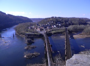
Explore Point of Rocks/ Potomac River Overlook
4.00.2 mi / 95 ft gainPark at the Chesapeake and Ohio Canal parking lot. Walk to the US 15 and cross the road. Trail is not marked, though its faint traces can be detected as you continue on. GPS is recommended. Enjoy the overlook and when you're ready to go back, retrace your steps.Read more -
Boyds, Maryland
Black Hill Regional Park Loop
5.02.78 mi / 312 ft gainThe Black Hill Regional Park has 1300 acres of oak forests that have views of the Little Seneca Lake. This lake offers a place for visitors to canoe and stand up paddle board. This trail is open to hiking and mountain biking. In addition, dogs are welcome to use the trail but must be on leash a...Read more -
Parkton, Maryland
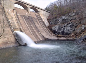
Photograph Prettyboy Dam
4.0Make sure you park in the designated spots located above the Dam. Walk across the Dam road bridge and about mid way stop and take a look over the edge. You will be greeted with the a beautiful view of the valley. To explore more keep walking over the dam bridge and walk down the stairs to view ...Read more -
Sharpsburg, Maryland
Antietam National Battlefield Trail
3 mi / 358 ft gainAntietam National Battlefield Trail is a loop trail that takes you by a river located near Sharpsburg, Maryland.Read more -
Montgomery Village, Maryland
Hike the Seneca Creek Greenway Trail Upper Section
5.014.86 mi / 836 ft gainPark in the lot off of Watkins Mill Road to access the trail. This hike is dog friendly and is accessible from March until November.Read more -
Boyds, Maryland
Hike or Bike the Hoyles Mill Trail
9.16 mi / 390 ft gainPark on Clarksburg Road (see map) and head onto the marked trail. It can get muddy at times so pack accordingly. Great for kids, and dog friendly too.Read more -
Cockeysville, Maryland
Hike the Oregon Ridge Park Trail
4.04.02 mi / 475 ft gainPark in the lot as indicated on the map (see below). This trail is accessible year round, dog-friendly, and is great for families.Read more -
Knoxville, Maryland
Hike the AT to Weverton Cliffs
4.93 mi / 1500 ft gainThe trailhead is located right off Weverton Cliff's Road in Knoxville, Maryland. Park at a Park and Ride on the right side of the road, then walk right out of the parking lot down Weverton Cliff's Road until you see the white blazes of the Appalachian Trail. Follow that trail for 1.5 miles along ...Read more -
Gardners, Pennsylvania
Hike to Sunset Rocks in Michaux State Forest
4.08.3 mi / 1000 ft gainSunset Rocks is a scenic two-mile spur off the Appalachian Trail in southern Pennsylvania's Michaux State Forest. If you hike it as a loop--incorporating 6 miles of the AT into the circuit--you can visit some of the AT's most notable landmarks in this area, including the remains of Michaux Camp (...Read more -
Parkton, Maryland
Hike the Gunpowder Falls North and South Loop Trail
5.013.3 mi / 1180 ft gainPark in the lot on Bunker Hill Road and then continue a short ways to the trailhead (see map). There are no bridges for crossing the water so be prepared to pick your way across.Read more -
Newville, Pennsylvania
Hike Pole Steeple, Pine Grove Furnace SP
3.61.5 mi / 1250 ft gainPole Steeple begins in Pine Grove Furnace State Park and ends in Michaux State Forest. The hike is short, only a .75 mile climb up, and ends at the rock outcropping where you get a great view of the entire park. Pole Steeple is the main trail to the summit but there is also a longer, less steep o...Read more -
Newville, Pennsylvania
Camp at Tom's Run Shelter
3 mi / 85 ft gainStarting from the small parking area on Bunkerhill Rd, head north (turn right) onto Michaux Rd. After about 1/3 of a mile you will reach the Appalachian Trail where you will want to head west (turn left).This will lead you on a leisurely hike through the woods (follow the white blazes). It won't ...Read more -
Purcellville, Virginia
Explore Potomac Wayside Park
4.00.25 mi / 75 ft gainThis is a small park along route 340 in Purcellville, Virginia near Harper's Ferry. After you have parked, look for the park sign which will be a few feet behind you. There is a trail that will take you down to the bottom of the waterfall and eventually to the Potomac River. There is also a trail...Read more -
Knoxville, Maryland
Hike to Maryland Heights
4.82.8 mi / 900 ft gainMaryland Heights is at the convergence of Maryland, West Virginia and Virginia, as well as the Potomac and Shenandoah Rivers. The Appalachian Trail and C&O Canal Towpath are also easily accessible from the trailhead parking lot. The parking lot holds about 16 cars and is between Locks 33 and ...Read more -
Knoxville, Maryland
Hike Maryland Heights Trail Loop
5.3 mi / 1600 ft gainLearn Civil War history as you hike through forts and read signs about the war. Enjoy beautiful lookouts, including one with a great view of Harpers Ferry. The 5.3 mile hike is relatively easy and offers an interesting opportunity to learn history in one of the most important historical areas i...Read more -
Harpers Ferry, West Virginia
Hike Weverton Cliffs Overlook from Harpers Ferry
5.08.2 mi / 925 ft gainParking and trail head: Park at the Harpers Ferry Visitors Center for $10 (171 Shoreline Dr, Bolivar, WV 25425) and take the shuttle a mile and a half to lower town (free). Walk straight from the shuttle to the large bridge. Cross the bridge to hop on the C&O canal trail. This is the point w...Read more

