Hawaii
Looking for the best hiking in Hawaii? We've got you covered with the top trails, trips, hiking, backpacking, camping and more around Hawaii. The detailed guides, photos, and reviews are all submitted by the Outbound community.
Top Hiking Spots in and near Hawaii
-
Hāna, Hawaii
Camp at Wai'anapanapa State Park
4.05 miWai'anapanapa State Park is located at mile marker 32 on the Hana Highway. The park has limited parking, but many of the tourists are making quick stops on their journey to Hana and the turnover for parking is fast. Once parked, check in at the office to obtain your overnight permit (must be orde...Read more -
Wailuku, Hawaii
Lahaina Pali Trail via Ukumehame (West) Trailhead
4.04.6 mi / 1611 ft gainIt can be difficult to spot the trailhead and parking lot, but look for an opening in a pack of trees off of Highway 30. If you are traveling with one car, make sure to come back down the same way from the crest. If you have another car with you, alternatively, you can park one at the east side a...Read more -
Kailua-Kona, Hawaii
Hike to Makalawena Beach
4.5From the parking area at Kekaha Kai State Park, it's about a 20-30 minute walk to the beach. The walk is through black lava fields and is very exposed. Depending on how much gear you're carrying, it could seem like an eternity by the time you hit the beach. If you have a 4-wheel drive car with go...Read more -
Kauai County, Hawaii
Hike Honopu Ridge
4.05 miDrive Waimea Canyon Drive until you reach mile marker 17. Continue about half a mile further, park at the turnout on a corner near a telephone pole. The trailhead is directly back from the turnout.You'll first encounter a maze of criss-crossing hunter trails. Stay mostly to the left, following ri...Read more -
Kalaheo, Hawaii
Swim in the Waikoko Stream & Waterfall
1 mi / 166 ft gainYou will need a 4WD high clearance vehicle to reach this trail. To reach the trailhead, take Highway 580 which will eventually turn to dirt. You'll cross over a couple of streams and when you reach a Y, take a left. In one more mile, you will reach a second Y which you will turn left. If the gate...Read more -
Kilauea, Hawaii
Wai Koa Loop Trail
3.35 mi / 227 ft gainThe trailhead is located at Anaina Hou Community Park, off Kuhio Highway near the Kauai Mini Golf Course. A Waiver for the trail must be signed within the office located at Kauai Mini Golf. There is plenty of parking and the trail is open to the public from dawn to dusk. There is no charge unless...Read more -
Kahuku, Hawaii
Hike from Turtle Bay to Kawela Bay
5.03 mi / 0 ft gainOnce you get to the Turtle Bay resort, you just follow the signs to Kawela Bay/ the Stables. From there the signs are super easy to follow, with options ranging from 0.5mi to 3.0mi. and you can do this as a simple out-and-back or as a longer loop that takes you through Banyan forests, beaches and...Read more -
Kailua-Kona, Hawaii
Relax at Honokohau Beach
4.00.5 miStop first at Hal Ho'okipa, the park visitor information center. It[s about 4.1 miles south of Kona Airport. Its a neat little building where you can pick up a map and learn more about the area. From there you can take the 0.5 mile Ala Hele Ike Hawai'i trail that leads to the coastal trail (Ala H...Read more -
Mountain View, Hawaii
Drive Chain of Craters Road
5.037.6 miStarting at the Kilauea Visitor Center, this 18.8 mile drive begins its 3,700 foot elevation change by meandering through the rainforest. Follow signs from the visitor center (near the entrance of the park) to Crater Rim Drive. Chain of Craters Road begins off of Crater Rim Drive, 3.3 miles south...Read more -
Waimea, Hawaii
Stroll along the Iliau Nature Loop
5.00.3 mi / 40 ft gainIliau, an endemic plant to Kaua'i's westside, grows along the path -- hence the name: Iliau Nature Loop -- is located in Waimea Canyon State Park. Not far after mile marker 8. It has the same trailhead as Kukui Trail.Native vegetation are identified in signs along the path. There are excellent vi...Read more -
Kula, Hawaii
Hike the Lau'ulu Trail to the Kalapawili Ridge
3 mi / 2200 ft gainIf you are looking for something akin to true backcountry travel and scrambling in Maui, the Lau'ulu trail and the Pohaku Palaha summit on the north/north east rim of the Haleakala volcano is a great option. You will find solitude, unparalleled views of the crater, surreal high-altitude tropical ...Read more -
Honolulu, Hawaii
Koko Crater Arch via Halona Blowhole Lookout
4.50.92 mi / 371 ft gainPark at the Halona Blowhole lookout and carefully cross the highway.. Walk west, towards Hawai'i Kai, and in a hundred feet or so you will pass mile marker 15, the trail starts on the rocks just past this marker. Carefully make your way up the rocky hill and onto the ridge, here you will find a t...Read more -
Rainbow Falls, Hawaii
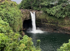
Explore Rainbow Falls
4.50.1 mi / 0 ft gainRainbow Falls is a gorgeous and easily accessible pull-off from Highway 11. This is not really a hike - just a short walk from the parking lot to a gorgeous 80 foot waterfall (making this fun for all ages!). Hit up Cafe Pesto in Hilo for a meal after. If you want to learn about the mythology sur...Read more -
Hanalei, Hawaii
Kayak Camp on Miloli'i Beach
17 miNOTE: The beach is closed in the winter months due to high surf. Be sure to work with a local guide to insure you do this adventure safely.The only way to reach Miloli'i is by Kayak. Unless you are going to be bringing your own kayak to the island chances are you will need to rent one from a com...Read more -
Kula, Hawaii
Backpack the Haleakala Wilderness: Halemau'u to Sliding Sands Trail
5.019 mi / 3643 ft gainDay 1, the trailhead begins just off the highway at 7,990 feet elevation and takes you to the north and east to an opening in the ridgeline. After 1.1 miles, you will begin your 2.6 mile descent from the crater ridge south, into the heart of the wilderness area and where you will arrive at Holua ...Read more -
Hanapepe, Hawaii
Hike Kawaikoi Stream
1.75 mi / 40 ft gainKawaikoi stream trail starts 3/4 mile beyond the Forest Reserve entrance sign on the Mohihi-Camp 10 road & across the stream at "Sugi Grove". It's a DLNR maintained trail, so there's signage & mile markers for the trail.At 1.75 miles total-roundtrip, it's a very easy walking trail, great ...Read more

