Rising Fawn, Georgia
Looking for the best camping in Rising Fawn? We've got you covered with the top trails, trips, hiking, backpacking, camping and more around Rising Fawn. The detailed guides, photos, and reviews are all submitted by the Outbound community.
Top Camping Spots in and near Rising Fawn
-
Rising Fawn, Georgia
Camp at Cloudland Canyon State Park
4.8If you're looking to camp somewhere with exceptional hiking and beautiful waterfalls, Southeastern Tennessee locals know not to look further than Lookout Mountain. Located on the western edge, Cloudland Canyon State Park straddles Sitton Gulch Creek and is perfect for a weekend exploration.If sta...Read more -
Rising Fawn, Georgia
Cloudland Rim Loop via East Rim Campground
4.66 mi / 873 ft gainCloudland Rim Loop via East Rim Campground is a loop trail in Cloudland Canyon State park, which offers up stunning vistas and several waterfalls. This trail is located near Rising Fawn, Georgia.Read more -
Rising Fawn, Georgia
Hike the West Rim Trail to Cherokee Falls
4.54.77 mi / 814 ft gainGood luck finding something you dislike about Cloudland Canyon State Park - one of Georgia's largest and most scenic parks. Sitting on the western edge of Lookout Mountain, it is home to a plethora of luscious trails, easily-accessible campgrounds or yurts, and flowing waterfalls. The West Rim L...Read more -
Summerville, Georgia
Hike the Marble Mine Trail
4.31.7 mi / 200 ft gainThis 1.7 mile loop is almost entirely on a wide pebbled road making this hike perfect for getting families and friends outdoors. Though there is some elevation gain, the Marble Mine Loop is quite an easy walk. Go during the Fall and the trees are boasting all the reds, oranges, and yellows of the...Read more -
Sequatchie, Tennessee
Foster Falls Loop
4.62.19 mi / 574 ft gainFoster Falls State Park is part of the South Cumberland State Park system. A short 45 minute drive from Chattanooga, Foster Falls boasts a stunning 60 foot waterfall that is worth visiting during any season of the year. The trailhead for this 2 mile hike starts from the Foster Falls parking lot a...Read more -
Estillfork, Alabama
Walls of Jericho via Alabama Trailhead
4.55.8 mi / 1417 ft gainAround 5pm, we hiked down the only clearly marked trail that departs from the parking lot. The path begins with gentle switchbacks and great views of the forest, occasionally passing by small waterfalls, sinkholes, and caves; and arriving at the Hurricane Creek crossing (log with handrail) after ...Read more -
Tracy City, Tennessee
Hike the Fiery Gizzard Trail
5.013.5 miStart this journey from the Grundy Forest Trailhead, where you will quickly begin a decent along the Little Fiery Gizzard Creek. At the 0.7-mile split, be sure to turn left and cross the bridge to stay on the Fiery Gizzard Trail. For the next 0.8-mile journey, you'll encounter the gorgeous Black ...Read more -
Soddy-Daisy, Tennessee
Hike the Hogskin Upper and Lower Loop
5.01.4 miAfter an easy 25 minute drive from Chattanooga you will reach North Chickamauga Gorge on Montlake Road in Soddy Daisy. Park any where in the gravel loop just make sure other cars can get through. From the Montlake Road Trailhead Kiosk the trail begins on an old mining road. Hogskin Upper Loop Tr...Read more -
Leesburg, Alabama
Camp at Sand Rock
5.01 mi / -100 ft gainWe camped in a rooftop tent, but many people used traditional tents and hammocks. After purchasing a camping permit, drive right up to your campsite. There are three general camping areas.First is the more exposed (to the often strong winds) campsites along the tops of the cliffs that are closest...Read more -
Leesburg, Alabama
Climb Sand Rock
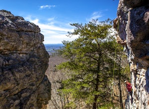
4.5Sand Rock is a unique set of rock outcropping that erupts from Shinbone Ridge overlooking scenic Lake Weiss. The climbable rock runs for about a quarter of a mile along the ridge and is a maze of trails, small caves and literally wall-to-wall climbing.You can find just about any climb to satisfy...Read more -
Guntersville, Alabama
Kayaking at Lake Guntersville State Park
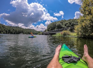
Lake Guntersville State Park is a publicly owned recreation area located on the far north side of the city of Guntersville in Marshall County, Alabama. The state park occupies 5,909 acres on the eastern shore of Guntersville Lake, a 69,000-acre impoundment of the Tennessee River. Lake Guntersvill...Read more -
Gruetli-Laager, Tennessee
Hike to Suter and Horsepound Falls
4.06 mi / 1794 ft gainLocated in South Cumberland State Park in the Savage Gulf section, this is a somewhat difficult 5 mile out-and-back viewing two waterfalls, cascades, creeks, rock shelters, and high bluffs. 2 miles past Suter Falls you'll come to Horsepound Falls, a unique waterfall formation with overlooks and l...Read more -
Palmer, Tennessee
Hike the North Plateau-North Rim Loop at Savage Gulf
4.014.7 mi / 2483 ft gainFrom the Savage Ranger Station, take the Savage Day Loop for roughly 2.2 miles until you reach the junction. From there take the North Plateau trail and return on the North Rim trail. The elevation gain on this trail is rather gradual and and subtle, but it is a long trek that requires endurance ...Read more -
Chatsworth, Georgia
Hike the Gahuti Trail
4.08.1 mi / 1223 ft gainFort Mountain rises prominently from the plateau to the West, serving as the start of the Blue Ridge Mountain range in Georgia. The Gahuti Backcountry Trail circumnavigates the mountain, with several overlooks with views in all directions. At 8.1 miles, this hike is moderately difficult, but can...Read more -
Beersheba Springs, Tennessee
Hike to Stone Door and Alum Gap Campground
6.8 mi / 825 ft gainThis is a fun and easy overnight trip that is good for all ages. Start at the Stone Door Ranger Station which has plenty of parking and public restrooms as well. Follow the signs to the Stone Door Trailhead and in a short 0.8 miles you'll arrive at the edge of the gulf (canyon) and the first sign...Read more -
Chatsworth, Georgia
Emery Creek Falls
5.05.9 mi / 833 ft gainThe hike to the five waterfalls on the Emery Creek trail is one of the most spectacular hikes in Georgia. This trail is moderate in climb, yet secluded in the Cohutta Wilderness and challenging enough to keep crowds away. Two things to note about this trail: it is wet (there are 20 creek crossing...Read more

