Union, Connecticut
Looking for the best chillin in Union? We've got you covered with the top trails, trips, hiking, backpacking, camping and more around Union. The detailed guides, photos, and reviews are all submitted by the Outbound community.
Top Chillin Spots in and near Union
-
Chaplin, Connecticut
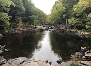
Hike to Diana's Pool
4.01.3 mi / 45 ft gainThe drive to Diana's Pool is worth it in an of itself, taking you through the backroads of Eastern Connecticut. To begin the hike just simply enter the woodland path and follow the trail. In order to go under the bridge just simply take the first left in the path and there will be a stream that f...Read more -
Sutton, Massachusetts
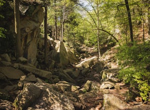
Hike the Purgatory Chasm Trail
4.71 mi / 115 ft gainFor this 1-mile hike, you can park at the Purgatory Chasm Visitor Center. From there hit the trail and explore the unusual gap between the tall granite walls, which might be adorned with climbers. Great for all ages and dogs are welcome too. The trail is open March-November.Read more -
Glastonbury, Connecticut
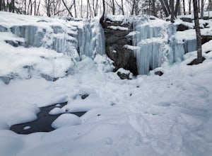
Blackledge Falls
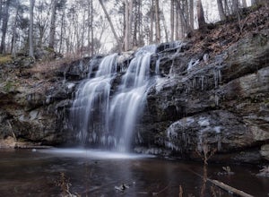
4.01.46 mi / 207 ft gainAlthough the park contains hiking trails, a pond and a streambelt, the primary draw of this parcel of land is the 25 foot waterfall. The falls flow varies depending on the volume of precipitation, from a trickle in the dry months to a three-pronged vertical drop after some consistent snow melt or...Read more -
Manchester, Connecticut
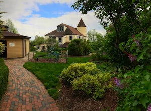
Explore Wickham Park
5.0Wickham Park Is open the first weekend in April and closes the last weekend in October. Entrances fees are $5 Monday-Friday and $7 Saturday-Sunday. The park is known for its 250 acres of open fields, wildflowers, gardens, ponds and nature center. There is no where else can you go have a picnic w...Read more -
Glastonbury, Connecticut
Hike the Cotton Hollow Nature Preserve
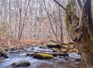
5.03 miThere are two parking locations for Cotton Hollow, the location tagged in the directions is the shortest hike to the old gun powder mill. Suggestions when it comes to exploring the preserve are to stay on the trails, know your limits, and enjoy! There are swimming holes along the river, but swim ...Read more -
Simsbury, Connecticut
Hike to the Heublein Tower on Talcott Mountain
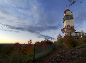
4.32.54 mi / 404 ft gainThe Heublien Tower Trail, located just inside the Talcott Mountain State Park entrance off of Route 185 in Simsbury CT, is a short 1.25 miles. While the hike isn't long, the first 1/3 of a mile is a steep incline that will get your heart pumping. The trail itself it very well kept, and although ...Read more -
Middlesex County, Connecticut
Hike to Glen Falls
5.00.75 miAccessing Glen Falls may be a little tricky at first. Parking will be very minimal, you will park on Grist Mill Ln. Hop onto the road and you will see the trail map on the left side. The adventure begins when you cross the street and go through the gate with the yellow blaze symbol. Keep followin...Read more -
East Haddam, Connecticut
Explore Chapman Falls in Devil's Hopyard SP
4.0If you map to Chapman Falls in East Haddam, CT, you will be brought to a parking lot opposite from the waterfall in Devil's Hopyard, a beautiful Connecticut state park. Once there, it's only a few minute walk down a very clear trail to the base of the 60 foot falls. There's plenty of room to set ...Read more -
Granby, Connecticut
Hiking Enders Falls
4.0Enders State Forest sprawls over approximately 2000 acres, and is found within the towns of Granby and Barkhamsted in Connecticut. Enders has a good sized parking lot directly on Route 219. From the junction of Route 219 and Route 20, visitors will proceed west on Route 219 for 1.2 miles and tu...Read more -
Clinton, Massachusetts
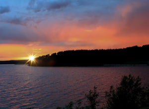
Watch a Sunset at Wachusett Reservoir
4.5Wachusett Reservoir is located in central Massachusetts, northeast of Worcester. Easy location and parking, you can go anytime of the day and you won't be disappointed. The Reservoir is the second largest body of water in the State of Massachusetts, taking place in 5 cities around the area, West ...Read more -
Bolton, Massachusetts
Take a Stroll at Fyfeshire Conservation Area
1.0Fyfeshire is located in Bolton Massachusetts off "Wattaquadock Hill Road", near the "Fotini's Restaurant and Bar". The trailhead begins at a small parking area with a stone gate that says Fyfeshire Conservation area on a wood plank. Once you are in the conservation area you will see an opening in...Read more -
Middletown, Connecticut
Explore Wadsworth Falls
5.00.25 miWhen it comes to exploring Wadsworth Falls its ease of access couldn't be better. As soon as you pull into the parking lot you hear the falls roaring. Take the quick walk to see the picturesque scenery.Facts about Wadsworth Falls:Height: 25ft tall and doubled in width Rock: Hampden Basalt -the ro...Read more -
Southington, Connecticut
Hike the Crescent Lake & Metacomet Trail Loop
4.02.4 mi / 269 ft gainThe hike to view Crescent Lake is peaceful. You can either walk through the woods where you will be blessed with natures finest birds and wildlife or you can take the trail along the lake edge. Both are similar distances and lead to the same hill at the end! Once you get to the top take a left on...Read more -
Meriden, Connecticut
Higby Mountain Trail
2.11 mi / 486 ft gainThe popular route for this hike is to park your car at the base of the trail which is located right before merging onto 91-S in Middlefield, CT. The parking lot does seem to get crowded mid-day, especially if the weather is nice! The beginning of the hike is mostly flatter land and an incline w...Read more -
Meriden, Connecticut
Hike the Metacomet, Blue, and Yellow Loop
5.04.5 mi / 976 ft gainStart from the Castle Craig road entrance. Walk until you're greeted by a beautiful reservoir. You'll notice the strange but beautiful Mine Island in the middle of all this. You'll also notice markers for White Trails and Yellow Trails. The White Trail is an easier/wider trail. The Yellow Trail C...Read more -
Acton, Massachusetts
Hike the Pratt's Brook Conservation Area Loop
4.01.5 mi / 85 ft gainPark in the small parking area right before the trailhead. *Notice this parking area is small and only fits about 3-4 cars so prepare to find street parking on a busy day. You can punch in the coordinates to a GPS if you need help finding it: 42.4545482, -71.4358192. The loop is very diverse wit...Read more

