Stamford, Connecticut
Looking for the best photography in Stamford? We've got you covered with the top trails, trips, hiking, backpacking, camping and more around Stamford. The detailed guides, photos, and reviews are all submitted by the Outbound community.
Top Photography Spots in and near Stamford
-
Hopewell Junction, New York
Beaver Pond via Appalachian Trail
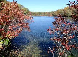
5.03 mi / 400 ft gainBeaver Pond is a small body of water created by a dam that was constructed during the days of iron ore mining in the area. The pond is crystal clear and has a wonderful tree line right on the water. The best time to visit here is early morning in the fall. With the leaves changing color they m...Read more -
Cold Spring, New York
Photograph Indian Brook Falls
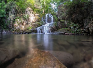
2.8This is about as short a walk and as little effort as you can put in for a beautiful waterfall. You can barely call it a hike, but I'll list it as such since you do walk through the woods for 5 minutes. The trail is extremely well built, and is pretty easily accessible through the winter.The trai...Read more -
Cold Spring, New York
Hike the Perkins/Fahnestock/Charcoal Burners Trail Loop
7.5 mi / 800 ft gainThis is one of my favorite hikes in the Clarence Fahnestock State Park. A real mixed bag but mostly very enjoyable. The trail starts at the Charcoal Burners Trailhead Route 301. There is only road side parking on a soft shoulder, both sides of the road. After a short walk into the forest, you re...Read more -
New Fairfield, Connecticut
Hike Squantz Pond Trail
2.2 mi / 321 ft gainThe hike is rated as moderate and is accessible all year round. While it’s accessible during all seasons, the sights of the leaves changing colors in the autumn makes it an exceptionally beautiful time to do this hike. You’ll definitely want to snap some photos along the way of the foliage reflec...Read more -
New York, New York
High Line
4.61.47 mi / 26 ft gainBuilt on a historic freight rail line and perched above the streets of Manhattan’s West Side, the High Line is a public park that features a green-lined walkway. Park hours depend on the season, although it never opens before 7am, so best to go for sunset. Although you may have some company on wa...Read more -
New York, New York
Walk the George Washington Bridge at Sunset
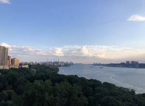
3.00.9 miJoin the thousands of people who cross the GWB each day, but do it by foot! This is an easy walk with beautiful views of the New York City skyline. You will begin seeing signs for the bridge bike path at Ft. Washington St. & E. 177th St., which you follow for a few blocks until you begin asce...Read more -
Brooklyn, New York
Brooklyn Bridge Park Piers
5.01.5 miStarting at the Brooklyn Main Street Park, you are on the right side of the Manhattan Bridge. Here you can check out the new outdoor climbing gym. Keep walking along the water and you'll soon come upon Pebble Beach. Now this beach is not exactly a "let's bring our beach chairs and spend the da...Read more -
Brooklyn, New York
Photograph Manhattan Bridge from Washington Street NYC
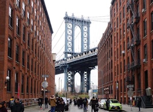
4.7Located in DUMBO this is seen as one of of the prime photography spots in NYC for good reason. Off the intersection of Washington Street and Water Street is a perfect view of the Manhattan Bridge sandwiched between two buildings. If you want to take it one step further you are able to get a close...Read more -
Brooklyn, New York
Photograph the Brooklyn Bridge
4.8Escaping the hustle and bustle of the city doesn't always require actually leaving the city. Hanging out next to the East River and focusing on photographing the Brooklyn Bridge can be just what you need to clear your head and get your fix for some outdoors time. This is a great spot to practice ...Read more -
Cold Spring, New York
Hike the Cornish/Brook/Notch/Washburn/Undercliff Loop
8 mi / 1500 ft gainThis loop is a great option to avoid crowds on the west side of the Washburn trail. Start at the same trailhead for the Washburn Trail. The Cornish Trail is on the left and there is an obvious sign at the trail split a few feet from the parking area. The Cornish Trail is an old road from about...Read more -
Cold Spring, New York
Hike the Washburn/Nelsonville/Undercliff Loop
7.2 mi / 2000 ft gainThis is a difficult loop hike that has several different starting points. I chose to start at the Washburn Trail Head, which is the lowest starting point you can select. Nearly on the Hudson River, the trail ascends immediately along a well maintained road designated by white disc markers. Aft...Read more -
New York, New York
Explore the South Street Seaport
5.0Get a feel for what New York was like in the 19th century at the Seaport! The Seaport boasts some of the oldest buildings and architecture in Manhattan, and the area continues to bustle today. The Seaport borders the Financial District and the East River - so there are lots of wonderful sights to...Read more -
Paterson, New Jersey
Explore the Great Falls of the Passaic River
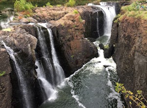
3.2Getting to the Great Falls of the Passaic River is a relatively straight shot. It is located off exit 57B on Route 80 which is also accessible from highway 287. Parking is located on McBride Avenue across the street from the park's welcome center.Typically during autumn park rangers offer 45 to 1...Read more -
Cornwall, New York
Storm King Mountain Loop
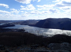
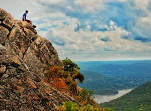
4.52.44 mi / 400 ft gainThis is an easy, yet very rewarding hike with a lot of viewpoints on the way up. Technically you scale up two mountains, Butter Hill and Storm King, but most people just describe it as Storm King Mountain. This is a great hike for families with younger kids, those who don't have much time but wan...Read more -
Cornwall, New York
Hike the North Point Loop
6.5 mi / 1400 ft gainThere is three different trailheads to access the North Point Loop. I chose the trailhead that would give me the longest hike. That would be the Butter Hill parking area on Route 9W north. From the parking lot, start on the connector trail designated with white markers. Follow this for about ...Read more -
Cold Spring, New York
Sugarloaf Mountain and Breakneck Ridge Loop
4.74.33 mi / 1562 ft gainThe Breakneck Ridge to Sugar Loaf Loop gives rise to various bypasses that offer hikers moderate to advanced terrain and multiple rock scrambles. The loop entails a total elevation gain of 1,670 feet and a total distance of 5.5 miles. The start of the trail begins at the (white blazes) at the no...Read more

