Walden, Colorado
Looking for the best photography in Walden? We've got you covered with the top trails, trips, hiking, backpacking, camping and more around Walden. The detailed guides, photos, and reviews are all submitted by the Outbound community.
Top Photography Spots in and near Walden
-
Walden, Colorado
Backpack to Kelly Lake In State Forest SP
13.2 mi / 2624 ft gainRound trip will take you along 13.2 beautiful miles of Northern Colorado backcountry. Starting from the trail head which can be found within the entrance of the park (near the horse ring and car camping), you'll head into some beautiful backcountry. Before you reach the woods, a 4x4 trail will be...Read more -
Walden, Colorado
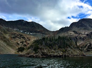
Backpack to Slide Lake in Mt. Zirkel Wilderness
6.4 mi / 1777 ft gainStart at the Rainbow Lake Trailhead 1126 in the Mount Zirkel Wilderness which is 19 miles south west of Walden, Colorado off Country Road 22A.The 6.4 mile out and back to Slide lake starts out at an elevation of 8750 and gives you a total elevation gain of 1777 feet at the end at Slide Lake. You...Read more -
Walden, Colorado
Dancing Moose Yurt [Closed]
NOTE: This property is currently closed as NeverSummer, the yurt operator, is no longer in business. The yurt is located near the small town of Walden, CO (coordinates: 40 33'57.43"N , 105 59'16.93"W) about two hours west of Fort Collins. In the winter, there are many backcountry ski runs, cros...Read more -
Walden, Colorado
Overnight at Nokhu Hut
5.03 mi / 540 ft gainThe Nokhu Hut is part of the Never Summer Nordic Hut system, and makes for the perfect beginner Hut trip. The Hut has a stocked kitchen, wood shed, and small wood burning stove that keeps the tiny hut toasty warm.From the Hut, it is a short, easy hike to Lake Agnes - the trail often stays snowy u...Read more -
Walden, Colorado
View Fall Color on Cameron Pass
From the front range, drive west of Fort Collins, Colo. on Highway 14 towards Walden, Colo. When you enter Highway 14 from Fort Collins, look for Ted's Place. Ted's is a gas station and convenient store, stop here to hit the bathroom, fill up on gas, and grab some snacks. There will be very few f...Read more -
Walden, Colorado
Cross-Country Ski to American Lakes
4.012 mi / 800 ft gainWARNING! AVALANCHE DANGER!Make sure you have avalanche safety knowledge and equipment. This route enters avalanche terrain.If you are looking for one of the ultimate cross-country ski treks along the northern Front Range, look no further. This trip takes you to the American Lakes at the base of t...Read more -
Bellvue, Colorado
Winter camp at Zimmerman Lake
2.7 mi / 518 ft gainThis is a fairly popular snowshoeing and cross country skiing trail in the winter and offers a variety of additional trail options from the lake. Starting at the parking lot, the trailhead is easily accessed and begins the very gradual assent to Lake Zimmerman. Once at the lake, there are beautif...Read more -
Bellvue, Colorado
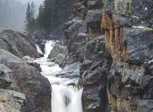
Photograph Poudre Falls
To get to Poudre Falls, simply drive up Poudre Canyon on Highway 14, just north-west of Fort Collins. The drive all of the way up to the falls is a little bit of a jaunt and will take about an hour or so. There are plenty of cool things to see on the way, so have the camera in the passenger seat...Read more -
Kremmling, Colorado
Hike to Lake Agnes
3.01.6 miIn State Forest State Park, you start at Agnes Cabin, a historic cabin built in 1925. Because of its rustic architecture, it is listed on the National Register of Historic Places by the United States Department of the Interior. It is a one-story, lodge pole pine log cabin. The cabin is empty, bu...Read more -
Walden, Colorado
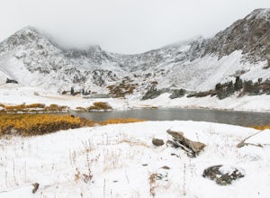
Hike to American Lakes
5.011 mi / 1680 ft gainAmerican Lakes are two high alpine lakes located within State Forest State Park and the Never Summer Mountain Range. The park is located about 75 miles west of Fort Collins, Colo. along Highway 14 on the west side of Cameron Pass.Coming down from Cameron Pass, look for a sign for the American Lak...Read more -
Kremmling, Colorado
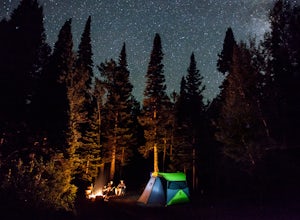
Camp Near Little Muddy Creek, Routt National Forest
5.0If you are looking to get away from the crowds then this is the site for you. Located in the Routt National Forest, this spot offers everything from a seasonal lake (I went out of season) to free range sheep.Because of all the aspen trees, this place will be glowing with color in the fall. You wi...Read more -
Steamboat Springs, Colorado
Hike Fish Creek Falls in Steamboat Springs
4.04.36 mi / 1440 ft gainEasily the most popular hike in Steamboat Springs, FishCreek Falls earns its popularity not just by its close proximity to town, butby its spectacular waterfalls. If you are a waterfall aficionado, then thishike is for you. Just 3.5 miles from Main Street in Steamboat, the hike tothe Lower and U...Read more -
Steamboat Springs, Colorado
Strawberry Park Hot Springs
4.6No matter the time of year, if you are going to be anywhere near Steamboat Springs, Strawberry Park Hot Springs is a can’t-miss experience. Steamboat is known primarily as a ski resort, but the area also offers amazing hikes and fishing in the summer, and top-notch leaf-peeping in the fall. Add a...Read more -
Grand Lake, Colorado
Hike the Colorado River Trailhead Loop
5.013.6 mi / 1245 ft gainSince this hike is 13.6 miles (according to my watch the hike was more around 14 miles, but it's in that range), I'm going to break it down into four different parts. To Lulu CityTo Little Yellowstone / Thunder PassThe Grand Ditch Red Mountain Trail The first 0.5 miles and the last 0.5 miles a...Read more -
Grand Lake, United States
Hike to Timber Lake
4.59.6 mi / 2050 ft gainI love Timber Lake! I never see that many people on the trail and I can't figure out why. The hike starts at the Timber Lake trailhead and climbs gradually through Pine and Aspen trees on the way up. We saw a few elk on the way up that didn't seem to be bothered by our presence. We also started h...Read more -
Estes Park, Colorado
Mt. Ida via Milner Pass
5.09.28 mi / 2112 ft gainThe hike to Mt. Ida offers some of the most stunning views of Rocky Mountain National Park. How to get there: From the east, take Trail Ridge Road all the way to the west side of the park. You will pass Alpine Visitor Center and the road sharply turns south at Medicine Bow Curve. The trailhead...Read more

![Dancing Moose Yurt [Closed]](https://images.theoutbound.com/uploads/1454553015692/sthmscbw5916pqfr/1b559ecab7d81fde80eacc99e3b36020?w=300&h=220&fit=crop&q=60&s=f88fa81bfb38a785f8adb78434f83f54)
