Nederland, Colorado
Looking for the best hiking in Nederland? We've got you covered with the top trails, trips, hiking, backpacking, camping and more around Nederland. The detailed guides, photos, and reviews are all submitted by the Outbound community.
Top Hiking Spots in and near Nederland
-
Littleton, Colorado
Hike the South Rim Trail at Roxborough State Park
3.83 mi / 300 ft gainRoxborough State Park is one of the closest parks to the Denver metro area and is the perfect place to go if you're looking to experience the great outdoors without having to drive too far from the city.One of my favorite trails in the park is the South Rim Trail which takes you on an easy to mod...Read more -
Littleton, Colorado
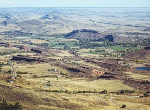
Hike to Carpenter Peak
4.56.2 mi / 1171 ft gainCarpenter Peak stands at 7,166 feet above sea level. While that altitude might not exactly take your breath away, the views from the top certainly will. Starting at the Visitor's Center, the trail to Carpenter's Peak begins as a relatively flat, well-traveled trail. A little less than a mile into...Read more -
Littleton, Colorado
Walk the Willow Creek Loop
1.4 miRoxborough State Park is located on the outskirts of Littleton, Colorado. Boasting incredible red rock formations and abundant wildlife, it is the perfect place for a quick escape outside.The Willow Creek Loop connects to the two parking lots in the park, so it is impossible to miss. With only th...Read more -
Bellvue, Colorado
Hike to Comanche Lake in Pingree Park
3.58 mi / 700 ft gainYou start out hiking through the average Colorado forest for the first 4 miles of the 7-8 mile trip at about 6,500 feet. The trail is largely downhill for the first couple miles until it levels out and you are headed North. A little more than halfway, you come to Comanche Reservoir and hike up al...Read more -
Breckenridge, Colorado
Hike Baker's Tank Loop
3.86 mi / 645 ft gainWhen the aspens are sporting their golden hues of autumn, Baker's Tank Loop is a perfect fall hike. The trailhead is about ten minutes from downtown Breckenridge. For part of the hike, you may have the world to yourself. But, for the road portion, you'll likely have to share with the leaf peep...Read more -
Breckenridge, Colorado
Breckenridge Troll
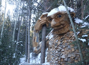
5.00.2 mi / 26 ft gainIsak Heartstone, otherwise known as the Breckenridge troll, can be accessed from the Illinois Gulch Trailhead. This trailhead can be full for much of the day, so it is advisable to find parking in town and then take a bus, walk, or bike to the starting point of this short walk. Once at the trai...Read more -
Aurora, Colorado
Walk the Cherry Creek Dog Off-Leash Area
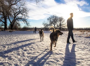
4.53 miCherry Creek Dog-Off Leash Area is an extended part of Cherry Creek State Park and encompasses 107 acres of fenced-in play area. Within the park there is a 3 mile loop trail that takes you through the trees and along the Cherry Creek. What makes this park so great is the several access points to ...Read more -
Breckenridge, Colorado
Hike the Sawmill Trail to Fairy Forest
3.01.5 mi / 250 ft gainIf you brought the family to Breckenridge chances are you're probably not bringing the little ones on your next 14'er summit. Are you looking for an easy hike to let the kiddos experience some nature and run around a bit? Well then this short hike is perfect for you and the family. Plus, it's rig...Read more -
Bellvue, Colorado
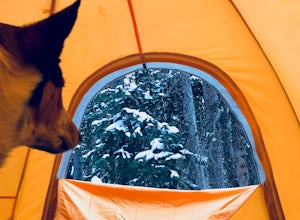
Winter camp at Zimmerman Lake
2.7 mi / 518 ft gainThis is a fairly popular snowshoeing and cross country skiing trail in the winter and offers a variety of additional trail options from the lake. Starting at the parking lot, the trailhead is easily accessed and begins the very gradual assent to Lake Zimmerman. Once at the lake, there are beautif...Read more -
Lone Tree, Colorado
Hike Bluffs Regional Park Trail
2.7 mi / 200 ft gainThis loop trail is 2.7 miles long but has several options for overlooks that add 0.8 miles to the trip. This is an easy hike with minimal elevation gain and is a great option for the whole family. Every time I've done this hike I've seen numerous deer which only adds to the hike!Read more -
Pine, Colorado
Little Scraggy Peak Loop
5.012.18 mi / 1621 ft gainLittle Scraggy Peak Loop is a loop trail that takes you past scenic surroundings located near Buffalo Creek, Colorado.Read more -
Breckenridge, Colorado
Camp at Boreas Pass
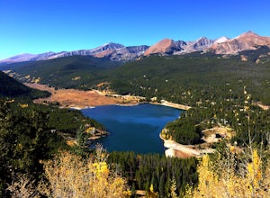
9 mi / 1500 ft gainBoreas pass is a high mountain pass in the Rocky Mountains that sits on the Continental Divide at 11,481'. Forest Service Road 33 goes over the pass and has numerous campsites all along its length, with several near the summit that feature breathtaking views of the Tenmile Range and the Breckenri...Read more -
Fort Collins, Colorado
Hike Arthur's Rock in Lory State Park
4.83.7 mi / 1150 ft gainThe climb to the summit of Arthur's Rock in Lory State Park provides relative isolation and solitude just 30 minutes from downtown Fort Collins along with great hiking, trail running, mountain biking, rock climbing, and horseback riding.Arthur's Rock Trail is the most direct route to the summit, ...Read more -
Fort Collins, Colorado
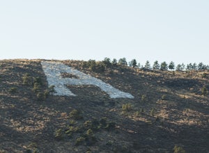
"The A" via the Foothills Trail
5.04.14 mi / 531 ft gainWhy is there an A on the side of the mountain? The "A" stands for Aggies. When Colorado State University was first founded in 1870, it was originally called Colorado Agricultural College. The mascot at the time was The Aggies. Though the college has now become Colorado State and its mascot, The...Read more -
Fort Collins, Colorado
Horsetooth Reservoir North Foothills Trail
2.64 mi / 295 ft gainHorsetooth Reservoir North Foothills Trail is a loop trail that takes you by a waterfall located near Fort Collins, Colorado.Read more -
Frisco, Colorado
Backpack to the Gore Range's Wheeler and Lost Lakes
4.510 mi / 2200 ft gainThe range offers many remote lakes and peaks which hikers can access from various points of entry. Wheeler and Lost Lakes lie within the boundaries of the Eagle's Nest Wilderness Area.The Gore Trail begins on the north side of the CO-91 pedestrian bridge over I-70. You will follow the trail up al...Read more

