
Little Scraggy Peak Loop
Pine, Colorado
Rated 5.0/5
based on 1 reviews
5.0/5
Details
Distance
12.18 miles
Elevation Gain
1621 ft
Route Type
Loop
Description
Added by Outbound
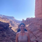
Little Scraggy Peak Loop is a loop trail that takes you past scenic surroundings located near Buffalo Creek, Colorado.
Download Outbound mobile app
Find adventures and camping on the go, share photos, use GPX tracks, and download maps for offline use.
Get the appFeatures
Mountain Biking
Hiking
Scenic
Little Scraggy Peak Loop Reviews
This area in Buffalo Creek has some cool and large rock formations. You could spend hours climbing around on the rocks here. There is a paid parking lot, but also a few free pull offs for parking. There is free camping on the road further up, but to fills up quickly in the summer. Popular with mountain bikers.
5.0
Leave No Trace
Always practice Leave No Trace ethics on your adventures and follow local regulations. Please explore responsibly!
Nearby

Dispersed Camp at the Buffalo Creek Area in Pike National Forest
50 miles from Denver, nestled in Pike National Forest, there are dozens of free dispersed camping sites. With quick access to the Colorado Trail and Buffalo Creek Mountain Bike Area, these campsites make for a perfect weekend getaway. The campsites begin on Forest Road 550, and are clearly marked with signs (be sure to follow these diligently, as a hefty ticket will be the result of parking/cam...

Fish Cheeseman Canyon
Cheesman Canyon is considered one of the top fisheries in the world, and this stretch of the South Platte River is easily accessed at the Cheesman trailhead off CR 126 just Southwest of Deckers. There are tons of great fishing opportunities along this stretch of the river, but it does tend to get crowded on weekends. This section of the river holds some monster trout, but they are smart so yo...

Devils Head Fire Lookout
This is one of my favorite hikes near Denver and the lookout itself is over 100 years old! On the road to the trailhead there are many spots for camping and other activities.
From Sedalia, CO head down Highway 67 for about 10 miles. Turn south onto Rampart Range Rd and continue for about 9.5 miles. You will then be going left towards Devils Head Campground. Rampart Range Road is a gravel road ...

Hike the Fountain Valley Trail at Roxborough State Park
The Fountain Valley Trail at Roxborough State Park is a very easy trail that's perfect for those that want to enjoy the outdoors but not subject themselves to the rigors of climbing a 14er. This very well maintained trail is wide and flat and perfect for groups, families, or for taking visitors that might not be used to high elevation just yet.This self guided trail starts at the Visitors Cente...

Hike to Carpenter Peak
Carpenter Peak stands at 7,166 feet above sea level. While that altitude might not exactly take your breath away, the views from the top certainly will. Starting at the Visitor's Center, the trail to Carpenter's Peak begins as a relatively flat, well-traveled trail. A little less than a mile into the hike, you're given the choice to take a left and head on the South Rim Trail, or a right and co...

Walk the Willow Creek Loop
Roxborough State Park is located on the outskirts of Littleton, Colorado. Boasting incredible red rock formations and abundant wildlife, it is the perfect place for a quick escape outside.The Willow Creek Loop connects to the two parking lots in the park, so it is impossible to miss. With only the slightest uphills and mostly flat, even terrain, its a great hike to take your older or younger fa...
Discover
Community
Mobile Apps

© 2026 The Outbound Collective - Terms of Use - Privacy Policy