Longmont, Colorado
Looking for the best backpacking in Longmont? We've got you covered with the top trails, trips, hiking, backpacking, camping and more around Longmont. The detailed guides, photos, and reviews are all submitted by the Outbound community.
Top Backpacking Spots in and near Longmont
-
Larimer County, Colorado
Sky Pond via Glacier Gorge Trailhead
4.78.43 mi / 1780 ft gainStart at the Glacier Gorge trailhead on Bear Lake Road. Parking is limited so it is advised to get there very early. It's a longer hike so plan on taking a full day to complete or stay overnight to enjoy more of the scenery. Within the first mile on the Glacier Gorge Trail you will pass by Alber...Read more -
Estes Park, Colorado
Green Lake via Glacier Gorge Trail
5.011.38 mi / 3400 ft gainBegin at the popular Glacier Gorge trailhead along Bear Lake Road in Rocky Mountain National Park. Arrive VERY early for parking as the lot typically fills by 7:30 am. For the best photography options - choose to either backpack into the Glacier Gorge campsite (reservations must be made early in ...Read more -
Larimer County, Colorado
Nymph, Dream, Emerald, and Haiyaha Lakes
4.94.51 miFrom the Bear Lake Trailhead, the path to Nymph Lake is a moderate paved trail. At the lake there are several places to sit and take in the scenery. This is also where you'll find the most people. From here, continue up the trail towards Dream Lake. On the way, the trail forks. The left will take...Read more -
Nederland, Colorado
Backpack to Caribou Lake
4.08.2 miThis is one of the most beautiful hikes I have ever done in Colorado. It is a great trip for photographers, fisherman or anyone who enjoys mountain views, forests filled with wildlife and peaceful meadows. Distances: Arapaho Pass: 3.2 miles, Caribou Lake: 4.2 miles, Caribou Pass: 6.4 miles, Meado...Read more -
Estes Park, Colorado
Backpack to Odessa Lake via Fern Lake Trailhead
4.09.65 mi / 1890 ft gainOdessa Lake seems to be one of the true hidden gems of Rocky Mountain National Park. Don't get me wrong, you will likely see some folks there, but it is a far cry from the other crowded Bear Lake trailhead lakes. There are two ways to reach Odessa; one, from the Bear Lake Trailhead, and the oth...Read more -
Estes Park, Colorado
Hike Deer Mountain
6.03 mi / 1200 ft gainBeginning in Rocky Mountain National Park near the Deer Ridge Junction (where US 34 & US 36 meet), park your car in one of the 20 spots on either side of the road. Start at the trailhead booth and head north, keeping to the right-side trail at the first intersection about a tenth of a mile fr...Read more -
Nederland, Colorado
Upper Forest Lakes Trail
7.86 mi / 1778 ft gainUpper Forest Lakes Trail is an out-and-back trail that takes you by a river located near Rollinsville, Colorado.Read more -
Nederland, Colorado
3 Crater Lakes via South Boulder Creek
5.06.92 mi / 1804 ft gainAfter turning on to Co. 16 (Tolland Rd.) from 119 at Rollinsville, drive about 8 miles down the dirt road along South Boulder Creek. The road will dead end at Moffat Tunnel where you'll find ample parking in a gravel lot with restrooms. You'll begin your hike along sweeping meadows until you ent...Read more -
Nederland, Colorado
Heart and Rogers Peak Lakes
4.88.62 mi / 2113 ft gainThe hike begins at the East Portal Trailhead outside Rollinsville. Start hiking along the South Boulder trail to the right (north) of the very obvious Moffat Rail tunnel. The trail begins with moderate grades past the Forest Lakes cutoff just 1.25 miles from the trailhead. Continue hiking straigh...Read more -
Granby, Colorado
Mirror and Crater Lakes via Cascade Creek Trail
4.614.94 mi / 2421 ft gainStart at the Monarch Lake trailhead (where there is a $5 parking fee unless you have one of the national lands passes) and follow the cascade creek trail around the north side of the lake. After about 1.5 miles the trail splits with the Arapaho pass trail, follow the cascade trail to the left as ...Read more -
Nederland, Colorado
Hike to Columbine Lake
5.07 mi / 1200 ft gainThe hike is about seven miles, give or take, however it feels longer. The elevation gain is little over 1000 feet. The drive here is about 45 minutes from both Granby and Winter Park, and is definitely worth it. You follow a trail dusted with wildflowers for the majority of the hike, and occasio...Read more -
Nederland, Colorado
Hike Rollins Pass to Devils Thumb
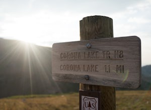
2.1 mi / 622 ft gainCorona Lake is an easy, short hike if you're pressed for time. It's scenic, secluded, and will put you in a great spot to hike to Devils Thumb the next day. There are two ways to reach Devils Thumb. This is considered the "easier" route because of the "lack of elevation gain." The sun and wind re...Read more -
Estes Park, Colorado
Backpack the Gorge Lakes
11.5 mi / 3200 ft gainStart at the Rock Cut Parking Area. Head east on Trail Ridge Road 0.25 miles to a more gradual and bald western slope leading down into Forest Canyon. This bald is located between two creeks which merge before joining the Big Thompson River (a small creek in mid September). Use the creeks to navi...Read more -
Allenspark, Colorado
Hike to Verna, Spirit, Fourth, and Fifth Lakes
19 mi / 2460 ft gainThis summer backpacking trip provides plenty of opportunities for exploration and endless moments to take in awe-inspiring scenery. On our visit, after setting up camp at the Lake Verna backcountry site, I quickly made my way to the next lake (Spirit Lake) to photograph the sunset. The symmetry a...Read more -
Allenspark, Colorado
Hike to Spirit Lake
15.8 mi / 2000 ft gainOne can reach spirit lake as a day hike, however it is most often visited as part of backpacking trip. Either way the route is the same and it starts at the East Inlet trail. To park you are supposed to pay or show your park/national lands pass. From the East Inlet trailhead you will soon pass Ad...Read more -
Allenspark, Colorado
Backpack to Lake Verna
5.013.5 mi / 2500 ft gainWant to get away it from it all and enjoy some high alpine lakes? The East Inlet Trail is just outside Grand Lake, on the westside of Rocky Mountain National Park, 2.35 miles east of Highway 34 on West Portal Road. From the trailhead, one can access 8 different campsites. The campsites are as ...Read more

