Leadville, Colorado
Looking for the best photography in Leadville? We've got you covered with the top trails, trips, hiking, backpacking, camping and more around Leadville. The detailed guides, photos, and reviews are all submitted by the Outbound community.
Top Photography Spots in and near Leadville
-
Independence, Ohio
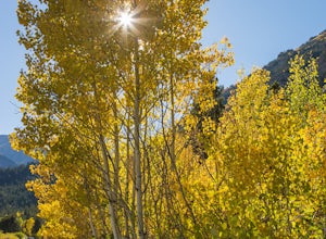
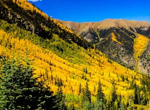
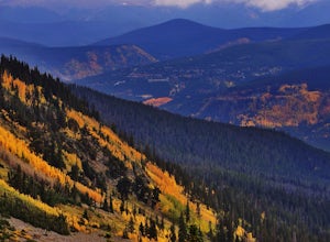
Photograph Fall Colors Along Independence Pass and Twin Lakes, CO
5.0While this is a more of a photography adventure and a fall drive to take through Colorado, there are also many areas to hike along the way. The drive can start from really anywhere in the general area. From the front range area of Colorado, head up I70 and get off toward Twin Lakes around Copper....Read more -
Buena Vista, Colorado
Mt. Belford and Mt. Oxford
4.510.34 mi / 5856 ft gainYou'll being your ascent at the Missouri Gulch Trailhead, which is located a few miles up Chaffee County Road 390, at around 9,600 feet. The trail is very clear and very well maintained, but is steeper than most trails (even quite a few of the 14er trails I've done) right from the get-go. Remembe...Read more -
Buena Vista, Colorado
Hike Missouri Mountain
5.010.5 mi / 4500 ft gainGetting there: The trail begins at Missouri Gulch TH. If you are a car camper or are trying to snag a sunrise summit, there are many many drive off sites in trees and near water before and after the trailhead. The road to get to the trailhead is not paved, but is well maintained - a super high cl...Read more -
Breckenridge, Colorado
Lower Crystal Lake via Crystal Creek Road
5.04.52 mi / 1624 ft gainTo get to the Crystal Lakes start at the Spruce Creek Trailhead. You can hike or drive to the Lower Crystal Lake along Crystal Creek Road. If you choose to drive, you will need a high clearance 4x4 vehicle as you follow along Crystal Creek Road. The road is steep, but when they get to the top it ...Read more -
Breckenridge, Colorado
Hike to & Stay at Francie's Cabin
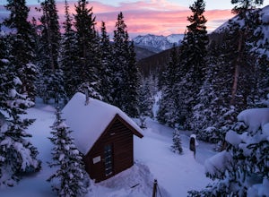
5.01.09 mi / 1000 ft gainLocated at 11,360' and owned by the 10th Mountain Division Hut Association, Francies Cabin was built in memory of Frances Lockwood Bailey in 1994 and is located just a short distance (5 mile drive, 1.05 mile hike) from town of Breckenridge, Colorado. It has a summer and winter capacity of 20 peop...Read more -
Breckenridge, Colorado
Backpack & Fish The Mohawk Lakes
4.06.8 mi / 1940 ft gainThe trailhead is located a few miles out side of Breckenridge Colorado. The trail starts at 10,390' and the first two miles are spent walking through a mix of fir, aspen, and spruce trees until the trail goes parallel to Spruce Creek Road and eventually crosses it and continues over a small dam (...Read more -
Breckenridge, Colorado
Day Hike to Lower & Upper Mohawk Lakes
4.67 mi / 1800 ft gainI recently spent the weekend in Breckenridge, and not being from the area, there was one hike that was on my bucket list: Mohawk Lakes. It didn’t disappoint! In late September, the Breckenridge area is full of gorgeous golden aspen trees, providing spectacular long-range views. In summer, abundan...Read more -
Meredith, Colorado
Hike to Chapman Lake
1.6 miFrom downtown Basalt, drive up the Fryingpan River Road 28 miles and turn right on CR #504, also known as Elliot Way, just before Norrie Colony. Drive across the river and up the switchbacks for approximately 3 miles. Take the left fork, continue 1 mile and take the right fork approximately 1/2 m...Read more -
Minturn, Colorado
Scramble the Halo Ridge on Mt. Holy Cross
5.015 mi / 5210 ft gainThe Halo Ridge is by no means the easiest route to the summit of Mt. Holy Cross, but it is definitely the most interesting and scenic. You'll begin at the Half Moon (Tigiwon) trailhead, but instead of the popular Halfmoon Trail, you will start on the Fall Creek Trail as it leaves the campground.T...Read more -
Minturn, Colorado
Hike to Tuhare Lakes
12 mi / 3000 ft gainOverview: About a 12 mile hike, with 3 alpine lakes, a significant climb and views worthwhile Photos: See all photos here. Getting There: The hike is accessed from the Half Moon pass parking lot - from the Fall Creek trailhead. The parking lot and trailhead are accessed at the end of Tigiwon Rd. ...Read more -
Minturn, Colorado
Ski Notch Mountain
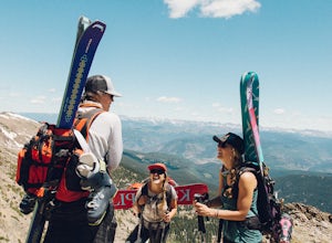
10 mi / 3000 ft gainWhat's not to love - you'll be skiing in the off season! We did this hike/ski in late June, our skis, boots, and avi gear packed with our hiking shoes on our feet. May could potentially be the most opportune time for this adventure. The hike you will take is the traditional Notch Mountain Hike. T...Read more -
Frisco, Colorado
Ski to Janet's Cabin
6 mi / 1900 ft gainJanet's Cabin is located on the eastern slope of the Continental Divide at 11,610 ft, near Copper Mountain ski resort. This hut is one of the rare huts with not only a sauna but indoor bathrooms (composting pits)! The cabin was built in 1990 and due to the location helicopters were required to b...Read more -
Frisco, Colorado
Backpack to the Gore Range's Wheeler and Lost Lakes
4.510 mi / 2200 ft gainThe range offers many remote lakes and peaks which hikers can access from various points of entry. Wheeler and Lost Lakes lie within the boundaries of the Eagle's Nest Wilderness Area.The Gore Trail begins on the north side of the CO-91 pedestrian bridge over I-70. You will follow the trail up al...Read more -
Aspen, Colorado
Hike Lost Man Loop
5.08.8 mi / 1290 ft gainThis 8.8 mile "loop" is not a true loop and the trail ends 4 miles apart along Independence Pass, so a car shuttle is recommended. I would recommend starting at the west trailhead (closer to Aspen) but will describe both trailheads so you can set up another car or shuttle at the other one.1) West...Read more -
Breckenridge, Colorado
Breckenridge Troll
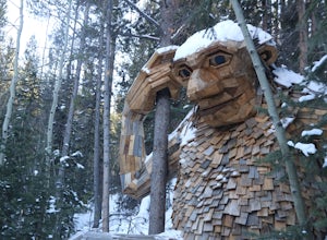
5.00.2 mi / 26 ft gainIsak Heartstone, otherwise known as the Breckenridge troll, can be accessed from the Illinois Gulch Trailhead. This trailhead can be full for much of the day, so it is advisable to find parking in town and then take a bus, walk, or bike to the starting point of this short walk. Once at the trai...Read more -
Breckenridge, Colorado
Camp at Boreas Pass
9 mi / 1500 ft gainBoreas pass is a high mountain pass in the Rocky Mountains that sits on the Continental Divide at 11,481'. Forest Service Road 33 goes over the pass and has numerous campsites all along its length, with several near the summit that feature breathtaking views of the Tenmile Range and the Breckenri...Read more

