Lakewood, Colorado
Looking for the best photography in Lakewood? We've got you covered with the top trails, trips, hiking, backpacking, camping and more around Lakewood. The detailed guides, photos, and reviews are all submitted by the Outbound community.
Top Photography Spots in and near Lakewood
-
Boulder, Colorado
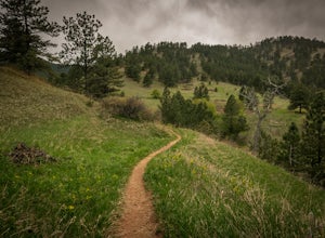
Green Mountain via West Ridge Trail
3.23 mi / 607 ft gainStarting at 7,600 ft this 1.35 mile (one-way) hike is the shortest, and by far the least strenuous, hike to summit one of Boulder's iconic peaks. Parking for this trail-head is available along the road a short drive, 4.5 miles, up Flagstaff Rd. The trail gently slopes along a ridge for the firs...Read more -
Idaho Springs, Colorado
Squaw Mountain Fire Lookout
4.03.92 mi / 791 ft gainCome check out the Squaw Mountain Fire Lookout, a historic spot located in the Mount Evans Wilderness Area of Colorado, and one of the highest lookout towers in the country, at an elevation of 11,486 ft. Just a short drive from the Front Range corridor, you can hike/backpack in to this lookout ar...Read more -
Idaho Springs, Colorado
Hike Chief Mountain, CO
4.54 mi / 1100 ft gainSitting at 11,709’, Chief Mountain is not one of Colorado’s highest peaks, but the views from this mountain are spectacular nonetheless and rival the views of any 14er I’ve climbed. This mountain sits along Squaw Pass Road so you get the luxury of a high trailhead for this peak.To get there, foll...Read more -
Boulder, Colorado
Watch Sunset from the Lost Gulch Overlook
From Boulder, drive west on Baseline road. Continue up for about 5.5 miles past the Flagstaff Summit (Realization Point) pull off. After some more steep and very tight switchbacks there will be a dirt parking lot on the north side of the road. From here you can head northwest towards the cliff...Read more -
Boulder, Colorado
Hike the Red Rocks Loop Trail
3.71 miParking is available on either Canyon or Sunshine Roads. During the weekends it tends to get crowded around sunset so plan accordingly. The entire trail is a loop and is a little over 1 mile in length so it doesn't take too long. The main feature is the massive red sand stone rocks that jut out o...Read more -
Boulder, Colorado
Mount Sanitas Loop & Settlers Park
4.43.83 mi / 1371 ft gainFirst off, these are two different hikes but both stem from the same parking lot and Settlers Park is a mere 5 minutes away from where you park so why not kill two birds with one stone? One of the more popular hikes in Boulder, Mount Sanitas is a 3 mile hike that quickly scales nearly 1,350 feet...Read more -
Boulder, Colorado
Sunshine Lion's Lair Loop
5.05.05 mi / 1257 ft gainThis is a mix of trails that will bring you on an easy loop to the peak of Mt Sanitas, but will keep you away from the usual crowds of the more well-known paths up. The hike is a clear path that brings you 5+ miles from around 5,500 ft in elevation to 6,800. You'll start at the Centennial Trail...Read more -
Boulder, Colorado
Mountain Bike the Betasso Preserve
4.03.3 mi / 564 ft gainThe Betasso Preserve features two loop trails that are accessible to both hikers and mountain bikers. Drive up (west) Boulder Canyon about 15 minutes outside of Boulder and turn right (north) on Sugarloaf Dr. After another 5 or so minutes you'll see a sign on the right-hand (northeast) side of...Read more -
Pine, Colorado
Dispersed Camp at the Buffalo Creek Area in Pike National Forest
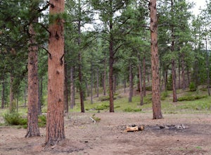
3.850 miles from Denver, nestled in Pike National Forest, there are dozens of free dispersed camping sites. With quick access to the Colorado Trail and Buffalo Creek Mountain Bike Area, these campsites make for a perfect weekend getaway. The campsites begin on Forest Road 550, and are clearly marked...Read more -
Nederland, Colorado
Climb the Avalon Crag in Boulder Canyon
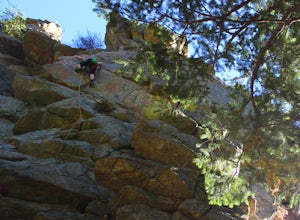
From Boulder, the pullout that is best to park at for the Avalon crag is 8.4 miles up the canyon. You will walk down the side of the road past the talus field, where if the river is too high to wade you can use the tyrolean traverse. Otherwise, you can wade or hop across rocks according to the da...Read more -
Evergreen, Colorado
Hike the Resthouse/Lincoln Lake Trail
4.5While the Mt. Evans Wilderness never has a shortage of visitors, thanks to its proximity to Denver, it is possible to find a more private hike if you know where to look. Lincoln Lake Trail, accessible from Echo Lake year-round, is not as glamorous as its sister trail, Chicago Lakes, but is a wond...Read more -
Evergreen, Colorado
Photograph Ancient Bristlecone Pines on Mt. Goliath
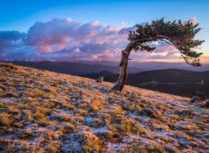
5.0On the way to the summit of Mt. Evans sits a small 160 acre preserve of some of the world's oldest living trees. The Mount Goliath Natural Area protects a rare site of Bristlecone Pines that make excellent photographic subjects.Immediately after parking you're surrounded by a miniature forest ful...Read more -
Idaho Springs, Colorado
Explore Echo Lake Park
4.01.2 mi / 88 ft gainLocated at the base of Mt. Evans Road, Echo Lake sits next to Squaw Pass Road, providing a great jumping-off point for numerous adventures. The park serves as a trailhead for hiking or snowshoeing into the Mount Evans Wilderness, offers picnic areas, and includes a nearby campground with 17 site...Read more -
Idaho Springs, Colorado
Hike to Idaho Springs Reservoir
3.9 mi / 800 ft gainThis is a great hiking area an hour outside of Denver, Colorado. It's still easily accessible in the winter and most of the time it can be hiked without snowshoes. Starting at the Echo Lake parking lot, hike around the right side of the lake until you reach a fork in the trail. Follow the path on...Read more -
Idaho Springs, Colorado
Lower and Upper Chicago Lake
4.59.22 mi / 2270 ft gainFrom the parking lot, stay to the right of Echo Lake and you will run into the Chicago Lakes Trailhead. Follow the switchbacks down and across Chicago Creek. After crossing the creek, follow the sign indicating that the trail follows the dirt road and hang a left; from here, you'll reach the Idah...Read more -
Boulder, Colorado
Catch the Sunrise on Sugarloaf
4.51 mi / 400 ft gainTo get there from downtown Boulder, head west on CO 119 and almost 4.5 miles after you have left Boulder, turn right onto Sugarloaf Road. 4 miles after the turn from CO 119, turn right onto Sugarloaf Mountain road (located at the top of the road). If the road starts descending, you've gone too fa...Read more

