Hartsel, Colorado
Top Spots in and near Hartsel
-
Woodland Park, Colorado
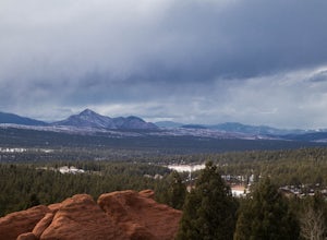
Red Rocks at Woodland Park
4.31 mi / 100 ft gainIn Woodland Park driving on HWY 24 towards Divide, you will see signs for HWY 67 which is where you'll need to get to. The Road will fork towards the end of town (left being 24 towards Divide, Right being 67). Stay right at the fork onto 67. You will then drive about 2 miles until you see a sign ...Read more -
Dillon, Colorado
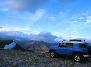
Off-Road to Glacier Mountain
5.07.4 mi / 2100 ft gainThe trail begins just past historical Main Street Montezuma. You will see a sign on your right for St. Johns road. This road is officially marked as 275 on a map. The original road lead to St. Johns but not much of the town remains.You will cross the Snake River almost immediately after you turn ...Read more -
Dillon, Colorado
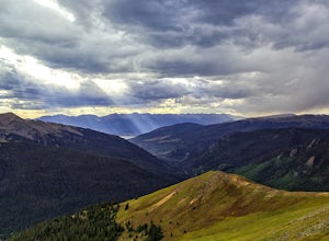
Sunset Views from Morgan Peak
8.42 mi / 2900 ft gainHow you get to Morgan Peak and the other 13ers in the area depends on if you have a 4-wheel drive with good clearance or not. If so, drive the rough Santa Fe road from the small town of Montezuma (just outside Keystone). The road is also known as Forest Service 264 and is a left at the stop sign ...Read more -
Conifer, Colorado
Elk Falls Loop
3.512.76 mi / 1893 ft gainBegin on Staunton Ranch Trail for 3.3 miles. Switch to Bugling Elk Trail for the next 1.1 miles, then to Lion's Back Trail for the last mile to the overlook. From here, you can create the loop by backtracking to the Chimney Rock Trail, which then connects with the Elk Falls Trail. To head back to...Read more -
Evergreen, Colorado
Watch the Sunset from Mt Evans Road
5.0Leave Evergreen, CO and access the Mount Evans Road and Mount Evans Recreation Area from Squaw Pass, CO 103 at Echo Lake.Drive along the slopes of Mount Evans, a Colorado 14er standing at 14,264 ft. 5 switchbacks down from the summit, on a tight hairpin turn, is a small parking area near 13,900f...Read more -
Conifer, Colorado
Davis Ponds Trail
4.02.31 mi / 295 ft gainDavis Ponds Trail is a loop trail that takes you by a lake located near Conifer, Colorado.Read more -
Idaho Springs, Colorado
Bierstadt, Evans, and The Sawtooth Loop
4.59.76 mi / 3438 ft gainStarting from the oddly poorly marked Guanella Pass Trailhead (Google maps directions to Guanella Campground and then drive about two miles past it to the south), the trail heads southeast toward Bierstadt, and much of your route to the first summit is visible from the parking lot. The trail to ...Read more -
Idaho Springs, Colorado
Watch the Sunrise at Guanella Pass
5.01 mi / 100 ft gainFrom Denver, take i70 to Georgetown and simply follow the signs through town to the top. This pass can also be accessed from the south via US Highway 285 at the town of Grant. Guanella Pass is closed in the winter, typically from about the last week in November through the last week of May. Watch...Read more -
Dillon, Colorado
Mount Bierstadt
4.67.18 mi / 2697 ft gainIf you’re ready for your first 14er, Mount Bierstadt holds a reputation for a great “starter” 14er. Of course, experienced climbers will enjoy this (relatively speaking) easy mountain as well. Besides the joy of the hike itself, Bierstadt is a stunning wildflower hike in July and August. Thanks t...Read more -
Georgetown, Colorado
Hike to Square Top Lakes
4.3 mi / 1080 ft gainStarting from Guanella Pass, right across from the Bierstadt trailhead, Square Top Lakes is definitely a hidden gem. Most people here are attempting to do the 14er, but if you've already bagged that one (or are just looking for some high altitude hiking to get you ready for it), Square Top Lakes ...Read more -
Woodland Park, Colorado
Ski Pikes Peak
Pikes Peak Toll Road can grant you access to a ton of super accessible backcountry skiing if you have the equipment and knowledge. From roughly Glen Cove up to the summit of the mountain you can access terrain varying from steep chutes off the summit to easy glades in an abandoned ski resort. T...Read more -
Woodland Park, Colorado
Lowell Gulch Upper and Lower Ridge Trail
4.04.45 mi / 719 ft gainLowell Gulch Upper and Lower Ridge Trail is a loop trail that takes you past scenic surroundings located near Woodland Park, Colorado.Read more -
Woodland Park, Colorado
Lovell Gulch Trail
5.22 mi / 814 ft gainLovell Gulch Trail is a loop trail that takes you by a river located near Woodland Park, Colorado.Read more -
Dillon, Colorado
Grays Peak via the South Ridge
9.9 mi / 3970 ft gainGrays is easily one of the most popular 14ers in Colorado due to its moderate difficulty and proximity to Denver. Grays Peak is an awesome 14er but the crowds take away from the hike. And while the views on top of Grays are amazing, the barren landscape of the hike to get there isn't the most ama...Read more -
Dillon, Colorado
Silver Dollar Lake Trail
5.03.93 mi / 945 ft gainGuanella Pass, which connects the charming and historic town of Georgetown in the north to the blink-and-you’ll-miss-it Grant to the south, is a recreational outdoorsman’s dream. Volumes could be written on what this 22-mile scenic byway has to offer. Silver Dollar Lake Trail is just one tiny po...Read more -
El Paso County, Colorado
Summit Pikes Peak via the Devils Playground Trail
3.05.5 mi / 1348 ft gainThis portion of a trek to the Pikes Peak begins about 13,000 feet. From the parking lot walk across the road back to the Northeast side and look for the hikers trail that begins by paralleling the road. By hiking this path you will have the time to enjoy the amazing views of the mountain range a...Read more

