Hartsel, Colorado
Top Spots in and near Hartsel
-
Dillon, Colorado
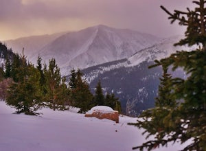
Snowshoe or Ski Watrous Gulch
4.04 mi / 1200 ft gainDespite sharing a trailhead with the popular Herman Gulch, I had not heard of Watrous Gulch until I stumbled across it while researching something else. Knowing that Herman Gulch is filled with spectacular views and deep snow ideal for snowshoeing/skiing, I had to discover if the smaller, lesser-...Read more -
Palmer Lake, Colorado
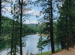
Palmer Lake Reservoir Trail
4.11 mi / 656 ft gainThis hike starts with a steep uphill, and if that doesn't take your breath away, the views of the lakes definitely will. After the uphill slog, you'll immediately reach the lower reservoir. On still mornings, it offers perfect reflections of its surroundings. The trail continues along its northe...Read more -
Minturn, Colorado
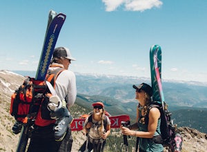
Ski Notch Mountain
10 mi / 3000 ft gainWhat's not to love - you'll be skiing in the off season! We did this hike/ski in late June, our skis, boots, and avi gear packed with our hiking shoes on our feet. May could potentially be the most opportune time for this adventure. The hike you will take is the traditional Notch Mountain Hike. T...Read more -
Minturn, Colorado
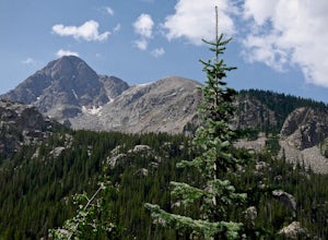
Climb Mount of the Holy Cross, North Ridge
4.5Just a few miles South Minturn, Colorado, turn onto Tigiwon Road (dirt) and take it about 5 miles to the Half Moon trailhead at . Tigiwon Road is easily accessed by 2WD vehicles and the trailhead should be reachable in the Summer months after the snows have melted.Start early as, at 12 miles, thi...Read more -
Minturn, Colorado
Scramble the Halo Ridge on Mt. Holy Cross
5.015 mi / 5210 ft gainThe Halo Ridge is by no means the easiest route to the summit of Mt. Holy Cross, but it is definitely the most interesting and scenic. You'll begin at the Half Moon (Tigiwon) trailhead, but instead of the popular Halfmoon Trail, you will start on the Fall Creek Trail as it leaves the campground.T...Read more -
Minturn, Colorado
Hike to Tuhare Lakes
12 mi / 3000 ft gainOverview: About a 12 mile hike, with 3 alpine lakes, a significant climb and views worthwhile Photos: See all photos here. Getting There: The hike is accessed from the Half Moon pass parking lot - from the Fall Creek trailhead. The parking lot and trailhead are accessed at the end of Tigiwon Rd. ...Read more -
Monument, Colorado
Mt. Herman & 715 Loop
4.06.16 mi / 1877 ft gainThe Basics: Mt. Herman is the most prominent peak overlooking Monument, CO and is easily spotted from I-25. The area between Monument and the mountain hosts a large network of meandering trails that are great for trail running and mountain biking. Our hike today starts at the uppermost parking lo...Read more -
Cascade, Colorado
Hike Barr Trail to Pikes Peak Summit
5.012 mi / 7400 ft gainBarr Trail is a 12 mile hike that travels the east face of Pikes Peak, from Manitou Springs (6700’) at the base, to the summit (14,115’). Because there are so many factors that can influence anyone’s experience of the trail (weather, fitness level, time of day, preparedness, etc.), and because ma...Read more -
Cañon City, Colorado
Drive Skyline Drive
5.0Skyline drive is a one way scenic roadway mainly going north to south. The 3 mile drive takes you about 800 feet above Cañon City. It starts on the west side of 50, and ends in a residential neighborhood southwest of where it begins. There are multiple pull offs on the right and left side of the...Read more -
Cascade, Colorado
Manitou Incline
4.73.8 mi / 1949 ft gainIf you're ready for a fitness challenge like no other, look no further than the Manitou Incline. The trail climbs the remnants of an old cog railway bed, gaining 2000 feet of elevation in less than a mile. Busy all year round, the popular trail is used by everyone from Army Rangers and Olympic ho...Read more -
Colorado Springs, Colorado
Hike Eagle's Peak (USAFA)
4.02.5 mi / 1100 ft gainThis is a short trail that goes very high in elevation. In about 1.25 miles you can go about 2000ish feet in elevation change. You need to wait till 9am to start the hike as it sits on the US Airforce Academy. It is definitely worth it. Bring shoes that can handle the rocky terrain.You take the f...Read more -
Idaho Springs, Colorado
Hike Chief Mountain, CO
4.54 mi / 1100 ft gainSitting at 11,709’, Chief Mountain is not one of Colorado’s highest peaks, but the views from this mountain are spectacular nonetheless and rival the views of any 14er I’ve climbed. This mountain sits along Squaw Pass Road so you get the luxury of a high trailhead for this peak.To get there, foll...Read more -
Evergreen, Colorado
Three Sisters
4.31.45 mi / 377 ft gainThe short 1.2 mile long trail, is a family-friendly, dog-friendly trail near Evergreen. The parking lot is incredibly easy to find and there is great signage to make sure you're going the right way. From the parking lot you can follow the Three Sisters trail signs until you reach the beginning of...Read more -
Evergreen, Colorado
Boulder The Eggs on the Hidden Fawn Trail
1.3 mi / 171 ft gainLooking for a place near Denver to perfect your bouldering skills? Or are you wanting to get the whole family out, but not looking for an extreme/technical hike? Which ever question best describes you, Alderfer/Three Sisters Park is the perfect place to go.This Jefferson County Open Space Park ha...Read more -
Evergreen, Colorado
Evergreen Mountain Loop
4.75.89 mi / 0 ft gainThe way up Evergreen Mountain is actually a few different trails stitched together throughout Alderfer/Three Sisters Park. The trail connects to both parking lots in the park, so if one is full you can just start from the other one, giving you lots of options for a quick day-hike. If you start ...Read more -
Littleton, Colorado
Hike the Fountain Valley Trail at Roxborough State Park
4.82.3 mi / 100 ft gainThe Fountain Valley Trail at Roxborough State Park is a very easy trail that's perfect for those that want to enjoy the outdoors but not subject themselves to the rigors of climbing a 14er. This very well maintained trail is wide and flat and perfect for groups, families, or for taking visitors t...Read more

