Gypsum, Colorado
Looking for the best hiking in Gypsum? We've got you covered with the top trails, trips, hiking, backpacking, camping and more around Gypsum. The detailed guides, photos, and reviews are all submitted by the Outbound community.
Top Hiking Spots in and near Gypsum
-
Rifle, Colorado
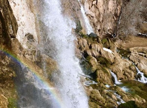
Rifle Falls
5.00.63 mi / 85 ft gainRifle Falls is a loop trail that takes you by a waterfall located near Silt, Colorado.Read more -
Carbondale, Colorado
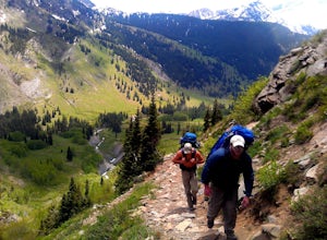
Backpack the Lead King Basin Trail
4.5 mi / 2000 ft gainWe began our hike at the beginning of the afternoon after about two-three hours driving up the 14 mile road. The first mile of the trail was mild, turning into an uphill adventure. Lots of switchbacks, winding paths, and some tree coverage. By mile 2, we were on a steep grade the rest of the way....Read more -
Carbondale, Colorado
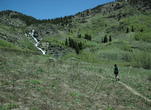
Hike to Geneva Lake
5.03 mi / 1256 ft gainThis is an intermediate hike with scenic views, even before reaching the lake and waterfall. Note that access to the trailhead does require 4WD, as the final section of road is difficult and steep in sections.Read more -
Turquoise Lake, Colorado
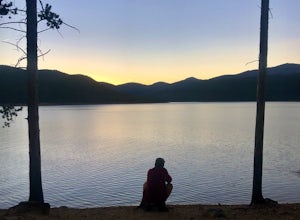
Escape to Turquoise Lake
5.0Turquoise Lake is an 'off the beaten path' gem only 3 hours from the Denver Metro Area. The area surrounding the lake is home to some spacious and tree-shaded campgrounds. If you plan ahead and book early, you'll have your pick of the best spots within close proximity to the lake. The campground ...Read more -
Aspen, Colorado
Hike Lost Man Loop
5.08.8 mi / 1290 ft gainThis 8.8 mile "loop" is not a true loop and the trail ends 4 miles apart along Independence Pass, so a car shuttle is recommended. I would recommend starting at the west trailhead (closer to Aspen) but will describe both trailheads so you can set up another car or shuttle at the other one.1) West...Read more -
Pitkin County, Colorado
Sunset Hike to Twining Peak
4 mi / 1700 ft gainTwining Peak is a ranked 13er located 2 miles north of Independence Pass. The hike involves around 1700 feet of elevation and is mostly off-trail with some class 2 scrambling (class 3 can be had if you look hard enough). Independence Pass is a prominent and popular pass on Highway 82 between Twin...Read more -
Carbondale, Colorado
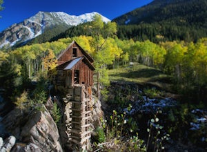
Hike by Lizard Lake to Crystal Mill
5.010 miAlthough the iconic Crystal Mill is the main attraction on this hike, the river that leads you there through the magnificent mountains of the White River National Forest is nothing short of extraordinary.Getting ThereThe hike is located in the small town of Marble, about 40 minutes east of Carbon...Read more -
Aspen, Colorado
Hike or Snowshoe Castle Creek
6 miAt the round-a-bout that leads into the town of Aspen, take the Castle Creek Road exit. Follow this road for 12 miles until you get to the ghost town of Ashcroft. The road itself is very scenic, so be prepared to pull over and whip out your camera!During winter, the road ends at Ashcroft and a cr...Read more -
Silverthorne, Colorado
Backpack to Upper Slate Lake
5.028 mi / 1386 ft gainStarting from the Rock Creek Trailhead parking lot, it is an up and down trek to Upper Slate Lake. The trail map states 10 miles each way, but accounting for switchbacks it ends up being closer to 14 long, hard miles.You will be among aspens and pines for the first half as you have a few moderate...Read more -
Aspen, Colorado
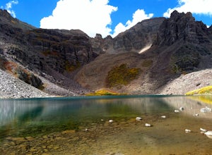
Backpack Cathedral Lake
4.75.6 mi / 2000 ft gainCathedral Lake offers an excellent alternative to escape the crowds that swarm the Maroon Bells area, especially in the peak autumn season. The drive along Castle Creek Rd towards the abandoned ski town Ashcroft is lined with aspens showing off their golden hues. Parking at the trailhead is plent...Read more -
Independence, Ohio
Hike Mountain Boy Ridge from the Top of Independence Pass
5.06 miThe trailhead is to the Independence Pass viewing deck is located at the Summit parking area, which is about 20 miles from Aspen and 24 miles west of Highway 24 on the Leadville side. At the parking area you will notice a paved walkway that takes you to the viewdeck, which is a easy five minute w...Read more -
Independence, Ohio
Hike Lost Man Pass via Independence Lake
5.04.5 mi / 1200 ft gainPark at the pull out just west of independence pass. From there, begin on the Linkin's Lake Trail. The trail is generally easy to follow (although it can be muddy as it is a wet area) and climbs 900 feet in the 1.8 miles to independence lake. From Independence lake it is about 0.5 miles and 400 f...Read more -
Rifle, Colorado
Rifle Gap Reservoir
5.01.54 mi / 46 ft gainRifle Gap Reservoir is an out-and-back trail that takes you by a lake located near Rifle, Colorado.Read more -
Aspen, Colorado
Castle Peak and Conundrum Peak
5.012.71 mi / 5125 ft gainThere are many different places to start the trek up to Castle and Conundrum. The first step, however, is always go to the end of Castle Creek Road just outside of Aspen, CO. When the paved road ends, there is parking available right off the road for those who don't wish to drive further. Howe...Read more -
Carbondale, Colorado
Hike to Frigid Air Pass
8.5 mi / 1400 ft gainAbout 15 miles away from the ski resort town of Crested Butte lies the West Maroon Pass trailhead. This trailhead sees thousands of visitors every year as they make their trek over West Maroon Pass down into Aspen. While West Maroon Pass is beautiful, the heavy summer traffic can detract from the...Read more -
Carbondale, Colorado
Climb South Maroon Peak
5.011.5 mi / 4800 ft gainStarting at the Maroon Lake Trailhead, walk on the trail past the lake and turn onto the trail heading towards Crater Lake. Hike approximately 1.75 miles to reach another signed trail junction, then turn left and continue on the West Maroon Creek trail to Crater Lake. Eventually you will reach a ...Read more

