Cripple Creek, Colorado
Top Spots in and near Cripple Creek
-
Littleton, Colorado
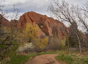
Hike the South Rim Trail at Roxborough State Park
3.83 mi / 300 ft gainRoxborough State Park is one of the closest parks to the Denver metro area and is the perfect place to go if you're looking to experience the great outdoors without having to drive too far from the city.One of my favorite trails in the park is the South Rim Trail which takes you on an easy to mod...Read more -
Littleton, Colorado
Hike to Carpenter Peak
4.56.2 mi / 1171 ft gainCarpenter Peak stands at 7,166 feet above sea level. While that altitude might not exactly take your breath away, the views from the top certainly will. Starting at the Visitor's Center, the trail to Carpenter's Peak begins as a relatively flat, well-traveled trail. A little less than a mile into...Read more -
Littleton, Colorado
Walk the Willow Creek Loop
1.4 miRoxborough State Park is located on the outskirts of Littleton, Colorado. Boasting incredible red rock formations and abundant wildlife, it is the perfect place for a quick escape outside.The Willow Creek Loop connects to the two parking lots in the park, so it is impossible to miss. With only th...Read more -
10746-11764 Greenhorn Highway, Colorado
Explore Bishop Castle
4.00.25 mi / 26 ft gainThis adventure is a unique experience, perfect for the off seasons. Park along the highway on CO-165 in Rye, Colorado, cross the street and walk into the largest one man project in the USA. You’ll enter under the grand front gate and follow the path that leads to the castle. There you’ll find mul...Read more -
Littleton, Colorado
Hike the Fountain Valley Trail at Roxborough State Park
4.82.3 mi / 100 ft gainThe Fountain Valley Trail at Roxborough State Park is a very easy trail that's perfect for those that want to enjoy the outdoors but not subject themselves to the rigors of climbing a 14er. This very well maintained trail is wide and flat and perfect for groups, families, or for taking visitors t...Read more -
Franktown, Colorado
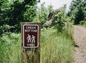
Hike the Creek Bottom Trail
5.04.1 miThe West Side of Castlewood Canyon is the more "rugged" side of the park, it has a dirt road, gravel parking lots, and only vault toilets. Luckily, this also means this is a less popular side of the park, making for less crowded trails and easier parking! Park at the first trailhead, for the Hom...Read more -
Franktown, Colorado
Hike the Rim Rock Trail
4.98 miThe West Side of Castlewood Canyon is the more "rugged" side of the park, it has a dirt road, gravel parking lots, and only vault toilets. Luckily, this also means this is a less popular side of the park, making for less crowded trails and easier parking! Park at the first trailhead, for the Hom...Read more -
Franktown, Colorado
Hike the Rim Rock / Creek Bottom Trail Loop
5.04.54 miThe West Side of Castlewood Canyon is the more "rugged" side of the park, it has a dirt road, gravel parking lots, and only vault toilets. Luckily, this also means this is a less popular side of the park, making for less crowded trails and easier parking! Park at the first trailhead, for the Hom...Read more -
Chaffee County, Colorado
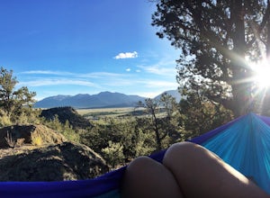
Camp in Browns Canyon Wilderness Study Area
4.0Head toward Nathrop, CO on U.S. High 295. Turn east between mile markers 144 and 145 onto Chaffee County Road 301. Take the road until the pavement runs out and turn right onto Chaffee County Road 300. Drive a couple miles on the road and through the Ruby Mountain campgrounds (paid lots only) unt...Read more -
Westcliffe, Colorado
Backpack to Sand Creek Lakes
5.04 mi / 1700 ft gainStart at the Music Pass trail head south of Westcliffe, Colorado off County Road 119. You will need a 4x4 with high clearance to get to the actual trailhead as the last 2.5 miles are rough. Otherwise, park at the Crape Creek TH and walk the 2.5 miles up to Music Pass Trailhead.Once on the trail...Read more -
Bailey, Colorado
Payne Creek Trail via Brookside McCurdy Trailhead
4.517.98 mi / 3773 ft gainDay 1: Park at the Payne Creek/Brookside Trailhead (8,040 ft.) right outside Bailey. You'll go on the trail for about a mile before the trail parts to Craig Meadows or Craig Park. If you start this in the nighttime, it's best to camp before you part ways on the trail as it's a little more spaciou...Read more -
Buena Vista, Colorado
Hike Davis Meadow
5.08.6 mi / 800 ft gainThis is a great hike that is very close to Buena Vista, CO. This trail is on the east side of town and is accessible in the spring. The hardest part of the hike is locating the trail-head. It is located in the northern part of Four Mile Canyon and is in San Isabel National forest. Starting in Bue...Read more -
Littleton, Colorado
Hike the Eagle's View Trail
4.34.3 mi / 900 ft gainReynolds Park is part of the Jefferson County Open Space system. Located a few miles south of Conifer, off Hwy 285 on S. Foxton Road, it is a foothills park geared for families, groups, and the casual hiker. The network of trails on the west side of the road offers hikers and equestrians anything...Read more

