Creede, Colorado
Looking for the best camping in Creede? We've got you covered with the top trails, trips, hiking, backpacking, camping and more around Creede. The detailed guides, photos, and reviews are all submitted by the Outbound community.
Top Camping Spots in and near Creede
-
Creede, Colorado
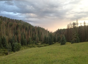
Hike the Weminuche Wilderness to Fourmile Falls
5.08 miLocated in Southern Colorado’s Weminuche Wilderness, Fourmile Falls is a beautiful day hike perfect for hikers and photographers. The highlights of the trail are the two massive, thundering waterfalls. The falls make this hike ideal in early to mid summer, when the falls are full of icy snowmel...Read more -
Del Norte, Colorado
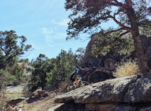
Mountain Bike at Penitente Canyon
8 mi / 900 ft gainThe Area: The maze of large round boulders in Penitente Canyon was once a refuge for a radical Christian sect. Now it is home to some radical mountain biking trails! Think Moab features, Fruita flow, and no crowds. Read below to find out the best trails to ride in this area, and combine riding wi...Read more -
Silverton, Colorado
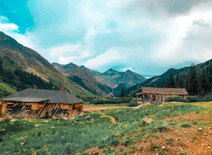
Explore Animas Forks
5.00.25 mi / 40 ft gainThe ghost town of Animas Forks, CO is located in the San Juan Mountains at an elevation of 11,200 feet. There are several original buildings remaining. The best way to explore the region is by Jeep or other high-clearance 4×4. The cabins began being built by prospectors in 1873. Three rivers meet...Read more -
Silverton, Colorado
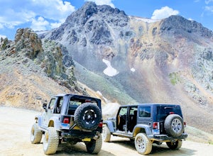
Drive to California Pass
California Pass’s summit is a jaw dropping 12,960 feet above sea level. A long way from the valley floor, California Gulch, but, as drivers start their trek, the valley floor starts to shrink and gives way to steep climbs and switchbacks. Off road vehicles are needed to reach the top, and drivers...Read more -
Silverton, Colorado
Explore Hurricane Pass and Lake Como
Spending much of the trek above tree line, Hurricane Pass is situated at 12,730 feet above sea level and offers up views of Poughkeepsie Gulch (a more extreme off-road trail) and sapphire blue mountain lakes, such as Lake Como. One of the most beautiful roads in the lower 48 states, Hurricane Pas...Read more -
Lake City, Colorado
Backpack to Wetterhorn Basin
13 mi / 3000 ft gainThis trip is for the lover of solitude and the appreciator of the unscathed backcountry. Wetterhorn Basin is in the heart of the beautiful San Juan Mountain range in Southwestern Colorado.With a 4WD high clearance vehicle start at the West Cimarron Trailhead at 10,750 feet (38.1117N -107.5533W),...Read more -
Pagosa Springs, Colorado
Camp and Fish at Platoro Reservoir
5.0Platoro is the blending of the Spanish words "plata" (silver) and "oro" (gold), and this secluded mountain reservoir strikes it rich when it comes to outdoor recreation. In 1870, gold and silver was discovered in area, which lead to a small boom in 1913 and the settling of the small town which st...Read more -
Ridgway, Colorado
Running to Grizzly Bear Mine
Bear Creek Trail, which leads to Grizzly Mine, is located just 2 miles outside of Ouray, Colorado on Highway 550 immediately following the first tunnel. There's two parking lots, a large one and a small one, the trail leads from the small parking lot over the tunnel and highway. There are no bath...Read more -
Ouray, Colorado
Backpack to Dragon's Back via Horsethief Trail
5.016 mi / 3520 ft gainThe Uncompahgre Wilderness stretches out through the mountains and forests of southwestern Colorado, with worn trails lingering beside abandoned 19th-century mines and crossing old alpine sheep pastures. Dragon's Back is the unofficial name for Point 12,968', a small but beautiful summit at the b...Read more -
Durango, Colorado
Camp at Little Molas Lake
5.01 mi / 40 ft gainLittle Molas Lake Campground is about 1 mile off of US Highway 550 on Molas Pass just North of and on the other side of the highway from the Molas Overlook. Pro-tip: there is also another campground nearby called Molas Lake Park & Campground, so it's important to distinguish which you are hea...Read more -
Durango, Colorado
Hike the Colorado Trail: Little Molas Lake to Lime Creek
5.010 mi / 755 ft gainTo hike this section of the Colorado Trail, you'll begin from the Little Molas Lake Campground at around 10,895-ft. Little Molas Lake Campground is about 1 mile off of US Highway 550 on Molas Pass just North of and on the other side of the highway from the Molas Overlook, which is just South of S...Read more -
Durango, Colorado
Crater Lake via Crater Lake Trail
5.011.73 mi / 2077 ft gainReaching this trailhead actually begins off of Andrews Lake - you will see signs for Andrews Lake off HWY 550. I will provide directions from both Durango and Silverton at the end. The trailhead is extremely well marked the entire way. The mileage from Andrews lake to Crater lake one way is 5.5...Read more -
Durango, Colorado
Summit 3 Peaks in the Chicago Basin
5.0I tell people all the time that if they only do one hike in Colorado, this is it. You get a little taste of everything: Colorado history, wildlife, beautiful campsite views, 14ers, and the largest wilderness in the state.This itinerary assumes you’re hitching a ride on the train from Silverton. ...Read more -
Gunnison, Colorado
Camp at Hartman Rocks
3.0Just 3 miles outside the small south central town of Gunnison, Colorado lies Hartman Rocks recreation area. This 8000 acre open space includes 40 miles of single track trails as well as 33 miles of road. Camping at Hartman Rocks is the perfect way spend a relaxing night, or get an early start to ...Read more -
Durango, Colorado
Backpack to Island Lake
5.08 mi / 3000 ft gainFrom the Ice Lakes basin Trailhead, this 8 mile round trip trail with 3000 feet of elevation gain will bring you to the Ice Lakes Basin with an abundance of beautiful lakes, especially Island Lake and Ice Lake. We camped on a little shelf above Island Lake, but you can camp anywhere you find a ni...Read more -
Durango, Colorado
Climb Fuller Peak
3.0Begin by hiking the Ice Lakes Trail for 3.5 miles, which will take you to Ice Lake. From here, you can identify the obvious, delta-shaped mountain to climber's left, known as Fuller Peak (13,761ft). Hike cross country, directly toward the base of the North Ridge (right skyline), walking past Full...Read more

