Conifer, Colorado
Looking for the best photography in Conifer? We've got you covered with the top trails, trips, hiking, backpacking, camping and more around Conifer. The detailed guides, photos, and reviews are all submitted by the Outbound community.
Top Photography Spots in and near Conifer
-
Conifer, Colorado
Elk Falls Loop
3.512.76 mi / 1893 ft gainBegin on Staunton Ranch Trail for 3.3 miles. Switch to Bugling Elk Trail for the next 1.1 miles, then to Lion's Back Trail for the last mile to the overlook. From here, you can create the loop by backtracking to the Chimney Rock Trail, which then connects with the Elk Falls Trail. To head back to...Read more -
Evergreen, Colorado
Maxwell Falls
3.43.95 mi / 928 ft gainLocated just outside of Evergreen, this beginner hike is a great escape from the city for a few hours. There are three different options to hike to the falls: Maxwell Falls Lower Trail (4 miles), Upper Maxwell Falls Trail (1.1 miles), and Maxwell Falls Bluffs Cliffside Trail Loop (5 miles). On th...Read more -
Littleton, Colorado
Hike the Eagle's View Trail
4.34.3 mi / 900 ft gainReynolds Park is part of the Jefferson County Open Space system. Located a few miles south of Conifer, off Hwy 285 on S. Foxton Road, it is a foothills park geared for families, groups, and the casual hiker. The network of trails on the west side of the road offers hikers and equestrians anything...Read more -
Evergreen, Colorado
Evergreen Mountain Loop
4.75.89 mi / 0 ft gainThe way up Evergreen Mountain is actually a few different trails stitched together throughout Alderfer/Three Sisters Park. The trail connects to both parking lots in the park, so if one is full you can just start from the other one, giving you lots of options for a quick day-hike. If you start ...Read more -
Evergreen, Colorado
Pence Park's Independence Mountain Trail
4.42.09 mi / 869 ft gainPence Park, part of the Denver Mountain Parks system, is nestled between the mountain communities of Indian Hills and Kittredge on Myers Gulch Road. It's one of those places I always drove right past without bothering to check it out. From the road, it looks the same as any other place in the foo...Read more -
Littleton, Colorado
Hike the Meadowlark Plymouth Trail
4.06 mi / 1197 ft gainFrom the parking lot, you can take the Meadowlark trail to the west or the Plymouth Creek Trail to the southeast. It does not matter which trail you take because it ends up becoming loop. For a more gradual slope up the hill, take the Meadowlark trail. After a little more than a mile, it intersec...Read more -
Littleton, Colorado
Hike the Coyote Song-Swallow Trail Loop
3.83 mi / 350 ft gainWe all love to live our weekends to the fullest, but say you're itching for an adventure and it's midweek with the weekend still a good 3 or 4 days away? South Valley Park is the place to go if you're looking for an after-work adventure or just don't feel like driving too far from the city. A sho...Read more -
Evergreen, Colorado
Hike Panorama Point at Corwina Park
4.72.7 mi / 640 ft gainJefferson County, the "Gateway to the Rockies" has dozens of great parks and trails. One of the best, however, is often overlooked, as it is sandwiched between bigger and more popular parks. Corwina Park is a small section located off Hwy. 74, near the village of Kittredge. Sitting between the po...Read more -
Littleton, Colorado
Hike or Bike Hildebrand Ranch
4.05.1 mi / 324 ft gainHildebrand Ranch Park is often overshadowed by the other nearby Jeffco Parks, but for the few that it does attract the trails do not disappoint. The Two Brands Trail starts at about 5600ft just off of Deer Creek Canyon Rd. It is a relatively flat trail that tops out at about 5821ft making it a...Read more -
Morrison, Colorado
Explore Red Rocks Park in Winter
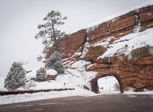
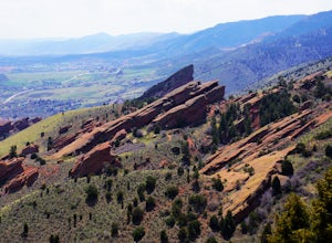
4.3Red Rocks is a bustling park in the summer when its famous amphitheater is filled with concerts. In winter though, the park dies down and becomes even more quiet when snow is falling. Grab your camera and head to the park during a winter storm to truly enjoy the beautiful red sandstone formations...Read more -
Littleton, Colorado
Winter Hiking and Wildlife in Waterton Canyon
3.712.4 miWaterton Canyon is the beginning of the Colorado Trail which stretches 500 miles from Denver to Durango. Camping is allowed on the Colorado Trail but is not allowed in the first 6 miles section of Waterton Canyon, which is managed by Denver Water. The gravel road is great for running, biking, hi...Read more -
Pine, Colorado
Dispersed Camp at the Buffalo Creek Area in Pike National Forest
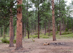
3.850 miles from Denver, nestled in Pike National Forest, there are dozens of free dispersed camping sites. With quick access to the Colorado Trail and Buffalo Creek Mountain Bike Area, these campsites make for a perfect weekend getaway. The campsites begin on Forest Road 550, and are clearly marked...Read more -
Golden, Colorado
Matthews/Winters Park Loop
4.04.99 mi / 827 ft gainMatthews/Winters Park, which is part of the Jefferson County Open Space system, is proof that you do not have to go far from the city to enjoy the mountains. Nestled in the foothills between Golden and Morrison just off I-70 and C-470, Matthews/Winters is easy to access from Denver and any of the...Read more -
Evergreen, Colorado
Private and Tranquil Retreat at Beaver Brook Watershed
4.0Note: This is NOT the Beaver Brook Trail in Genesee Park/Lookout Mountain! If you enjoy the scenery and ambiance of Evergreen, but Evergreen Lake has become too crowded for your tastes, Beaver Brook Watershed (owned by the City of Golden) is an excellent alternative. It’s a small, secluded area a...Read more -
Bailey, Colorado
Payne Creek Trail via Brookside McCurdy Trailhead
4.517.98 mi / 3773 ft gainDay 1: Park at the Payne Creek/Brookside Trailhead (8,040 ft.) right outside Bailey. You'll go on the trail for about a mile before the trail parts to Craig Meadows or Craig Park. If you start this in the nighttime, it's best to camp before you part ways on the trail as it's a little more spaciou...Read more -
Golden, Colorado
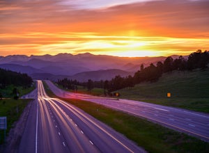
Capture the Mountains Leaving Denver
5.0After shooting a friend's wedding, I was on my way home when I noticed the sky start to light up to the west. I parked the car and ran down the road. The spot is well known for how perfectly the overpass frames the mountains as drivers leave the Denver area.The total exposure time was just over 2...Read more

