Blue River, Colorado
Looking for the best photography in Blue River? We've got you covered with the top trails, trips, hiking, backpacking, camping and more around Blue River. The detailed guides, photos, and reviews are all submitted by the Outbound community.
Top Photography Spots in and near Blue River
-
Jefferson, Colorado
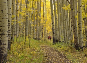
Colorado Trail: Kenosha Pass to FR 130
4.66.81 mi / 938 ft gainThe Colorado Trail (http://www.coloradotrail.org) is 500 miles long and stretches from Denver to Durango. Perhaps the most-traveled portion of the Colorado Trail is at Kenosha Pass. Kenosha Pass is well-known for its thick, colorful stands of aspen in the fall. During peak leaf season (late Septe...Read more -
Red Cliff, Colorado
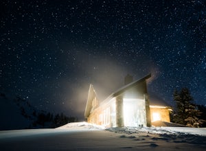
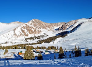
Ski to Fowler-Hilliard Hut
6.5 mi / 2500 ft gainFowler-Hilliard hut sits at 11,500 ft on a forested ridge of Resolution Mountain, with easy access to intermediate and expert backcountry skiing right out the door. This newer hut was built in 2010 after the original hut burned down from a lightning strike. The hut comes stocked with padded mattr...Read more -
Silverthorne, Colorado
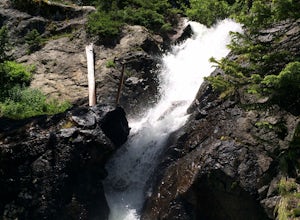
South Willow Falls
4.66.17 miStart at the Willowbrook Trailhead. You’ll hit a “Y” in the trail pretty quickly - go left and you’ll soon be at the first log bridge. There are quite a few water crossings on the trail, but they are easy to maneuver. After hiking in the Willow Creek Open Space for a bit, you’ll enter Eagle’s Ne...Read more -
Fairplay, Colorado
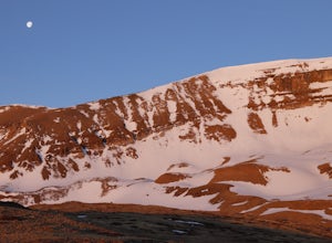
Climb Horseshoe Mountain via Boudoir Couloir
7 mi / 2500 ft gainHorseshoe Mountain is a peak that is ranked in the top 100 tallest peaks in Colorado at 13,898 feet, and it can be done in the summer but is arguably more fun in the spring as a snow climb. Avalanche safety, snow climbing, and snow safety experience is necessary. To get to the trailhead, follo...Read more -
Leadville, Colorado
Overnight at the Emma and Marceline Yurts, Leadville
11 mi / 1200 ft gainDrive past the main downtown of Leadville and then head into the mountains south of town, following Mt. Sherman Road to the Yurt parking along a ridge before you come to the Black Cloud Mine. There are signs that say "Yurt Parking". Follow the road a little further down to a jeep road just before...Read more -
Loveland Pass, Colorado
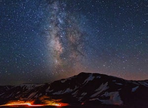
Photograph the Milky Way at Loveland Pass
Loveland Pass is often very busy during the winter as people move through the pass to access the nearby ski areas and just as popular for tourists admiring the beauty of the continental divide in the summer. It is also the start of some great hiking trails like the Mount Sniktau Trail. However, ...Read more -
Dillon, Colorado
Hiking Mount Sniktau
5.04 miMount Sniktau is a great beginner 13er. This hike offers a fun ridge walk with amazing views! Make sure you come prepared, the wind can be pretty relentless. Parking is limited so make sure you arrive early.This hike will get your blood pumping from the moment you exit your vehicle. You will cli...Read more -
Dillon, Colorado
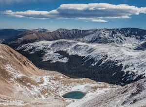
Hike Grizzly Peak at Loveland Pass
5.06 mi / 2900 ft gainWhile a typical Colorado hike may be an ascent to your destination followed by a descent back to your car, the hike to Grizzly Peak at Loveland Pass (Grizzly Peak "D") breaks that mold. At 13,427 feet, Grizzly Peak stands in the path to Torreys Peak’s west face (14,267’). Even though it is only ~...Read more -
Silverthorne, Colorado
Backpack to Upper Slate Lake
5.028 mi / 1386 ft gainStarting from the Rock Creek Trailhead parking lot, it is an up and down trek to Upper Slate Lake. The trail map states 10 miles each way, but accounting for switchbacks it ends up being closer to 14 long, hard miles.You will be among aspens and pines for the first half as you have a few moderate...Read more -
Dillon, Colorado
Silver Dollar Lake Trail
5.03.93 mi / 945 ft gainGuanella Pass, which connects the charming and historic town of Georgetown in the north to the blink-and-you’ll-miss-it Grant to the south, is a recreational outdoorsman’s dream. Volumes could be written on what this 22-mile scenic byway has to offer. Silver Dollar Lake Trail is just one tiny po...Read more -
Turquoise Lake, Colorado
Escape to Turquoise Lake
5.0Turquoise Lake is an 'off the beaten path' gem only 3 hours from the Denver Metro Area. The area surrounding the lake is home to some spacious and tree-shaded campgrounds. If you plan ahead and book early, you'll have your pick of the best spots within close proximity to the lake. The campground ...Read more -
Silver Plume, Colorado
Grays and Torreys Peaks
4.37.97 mi / 3458 ft gainAt about an hour's drive from Denver, Grays Peak (14,270 ft./4338m) and its sister mountain, Torreys Peak (14,267 ft./4337m), are two of the most popular 14ers in the state. Because of this, a wealth of information is available on the internet. Rather than go into all the details of the technical...Read more -
Silver Plume, Colorado
Torrey's Peak via Kelso Ridge
5.05.79 mi / 2982 ft gainThe start of this route up the Kelso Ridge is the same as doing the standard route of Gray's and Torrey's peaks. From the trailhead cross the large metal bridge and continue on the great trail as it slowly climbs away from the parking lot and trailhead. This first section is not steep, but prov...Read more -
Silver Plume, Colorado
Grays Peak Trail
4.57.25 mi / 2995 ft gainThe first challenge you'll face on your way to the summit of Gray's peak is Steven's Gulch Road. My Corolla rolled up to the start of what I’ve seen described as a “4x4 road that should probably not be attempted in a low clearance vehicle”. But what the heck, it was late, and I didn't feel like w...Read more -
Georgetown, Colorado
Hike to Square Top Lakes
4.3 mi / 1080 ft gainStarting from Guanella Pass, right across from the Bierstadt trailhead, Square Top Lakes is definitely a hidden gem. Most people here are attempting to do the 14er, but if you've already bagged that one (or are just looking for some high altitude hiking to get you ready for it), Square Top Lakes ...Read more -
Idaho Springs, Colorado
Bierstadt, Evans, and The Sawtooth Loop
4.59.76 mi / 3438 ft gainStarting from the oddly poorly marked Guanella Pass Trailhead (Google maps directions to Guanella Campground and then drive about two miles past it to the south), the trail heads southeast toward Bierstadt, and much of your route to the first summit is visible from the parking lot. The trail to ...Read more

