Avon, Colorado
Top Spots in and near Avon
-
Buena Vista, Colorado
Hope Pass via Willis Gulch
5.08.75 mi / 3297 ft gainHope Pass is accessed from the Willis Gulch trailhead about 25 miles outside of Leadville, Colorado. To get to the trail head, follow Highway 24 East for about 16 miles until you arrive at the junction for Highway 82. Turn right and follow Highway 82 for about 8.3 miles. You will see a sign on th...Read more -
Aspen, Colorado
Camp at Silver Queen Campground
To start it off, head out from Aspen on Maroon Creek Road. Once you get to the park, you will either have to pay the charge at the booth or if you get there after 5pm, you can self pay at the cash box, which is $10. You'll also want to get an overnight parking pass set up which doesn't cost extra...Read more -
Carbondale, Colorado
Trail Run Mushroom Rock and Red Hill
5.03 miMushroom Rock sits high above Colorado Highway 82 overlooking the town of Carbondale. With huge views up the Crystal and Roaring Fork River Valleys, terrain that inspires more desert-Utah than Rocky-Mountain-Colorado, this recreation area feels like a getaway even when it is minutes from Main Str...Read more -
Grand Lake, Colorado
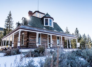
Snowshoe to Rowley Homestead at Snow Mountain Ranch
3.03 mi / 100 ft gainAt Snow Mountain Ranch, you can strap on the snowshoes and heading to an old homestead on the ranch. It is about 3 mile round trip adventure.You snowshoe through the woods and by some of the cabins at Camp Chief Ouray. On the trail, check out the aspen trees. You can see the markings where the e...Read more -
Buena Vista, Colorado
Hike to the Historical Interlaken Resort
5.06 mi / 500 ft gainFollow Colorado Highway 24 South from Leadville for 14 miles, then turn right onto Colorado 82 towards Aspen. Turn left onto County Road 25, then follow the road for 1 mile to a small parking area for the Colorado Trail. You have arrived!This trail starts near 9,200 feet of elevation and while yo...Read more -
Snowmass, Colorado
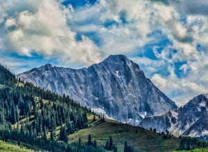
Capitol Lake via Capitol Ditch
5.012.28 mi / 2575 ft gainThe route to Capitol Lake is fairly straightforward, but not without its minor hardships. The route begins at the end of Capitol Creek Road, 9 miles from the small "town" of Snowmass (NOT Snowmass Village - that's the high-class ski resort). The last few miles of this road provide the first min...Read more -
Berthoud Pass, Colorado
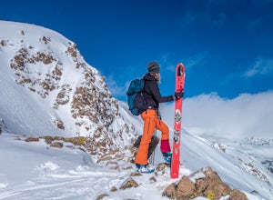
Ski or Snowboard Berthoud Pass Colorado
Berthoud Pass is 55 miles from Denver making it one of the closest places to get out and backcountry tour in the winter. At 11,370 Berthoud Pass crosses the continental divide. From the top of the pass you can do shuttle runs down the south side of the pass. Or, you can venture on the East or Wes...Read more -
Berthoud Pass Parking Lot, Colorado
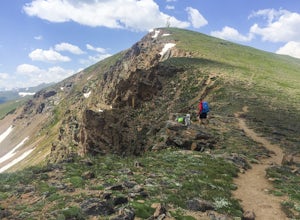
Mount Flora
5.06.29 mi / 1788 ft gainColorado’s Rocky Mountains offer hikes of all lengths, sizes and difficulties. Mt. Flora stands at a lofty 13,146 ft and is a great intro to climbing peaks in Colorado. Roundtrip, this hike is 6.3 miles and will take you (in the summer) through fields of alpine wildflowers as you climb into Color...Read more -
U.S. 40, Colorado
Parry Peak
11.82 mi / 4209 ft gainThe trek to Parry Peak crosses three other peaks (Colorado Mines Peak, Mt. Flora, and Mt. Eva) along the Rocky Mountains. Begin your hike around sunrise as inclement weather often rolls in during the late afternoon. The trail is extremely rocky and steep. From the Berthoud Pass parking lot, fol...Read more -
Winter Park, Colorado
Snowshoe Mount Flora
6.2 mi / 1738 ft gainMy friend Austin and I hiked up to Mt Flora last year on what was probably the coldest day ever. Ever? It was 9 degrees at the Berthoud Pass parking lot and we had 32mph winds nearly the whole way. We estimated the temp to be around -28ºF with the windchill... brrrr!DirectionsFrom the Berthoud Pa...Read more -
Garfield County, United States
Hike the Devil's Causeway Loop
5.010.5 mi / 1550 ft gainCrossing the Devil's Causeway is a rite of passage for Colorado hikers. The dramatic exposure will terrify some and exhilarate others, but the loop offers much more than the short rocky expanse that's the draw for most people.The Approach: From the trailhead at Stillwater Reservoir, the East Fork...Read more -
Winter Park, Colorado
Snowshoe to Broome Hut
1.5 mi / 729 ft gainTake I-70 from Denver and then US 40, go all the way to Mile marker 240 of US 40 and park in the area at the side of the road. The Second Creek trail head is just behind the parking area and is easy to find.The trail climbs from a start at 10,600ft and finishes up at 11,325ft at the hut, but you ...Read more -
Winter Park, Colorado
Twin Cones via Second Creek Trailhead
5.04.85 mi / 1614 ft gainThis hike begins at Second Creek Trailhead off of US Highway 40. It's pretty steep right off the bar gaining about 800ft of elevation in the first mile. This first mile takes you to Broome Hut, which has a bathroom and is a great place to stop and take a break. Keep in mind that there are no dogs...Read more -
Silver Plume, Colorado
Argentine Railroad Grade
5.05.35 mi / 863 ft gainThe Argentine Central Railroad Grade trail is just what it says: it follows the old rail bed of the Argentine Central line. All railway remnants have long since been removed, and in its place is a wide, well-defined trail with an easy grade. With just a 900-foot incline over the course of about t...Read more -
Dillon, Colorado
Silver Dollar Lake Trail
5.03.93 mi / 945 ft gainGuanella Pass, which connects the charming and historic town of Georgetown in the north to the blink-and-you’ll-miss-it Grant to the south, is a recreational outdoorsman’s dream. Volumes could be written on what this 22-mile scenic byway has to offer. Silver Dollar Lake Trail is just one tiny po...Read more -
Aspen, Colorado
Hike or Snowshoe Castle Creek
6 miAt the round-a-bout that leads into the town of Aspen, take the Castle Creek Road exit. Follow this road for 12 miles until you get to the ghost town of Ashcroft. The road itself is very scenic, so be prepared to pull over and whip out your camera!During winter, the road ends at Ashcroft and a cr...Read more

