Allenspark, Colorado
Looking for the best chillin in Allenspark? We've got you covered with the top trails, trips, hiking, backpacking, camping and more around Allenspark. The detailed guides, photos, and reviews are all submitted by the Outbound community.
Top Chillin Spots in and near Allenspark
-
Boulder, Colorado
Catch a Boulder Sunrise from NCAR
A great place to watch the sunrise in Boulder is at NCAR, the National Center for Atmospheric Research. Park in the parking lot at the top of the hill, and if you're feeling up to it, you can walk south for about 10 minutes to an adjacent hill with beautiful views. Either way, you will want to ge...Read more -
Boulder, Colorado
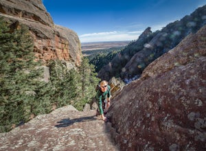
Scramble Angel's Way
5 mi / 1000 ft gainAngel's Way is an amazing 8 pitch rock climb scramble (5.2) that is tucked away in Skunk Canyon, hidden from the crowds of Chautauqua. The best part of this scramble is you only need your climbing shoes and chalk-bag. It is similar to the 'Free Way' on the Second Flatiron. I would encourage ev...Read more -
Idaho Springs, Colorado
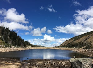
Camp and Fish at Loch Lomond
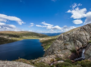
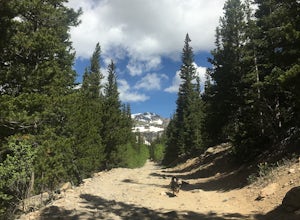
5.0The trail to Loch Lomond is very rocky. I suggest a high clearance 4x4 vehicle (I did see a small SUV and a Subaru..Not sure how they did it!!!). There are a few campsites at the lake and several along the way. I set up camp by the lake but had to move because the wind was so intense. I recommend...Read more -
Boulder, Colorado
Shanahan Ridge Trail
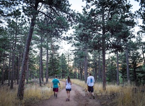
4.03.84 mi / 715 ft gainStarting on the edge of a neighborhood in South Boulder, this 3.8 mile loop begins its 869 foot elevation gain by meandering through a pine forest. You can 'choose your own adventure' by exploring the handful of trails that meet up with the Shanahan Ridge Trail, such as the South Mesa Trail, Shad...Read more -
Idaho Springs, Colorado
Explore Fall River Reservoir
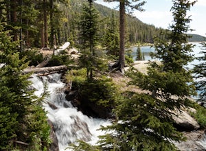
4.01 mi / 144 ft gainThis spot may be a little more difficult to reach than others, but the payoff is worth it. You'll start by taking a dirt road that splits off from Fall River Road. It is pretty easy going for the first mile or so, but then you'll want to make sure you have a little higher clearance 4x4 vehicle to...Read more -
Idaho Springs, Colorado
Camp at Chinns Lake
Take the road as if you are going to St. Mary's Glacier, but you will take a left off the road (next to a very nice house) before the road makes a sharp right turn to go up hill. The road is a smooth dirt road for about a mile, but gets very rocky after that and you will need a good off road vehi...Read more -
Idaho Springs, Colorado
Hike to Loch Lomond
5.04.6 mi / 948 ft gainWhen you start the hike to Loch Lomond, you'll have a few options for parking. The further up the road you go the trickier it's going to be to get back out. I parked at the bottom of the road and hiked my way up. The first mile or two is mostly elevation gain and to be quite honest I thought I wa...Read more -
Idaho Springs, Colorado
Explore 'The Hidden Gems' of Loch Lomond
5.04.6 mi / 950 ft gainGetting There From Denver, go W on I-70 and take exit 238 for Fall River Rd. Continue on this road before taking a left on Alice Rd. Continue on Alice Rd. until you see the right hand turn for Steuart Rd. This is where you park. Do not attempt this road in a AWD or 2WD you definitely need a good ...Read more -
Walden, Colorado
Dancing Moose Yurt [Closed]
NOTE: This property is currently closed as NeverSummer, the yurt operator, is no longer in business. The yurt is located near the small town of Walden, CO (coordinates: 40 33'57.43"N , 105 59'16.93"W) about two hours west of Fort Collins. In the winter, there are many backcountry ski runs, cros...Read more -
Loveland, Colorado
Hike the Valley Loop Trail in the Bobcat Ridge Natural Area
4.4 mi / 500 ft gainThe Valley Loop Trail in the Bobcat Ridge Natural Area begins at the main entrance of the Natural Area, just off W County Road 32 C near Masonville, west of Fort Collins and the Horsetooth Reservoir.To get there take West County Road 38 E west from Fort Collins over and around the Horsetooth Rese...Read more -
Loveland, Colorado
Hike the D.R. Trail in the Bobcat Ridge Natural Area
3.76.2 mi / 1050 ft gainD.R. Trail, named for David Rice Pulliam who donated the land to create the Bobcat Ridge Natural Area, is a 3.1 mile spur off the Valley Loop Trail that climbs roughly 1,000' into Mahoney Park before it intersects with the Powerline and Ginny Trails. To get to the start of the trail, take the Val...Read more -
Golden, Colorado
Hike to Forgotten Valley
4.33.6 mi / 852 ft gainThere are over 35 miles of hiking trails in the park. The twelve trails in Golden Gate Canyon State Park are named after an animal and marked with the animal’s footprint.For a 2.6 round trip hike, start at the Burro Trailhead in Golden Gate Canyon State Park. You’ll immediately cross over a lit...Read more -
Fort Collins, Colorado
Hike to Horsetooth Rock
4.55 mi / 1440 ft gainThe Horsetooth Mountain Park Open Space is located just 4 miles from Fort Collins. The 2,886 acre park offers 29 miles of hiking, biking, and horse back riding trails.Having taken both the multi use trail and the hiking only trail, I recommend the hiking only. This trail offers you the views and ...Read more -
Fort Collins, Colorado
Hike to Horsetooth Falls
4.52.22 mi / 101 ft gainHorsetooth Mountain Park is an outdoor trail haven just minutes from downtown Ft. Collins. The 2711 acre area has 29 miles of trails of varying length and difficulty for all levels of adventurers to explore. Horsetooth Falls is one of the shortest (yet stunning) trails in the area. This hike is i...Read more -
Parshall, Colorado
Camp at Jones Pass
4.5To locate these campsites all you have to do is type in Jones Pass Road into google maps or your iPhone and it will take you straight there. There are road signs once you get off I-70 that will help you the rest of the way that say Jones Pass. Once you hit the dirt road and pass the Jones Pass Tr...Read more -
Fort Collins, Colorado
Hike the Coyote Ridge Trail
1.03 mi / 550 ft gainThe Coyote Ridge Natural Area is one of several Larimer County "gateway" preserves and Open Lands that lead into the Front Range of the Rocky Mountains, connecting the shrublands of the Great Plains to the Rocky Mountain themselves through a network of trails, parks, and preserves. The Coyote Rid...Read more

![Dancing Moose Yurt [Closed]](https://images.theoutbound.com/uploads/1454553015692/sthmscbw5916pqfr/1b559ecab7d81fde80eacc99e3b36020?w=300&h=220&fit=crop&q=60&s=f88fa81bfb38a785f8adb78434f83f54)
