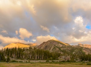
Wishon, California
Looking for the best backpacking in Wishon? We've got you covered with the top trails, trips, hiking, backpacking, camping and more around Wishon. The detailed guides, photos, and reviews are all submitted by the Outbound community.
Top Backpacking Spots in and near Wishon
-
Tuolumne County, California
Mono Pass to Silver Lake Trailhead via Koip Peak Pass
20.25 mi / 3606 ft gainThis trip begins in Yosemite National Park and can be completed as an out-and-back or by hiking one-way to the Ansel Adams Wilderness and exiting at Silver Lake on the east side of the mountains. Start at the Mono/Parker Pass trailhead, a few miles past Tuolumne Meadows. Don't forget to make a pe...Read more -
Mammoth Lakes, California
Hike to Steelhead Lake through McGee Creek Canyon
5.011.5 mi / 2510 ft gainWhether you’re looking for a dayhike near Mammoth Lakes, planning a backpacking trip along the JMT, or have a few extra hours to spare on a cross-California road trip, this is an easy and popular trail choice for killer mountain views.I was delighted to discover that this is one of the most easil...Read more -
Mammoth Lakes, California
Backpack to Red Slate Mountain
22 mi / 5600 ft gainI would recommend you spend the night in the area to acclimatize, since the trailhead does start at ~8,000ft and you will be hiking up to ~10,500ft at the end of the first day and climbing up to 13,100ft on the second day. One option would be to reserve a spot at the nearby McGee Creek Campground...Read more -
Bishop, California
Fish for a Sierra Grand Slam in Little Lakes
Access to this relatively mellow (for the Sierras) trail can be reached via Rock Creek Road off of Highway 395, north of the town of Bishop, California. Following Rock Creek road southwest until its terminus will take you directly to the parking lot and signed trailhead for Little Lakes Valley.Fr...Read more -
Bishop, California
Backpack to Ruby Lake
5.04 mi / 1000 ft gainAt 10,200 feet, the trailhead (Little Lakes Valley) for Ruby Lake is one of the highest (if not the highest) in the Sierra. Meaning you get right to the heart of the mountains quickly. Ruby Lake itself is at 11,200 feet elevation.How to get there: At Tom's Place off of Hwy 395, turn southwest int...Read more -
Lee Vining, California
Hike to Upper Sardine Lake
Directions (from south of June Lake): 395 northTurn right onto the 158Keep right at fork onto Parker Lake Rd and go about 0.5 milesTurn right at first right and head all the way to the top until you hit a parking lot/camping ground/trail head From North of June Lake: 395 southTurn left at 158Keep...Read more -
Bishop, California
Hike Pine Creek Pass to Lower Pine Lake
10 mi / 2500 ft gainThe Pine Creek Pass is usable for day hiking and overnight adventures. If you'd like to spend the night, be sure to pickup a wilderness permit! If you plan to bring a four legged friend, make sure to indicate that on your wilderness permit request. There are several lakes you can stop at througho...Read more -
Groveland, California
Hetch Hetchy to Rancheria Falls
4.812.55 mi / 2500 ft gainSituated in the northwest portion of Yosemite National Park, Hetch Hetchy is is a not often visited treasure of the Central Sierra Nevada. In 1913, in an extremely controversial move, work on the O’Shaughnessy Dam was started to provide water to the growing population of San Francisco. Today, Het...Read more -
Lee Vining, California
Junction Campground, Mono County
Junction campground is by far one of my favorite campsites when I am visiting the High Sierra and Tuolumne Meadows. The only downside is, you can only camp certain months; usually from June through October when highway 120 is open. The Junction campground is far away from the crowds of Yosemite...Read more

