Sunol, California
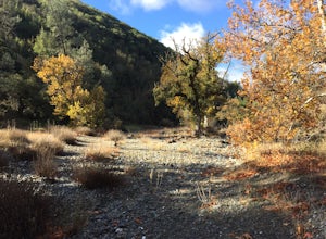
The best Trails and Outdoor Activities in Sunol, California, offer top-notch scenic views and outdoor adventures. One must-visit is the Ohlone Wilderness Trail, a challenging 28-mile hiking trail that boasts a variety of natural features. As you hike, you'll encounter beautiful landscapes filled with rolling hills, oak trees, and abundant wildlife. The trail also offers stunning views of the San Antonio Reservoir and the Livermore Valley. For a shorter hike, the Little Yosemite area offers a 2-mile trail alongside a creek, with small waterfalls and large boulders. Other outdoor activities in and near Sunol include fishing in the Alameda Creek and bird watching, with over 100 species of birds reported. Remember to pack your hiking boots and binoculars for the best experience.
Top Spots in and near Sunol
-
San Francisco, California
Visit the Conservatory of Flowers
4.7Spend a day exploring Golden Gate Park by jogging, cycling, or leisurely strolling. There are so many fantastic stops in the park including a variety of lakes, playgrounds, a golf course, the California Academy of Science, the Conservatory of Flowers, and much much more! It is definitely worth ...Read more -
Daly City, California
Mussel Rock Loop
4.01.95 mi / 322 ft gainMussel rock, a three-story, 50 million year old rock that has been carried some 500 miles northwest from Southern California, is where the San Andreas fault meets the Pacific Ocean. It's also an excellent spot to drink some wine and catch a sunset. From San Francisco, take Highway 1 south towar...Read more -
Pacifica, California
Surf at Pacifica State Beach
4.5If you're looking for a place to surf and Ocean Beach isn't quite your speed or Santa Cruz is too far, head to Pacifica, specifically Linda Mar. Linda Mar is usually more wind protected and user-friendly than ocean beach. Break out your longboard or hybrid board and head to this beach. There is e...Read more -
San Francisco, California
Lake Merced Loop
4.74.53 mi / 180 ft gainLake Merced Loop is a loop trail in the southwestern part of San Francisco. This trail is used for running and walking. You'll see plenty of people getting exercise or taking their dog for a stroll. There are also benches and tables around the loop. The lake itself is fresh water and is used for...Read more -
San Francisco, California
Grand View Park ("Turtle Hill")
5.00.21 mi / 7 ft gainA recipe for happiness in the "cool grey city of love." To the seasoned San Franciscan there is no finer view in the Bay Area than that from San Francisco's front porch, Turtle Hill or "Grand View Park". If the North American continent / plate is a ship, then Grand View Park is the prow giving e...Read more -
Half Moon Bay, California
Stroll along the Southern Beaches at San Gregorio State Beach
4.02.9 mi / 413 ft gainNot a trail per se, but approximately 3 miles (down and back) of beautiful beach to walk down. Lots of interesting caves, wild animals, and rock formations to discover. This is a popular location for sea kayakers. San Gregorio State Beach was originally founded to protect the estuary at the back ...Read more -
Morgan Hill, California
Backpack to Coit Lake
5.026 miThis trail can be started from Coe Headquarters or Hunting Hollow Trailhead. The trail from Coe HQ is 2 miles longer, almost all elevation but provides beautiful views of the surrounding mountains. These directions will be starting from Coe HQ.Follow the loop around the parking area to the backpa...Read more -
Morgan Hill, California
Backpack to Mississippi Lake
5.026.4 mi / 3600 ft gainIf you're tired of trying and failing to get reservations for backcountry camping around the bay area, then Henry Coe State Park is the perfect place to visit. No reservations need to be made prior to the trip. All you need to do is get to the HQ on the morning of your trip, get your permits and ...Read more -
San Francisco, California
16th Avenue Tiled Steps
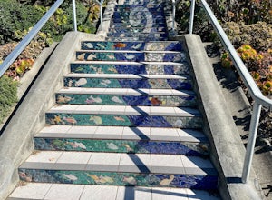
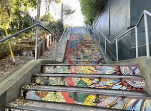
4.60.09 mi / 79 ft gainThe 16th Avenue Tiled Steps also known as the Moraga steps are an impressive community achievement, and an equally killer workout. Take an easy lap up the stairs to check out the amazing art, take in the views from the top, then get down to business. You'll be glad you made the trek over to this ...Read more -
Half Moon Bay, California
Catch the Sunset at Maverick's Beach
5.01 miMaverick's beach is most well-known for the Maverick surf competition and the gnarly waves which surface here in the winter months. For the rest of the year, the beach is still a site to see. With huge waves crashing ¼ mile off shore and bluffs towering 100 feet above you, it’s a picturesque plac...Read more -
San Francisco, California
Hidden Garden Steps
4.30.1 mi / 39 ft gainThese tiles steps are ironically iconic, as they are called the "Hidden" Garden Steps. They are one of 3 tiled staircases that San Francisco is famous for. The others are the 16th Ave Tiled Steps and the Lincoln Park Steps. Tip: When calling an uber, try to get dropped off at the top of the ste...Read more -
San Francisco, California
Presidio Ecology Trail
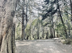
5.01.82 mi / 427 ft gainPresidio Ecology Trail is a loop trail through the Presidio located near San Francisco, California. This loop can be started at the Upper Ecology Trail off of Arguello Blvd near Pacific or down at the Lower Ecology Trail near the Inn at the Presidio. This trail is dog friendly on-leash.Read more -
San Francisco, California
Presidio Bay Area Ridge Trail
5.02.73 mi / 203 ft gainPresidio Bay Area Ridge Trail is a point-to-point trail where you may see wildflowers located near San Francisco, California.Read more -
San Francisco, California
Presidio Loop
5.95 mi / 823 ft gainThis route starts and ends on Jackson street in the Presidio Terrace neighborhood of San Francisco. This loop can be started in several areas of the Presidio including off of the Lyon street steps, but this starting point creates a good midpoint of the loop. Along the route, be sure to keep an ...Read more -
Moss Beach, California
Pillar Point Bluff Loop
4.71.84 mi / 154 ft gainSitting on a 140 acre bluff top, the Pillar Point Bluffs are a simple, easy hike with breathtaking views throughout. The bluffs are 22 miles from San Francisco – a 30 minute drive depending on the traffic. There is a small 10 car or so parking lot off of Airport Blvd, but there are two additional...Read more -
Richmond, California
Hike the Wildcat Canyon Loop
4.010.5 mi / 2300 ft gainStarting off on Wildcat Creek Trail, the trail is wide and rolling. After about 4 miles make a left on Jewel Trail, then onto Sylvan Trail. Another left puts you on Wildcat Peak Trail. Be sure to check your map, as many trails intersect here. Wildcat Peak Trail runs into Nimitz Way, at which poin...Read more

