Sunol, California
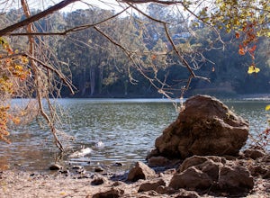
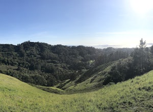
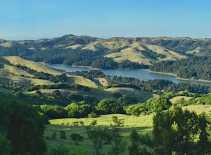
The best Trails and Outdoor Activities in Sunol, California, offer top-notch scenic views and outdoor adventures. One must-visit is the Ohlone Wilderness Trail, a challenging 28-mile hiking trail that boasts a variety of natural features. As you hike, you'll encounter beautiful landscapes filled with rolling hills, oak trees, and abundant wildlife. The trail also offers stunning views of the San Antonio Reservoir and the Livermore Valley. For a shorter hike, the Little Yosemite area offers a 2-mile trail alongside a creek, with small waterfalls and large boulders. Other outdoor activities in and near Sunol include fishing in the Alameda Creek and bird watching, with over 100 species of birds reported. Remember to pack your hiking boots and binoculars for the best experience.
Top Spots in and near Sunol
-
Saratoga, California
Skyline-to-the-Sea Trail
4.530.8 miWant to experience one of the bay area's most memorable backpacking trips? We've got the details to get you out on the trail. To start the trek, drop your car at the Castle Rock State Park Parking Lot, which is located ~2.5 miles south of the junctions of Highways 35 and 9 off of Highway 35. Not...Read more -
Saratoga, California
Backpack Castle Rock State Park
4.7Castle Rock Trail Camp has a different policy than other backcountry camps in the area (i.e. campsites along Skyline to the Sea). This campground is open all year and is available on a first come, first served basis. If you can, grab a spot a Frog Flat Camp. To get to the camp, park your car at t...Read more -
Los Gatos, California
Hike the Saratoga Gap Trail
4.64.7 miThe Saratoga Gap Trail is relatively lightly trafficked trail that is good year round, although waterfalls peak in late winter and spring. Overall, this 4.7 mile partial loop hike is moderate, with about 1000 feet in elevation change. Trailhead elevation is about 3090 feet. The featured hike desc...Read more -
San Francisco, California
San Francisco Crosstown Trail
5.016.71 mi / 1975 ft gainThe San Francisco Crosstown Trail runs point-to-point from Candlestick Point to Land End. The SF Crosstown Trail officially opened in 2014. It connects park trails to neighborhoods and communities. In it's in entirety it's almost 17 miles long with 5 Sections available for those looking to bre...Read more -
Burlingame, California
Hike the Ed Taylor Loop Trail in Mills Canyon
4.01.4 mi / 300 ft gainThis hike can be done at any time of year. Hiking in winter and spring means that many varieties of wildflowers will be present, and the creek will have much more water. Summer and fall mean higher temperatures and drier conditions, but the hike is still a pleasant experience. Begin the hike at t...Read more -
Redwood City, California
Hike the Methuselah and El Corte De Madera Creek Loop
6.2 mi / 1800 ft gainThis loop hike will provide people with the opportunity to experience the tranquility of the lower canyons of the preserve, which tend to be more isolated than the heavier-trafficked trails that are closer to the main highway. Be warned that this hike is fairly strenuous because of the large amou...Read more -
La Honda, California
Hike the Brook Trail Loop
7.1 mi / 1500 ft gainThe Brook Trail Loop is a beautiful hike, starting off in Sam McDonald County Park and later entering into Pescadero Creek County Park. This adventure can be done in any season, with the trails almost entirely shaded for even the hottest summer days. Starting off from the Heritage Grove trailhead...Read more -
Half Moon Bay, California
Purisima Creek Trail and Craig Britton Trail Loop
4.06.95 mi / 1411 ft gainThis hike is perfect for any time of year, always staying cool because it is near the coast, and there are multiple creeks that flow year-round. Even on foggy days, the fog condenses on trees to make it seem like it is "raining." Be warned that this hike has a lot of elevation change and is stre...Read more -
Berkeley, California
Hidden Waterfall in Codornices Park
4.00.5 miPark along the street in front of Codornices Park in Berkeley. Follow the stream to the left of the playground. Take the path up the hill to the right (don't head over the bridge on the left). Keep walking up multiple concrete stairs. After the first flight of stairs you'll see a path on the left...Read more -
Berkeley, California
Berkeley Rose Garden
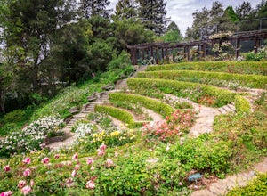
4.0I'm always surprised at how few people know of this beautiful garden. I'm often alone when I visit, which allows for perfect serenity. Visit in early spring for maximum blooms. Park on Euclid Ave, which is where you'll find the entrance to the amphitheater (you can't miss the giant sign). Spend ...Read more -
Berkeley, California
Lake Anza in Tilden Park
5.0Lake Anza makes for a great warm weather swimming hole. The parking area is close to the beach along with the trail, which will take you around the lake. The beach gets plenty of sun and is fairly wind protected, which makes for a relaxing day. Bring some picnic food out to the lake and snag your...Read more -
Berkeley, California
Seaview and Big Springs Loop
4.54.28 mi / 1007 ft gainThe trail is dog and horse friendly, and many trail loops make Tilden Regional Park fun for families and those of any skill level. The Seaview and Big Springs Trail loop is typically used by avid hikers, trail runners, or mountain bikers. The first half of the trail is exposed to the sun and rock...Read more -
San Francisco, California
Bayview Hill Loop
4.01.24 mi / 184 ft gainBayview Hill Loop is a loop trail that starts with a paved uphill climb and views of the bay facing toward the East Bay located in the Bayview neighborhood of San Francisco, California.Read more -
Orinda, California
Wildcat Peak Loop
4.05.89 mi / 1050 ft gainFrom Inspiration Point, head toward Nimitz gate. Once you pass through the gate, keep an eye out for Curran Trailhead; this is the trail you'll be starting on. After about 1/8 of a mile, you'll reach a junction with the Meadows Canyon Trail. Turn right onto this trail to continue the loop. This p...Read more -
Berkeley, California
Wildcat Peak via Nimitz Way
4.74.16 mi / 459 ft gainTilden Park is a beautiful recreational area with scenic hiking trails, a swimming lake, small animal farm, a steam train and botanical gardens. The versatility of this park makes it very family and kid friendly, and those who are looking for a moderate hike within the park have almost forty mile...Read more -
La Honda, California
Sam McDonald Park Loop
5.012.19 mi / 2192 ft gainThe Pescadero Creek Park Complex is a great place to escape for a day or overnight hike in the heart of the Bay Area. You will need to get a permit to stay overnight - these can be attained on a first-come, first-serve basis from the ranger station. Most of the campsites here are also available f...Read more

