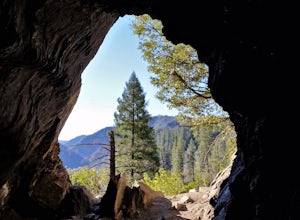
Soda Springs, California
Soda Springs, California, is a great place to explore. From must-visit parks to unique and memorable experiences, there's something for everyone. Take a hike and explore the area's trails, or take a kayak out on the lake. Head to the nearby ski resort for a day of skiing and snowboarding. For a more leisurely activity, take a drive to explore the area's roads and overlooks. No matter what type of activity you're looking for, Soda Springs has something for everyone. So come explore the best in and near the area!
Top Spots in and near Soda Springs
-
Reno, Nevada
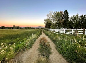
Anderson Park Loop
4.01.64 mi / 92 ft gainAnderson Park Loop is a popular trail for walking or running tucked away in a quiet neighborhood near Reno, Nevada. The trail loops around a pasture and connects up to Bartley Ranch for a longer or more scenic route. Take in scenic views of the surrounding mountains, but there may be some traf...Read more -
Twin Bridges, California
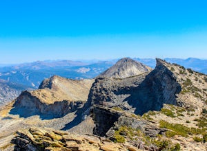
Summit Price & Agassiz from Desolation Wilderness
5.0Mount Price (9,975') is the second highest summit in the Desolation Wilderness, standing just eight feet lower than Pyramid Peak to the south. In between these two peaks stands Mount Agassiz (9,967'), whose overhanging summit resembles a granite wave poised to crash down into the Desolation Vall...Read more -
Reno, Nevada
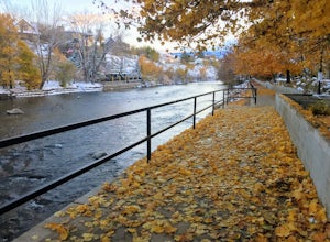
Truckee River Pathway: Downtown to Dorostkar Park
4.04.42 mi / 220 ft gainTruckee River Pathway: Downtown to Dorostkar Park is a point-to-point trail that takes you by a river located near Reno, Nevada.Read more -
Reno, Nevada
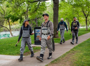
Fly Fish the Truckee River from Wingfield Park
At just 121 miles long from Lake Tahoe to Pyramid Lake, the Truckee River continues to produce the largest trout in the Lower 48. Fly fisherman commonly divide the river into two reaches – East & West, and there is excellent fishing to be found right in downtown Reno all along the Truckee and...Read more -
New Washoe City, Nevada
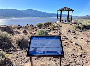
Deadman's Overlook Trail
4.01.28 mi / 318 ft gainDeadman's Overlook Trail is a loop trail where you may see beautiful wildflowers located near Washoe Valley, Nevada.Read more -
Reno, Nevada
May Arboretum and Herman Pond Trail
5.01.07 mi / 89 ft gainMay Arboretum and Herman Pond Trail is a loop trail where you may see beautiful wildflowers located near Reno, Nevada.Read more -
Reno, Nevada
Miners Trail to The "N"
3.51.89 mi / 371 ft gainMiners Trail to The "N" is an out-and-back trail that provides a good opportunity to view wildlife located near Reno, Nevada.Read more -
Nevada City, California
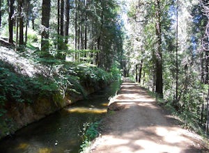
Take a Family Ride
4.5Well if you start at Banner Lava Cap and Gracie Roads then you will see the canal at the top of Gracie Rd. Hop onto the berm of the canal and head north {upstream}. The trail is dirt and about 4 ft wide in the beginning and widens to 6 to 8 ft for most the way . Continue upstream on the canal and...Read more -
Plumas County, California
Hike to Little Jamison Falls
3.02 mi / 500 ft gainTo get to the falls from the town of Graeagle, CA take Graeagle-Johnsville off Highway 89 towards the town of Johnsville. After 4.5 miles take a left on a dirt road to Jamison Mine Day Use Parking. If you go over the bridge and into the town of Johnsville, you have gone too far. Continue down th...Read more -
Kyburz, California
Hike to Twin and Island Lakes
5.07 mi / 1600 ft gainThe Twin Lakes trail starts winding through a pine forest, with a couple bridge crossings over crystal clear trout-filled streams. The marsh-like water is very slow moving, and even though it is indeed beautiful, it is also a prime location for pesky mosquitoes in the summertime. Be sure to loa...Read more -
Kyburz, California
Backpack Desolation's Primitive Western Edge through Rockbound Pass
4.426.28 mi / 5151 ft gainThis 26 mile loop meanders through some of the most primitive trails in Desolation Wilderness. Starting from Wrights Lake, the route proceeds over Rockbound Pass, loops around several lakes, and returns to Wrights Lake. Not many hikers venture past the steep and rocky Rockbound Pass to enter this...Read more -
Kyburz, California
Gertrude Lake Trail
8.28 mi / 1362 ft gainGertrude Lake Trail is an out-and-back trail that takes you by a lake located near Kyburz, California.Read more -
South Lake Tahoe, California
Catch a Sunset at Keys Beach
Owned by the State of California, Keys Beach sits at the end of a peninsula bordered by the Tahoe Keys marina inlet to the west and the Upper Truckee River to the east. This relative isolation along with its only access being by water or a single trail keeps the beach remarkably quiet relative to...Read more -
Kyburz, California
Backpack to Smith Lake, Desolation Wilderness
5.05.6 mi / 1750 ft gainTo get to the Twin Lakes Trailhead from the Bay Area/Sacramento, head east on HWY 50 past Kyburz for 4 miles until you see the left-hand turnoff for Wrights Road. If coming westbound on HWY 50, this will be a right-hand turn 5 miles past Strawberry. Follow this paved road for 8 miles (watch for p...Read more -
Kyburz, California
Hike the Grouse, Hemlock, and Smith Lake Trail
5.0Starting from the Wright's Lake parking area, walk past the service gate to find the loop trail. Follow the loop trail to the signed trail for Twin, Grouse, Island, and Hemlock Lakes heading toward the right. You will begin an approximate 150 foot ascend before coming to a saddle. Another 150 foo...Read more -
Colfax, California
Hike The Historical Stevens Trail
5.08 mi / 3376 ft gainBest known as one of the most popular hiking and biking trails to the North Fork American River, in part because of the easy access from Colfax. However, this is a remote trail, and hikers are advised to bring plenty of fluids as well as carry a whistle. The entire trail is primarily shaded, pa...Read more

